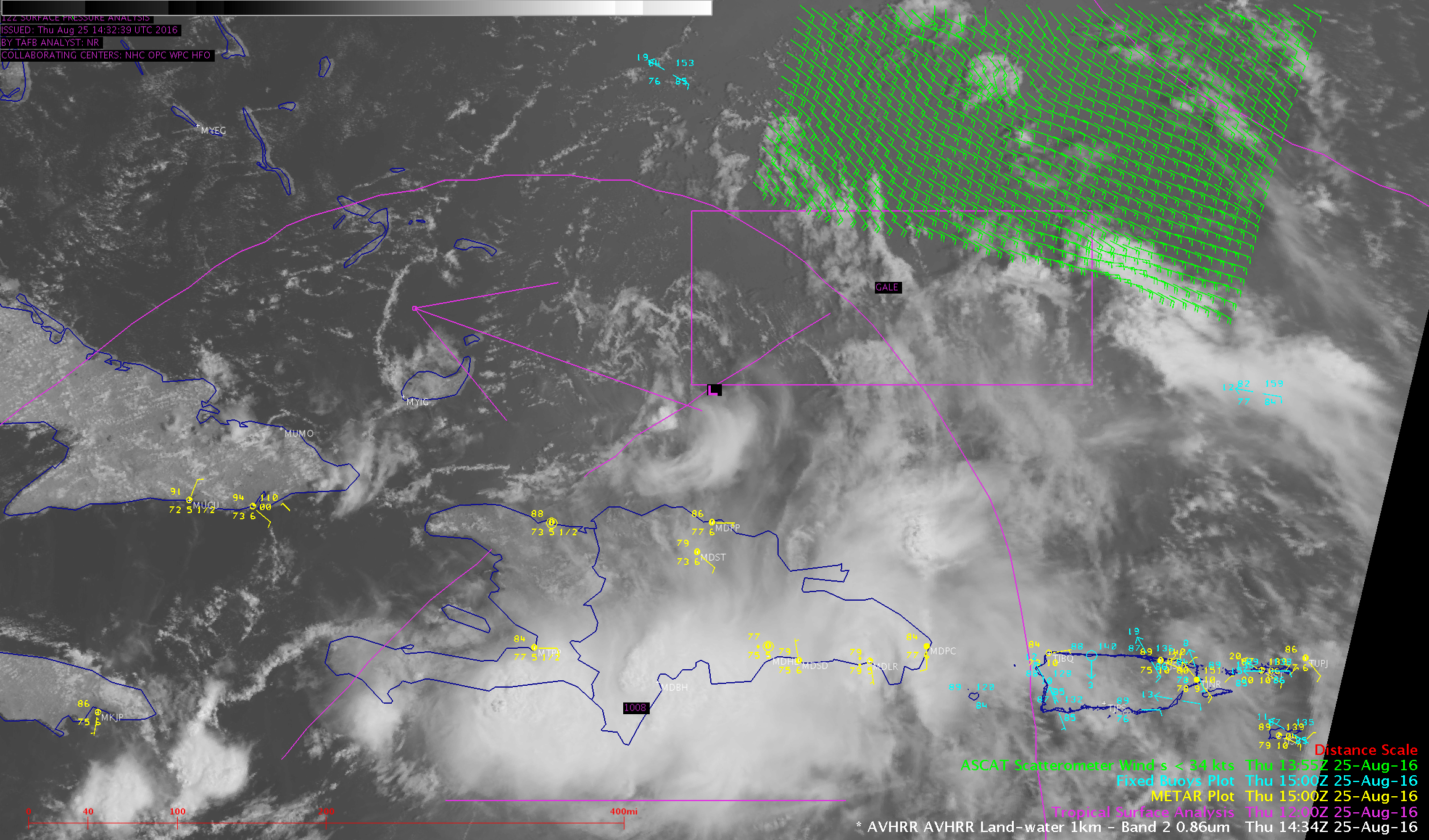
GOES-14 SRSO-R: Tropical Disturbance near the Caribbean
![GOES-14 Visible (0.63 µm) images [click to play animated gif]](https://cimss.ssec.wisc.edu/satellite-blog/wp-content/uploads/sites/5/2016/08/GOES14_25AUG_VIS_2016anim.gif)
GOES-14 Visible (0.63 µm) images [click to play animated gif]
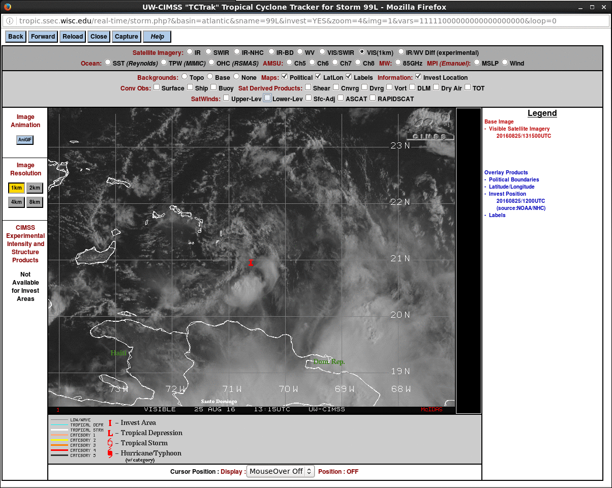
A 2-panel comparison of GOES-14 Visible and Infrared Window images, below (also available as a large 200 Mbyte animated GIF), provided a slightly closer view of the LLCC feature.
![GOES-14 0.63 µm Visible (top) and 10.7 µm Infrared Window (bottom) images [click to play MP4 animation]](https://cimss.ssec.wisc.edu/satellite-blog/wp-content/uploads/sites/5/2016/08/480x1280_AGOES14_B14_GOES14_VIS_IR_99L_25AUG2016_2016238_150900_0002PANELS.GIF)
GOES-14 0.63 µm Visible (top) and 10.7 µm Infrared Window (bottom) images [click to play MP4 animation]
![Wind Shear Analysis, 1200 UTC on 25 August 2016 [click to play animated gif]](https://cimss.ssec.wisc.edu/satellite-blog/wp-content/uploads/sites/5/2016/08/Shear_1200UTC_25Aug2016.gif)
Wind Shear Analysis, 1200 UTC on 25 August 2016 [click to enlarge]
![Morphed Observations of Total Precipitable Water from MIRS, 0000 UTC 24 August - 1500 UTC 25 August [click to play animated gif]](https://cimss.ssec.wisc.edu/satellite-blog/wp-content/uploads/sites/5/2016/08/TPW_24-25AugMIRSanim.gif)
Morphed Observations of Total Precipitable Water from MIRS, 0000 UTC 24 August – 1500 UTC 25 August [click to play animated gif]
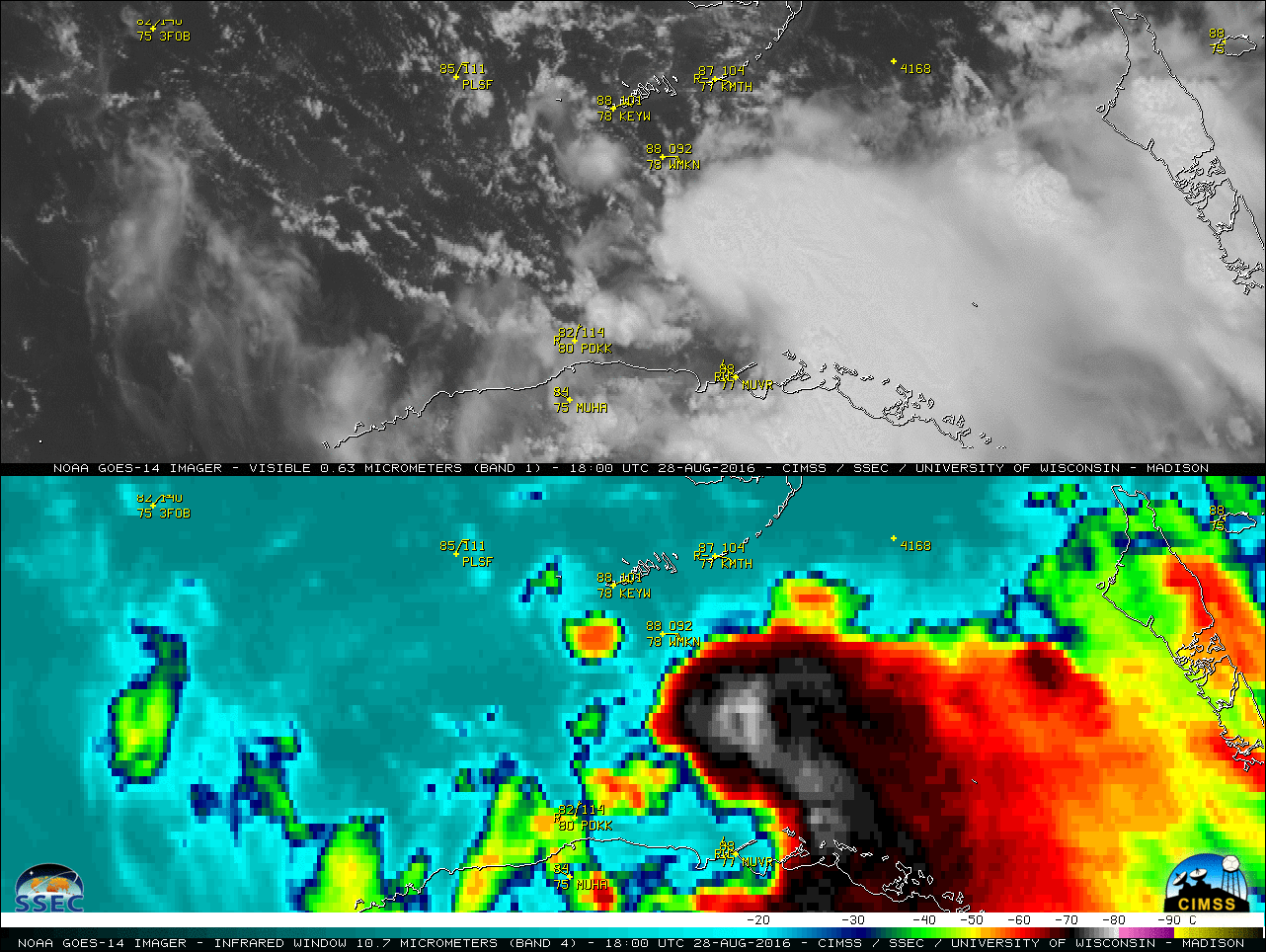
===== 28 August Update =====
![GOES-14 0.63 µm Visible (top) and 10.7 µm Infrared Window (bottom) images [click to play MP4 animation]](https://cimss.ssec.wisc.edu/satellite-blog/wp-content/uploads/sites/5/2016/08/480x1280_GOES14_B14_GOES14_VIS_IR_TD9_28AUG2016_2016241_180100_0002PANELS.GIF)
GOES-14 0.63 µm Visible (top) and 10.7 µm Infrared Window (bottom) images [click to play MP4 animation]