Of lake-effect snow bands, ice floes, and satellite navigation
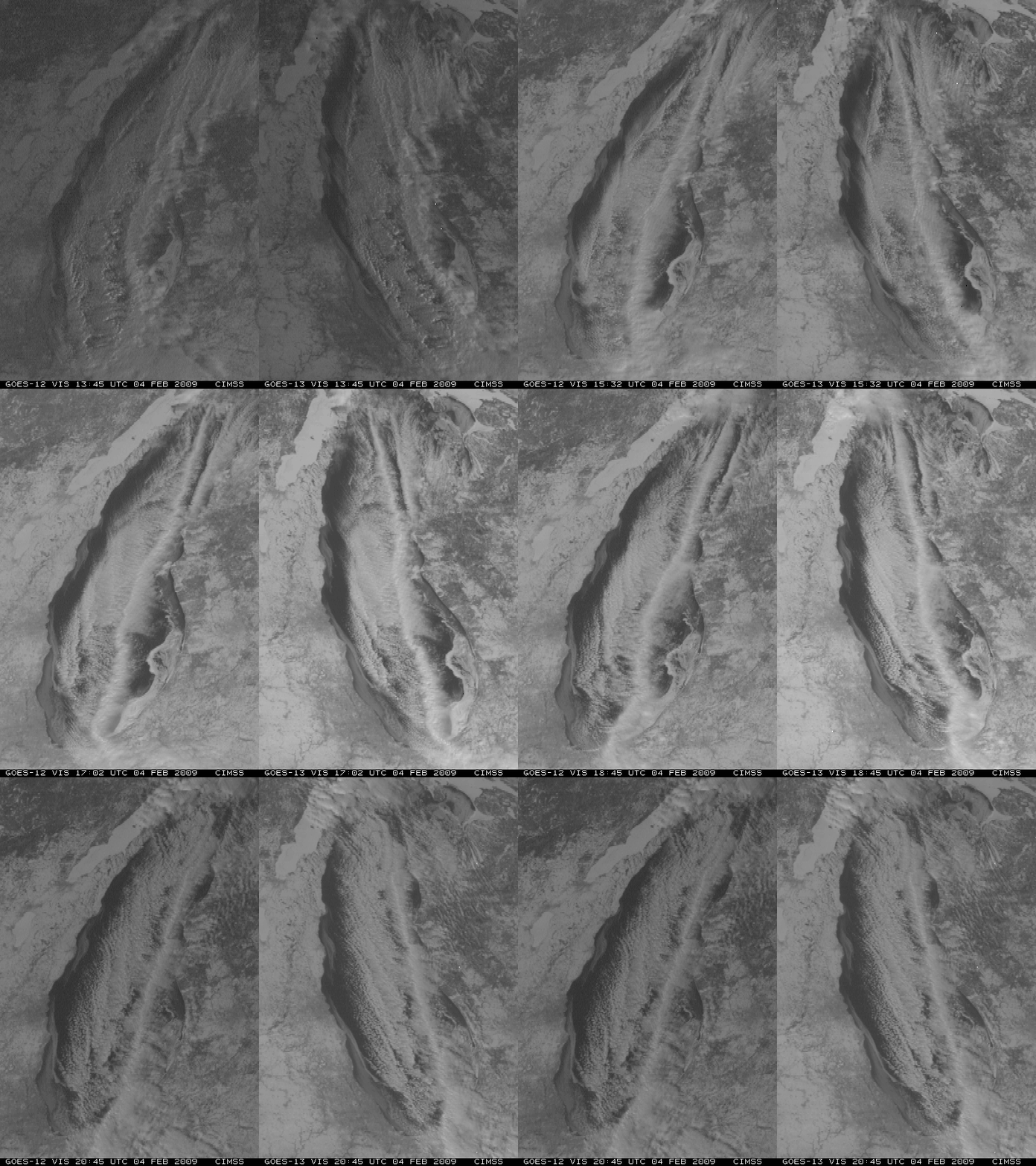
A side-by-side comparison of GOES-12 and GOES-13 visible images (above) shows a well-defined lake-effect cloud band that was oriented generally north-to-south across Lake Michigan on 04 February 2009. This narrow cloud band was producing heavy snow as it moved inland over far northwestern Indiana, with 15-20 inches of storm total accumulation reported. The GOES-12 and GOES-13 images are displayed in their native satellite projections (GOES-12 is positioned over the Equator at 75º West longitude, while GOES-13 is positioned at 105º West longitude).
The improved Image Navigation and Registration (INR)Â system on the GOES-13 satellite is immediately obvious, with much less image-to-image “wobble” — and the better navigation of the GOES-13 imagery makes it easier to follow the motion of the ice floes that were drifting over both the western and eastern nearshore waters of Lake Michigan.
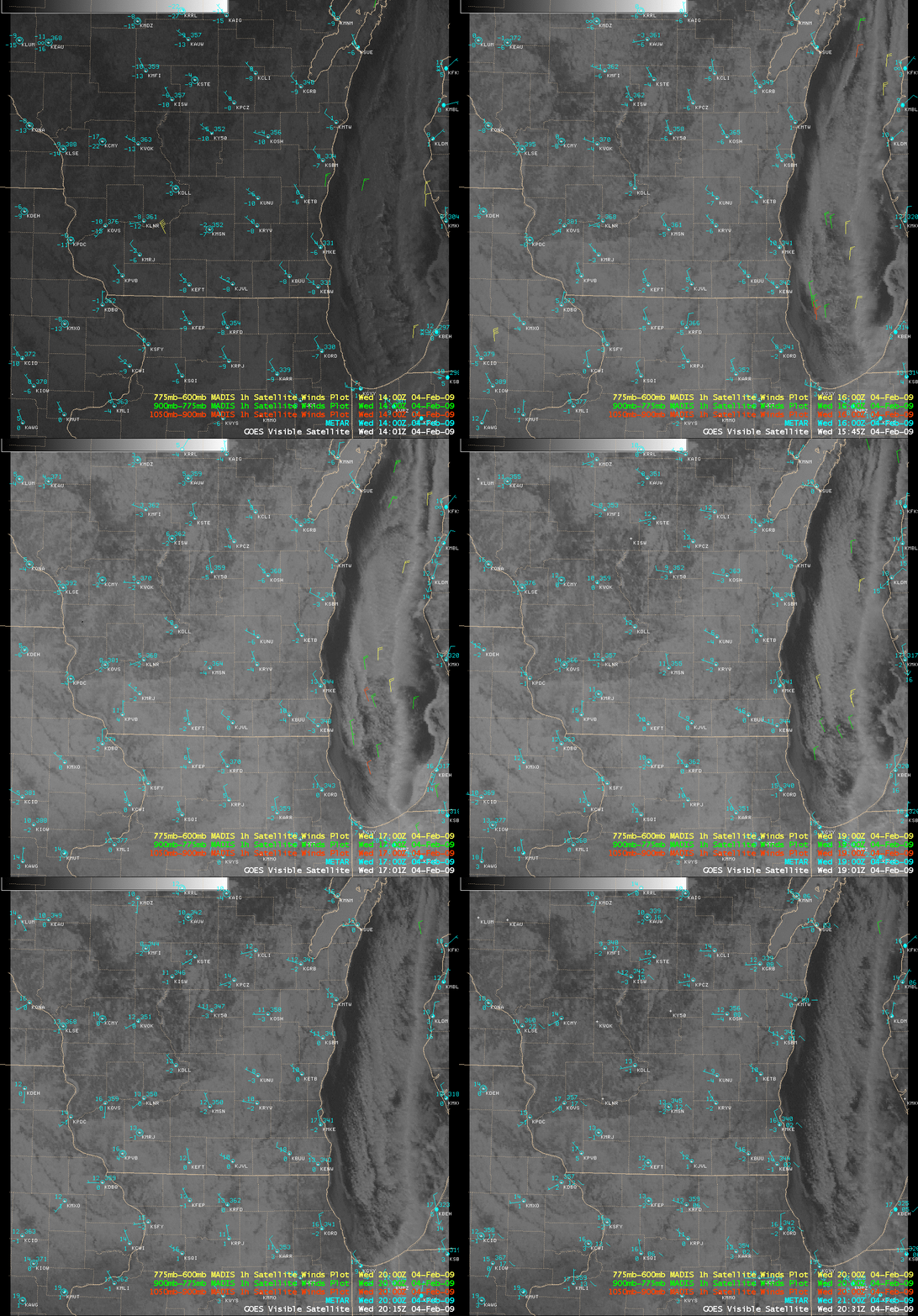
Even with the GOES-12 images being re-mapped for display in AWIPS (below), the amount of image-to-image wobble is still obvious. Hourly MADIS winds (or “atmospheric motion vectors”) are also plotted on the visible imagery — these winds are derived by following targets on 3 consecutive satellite images.
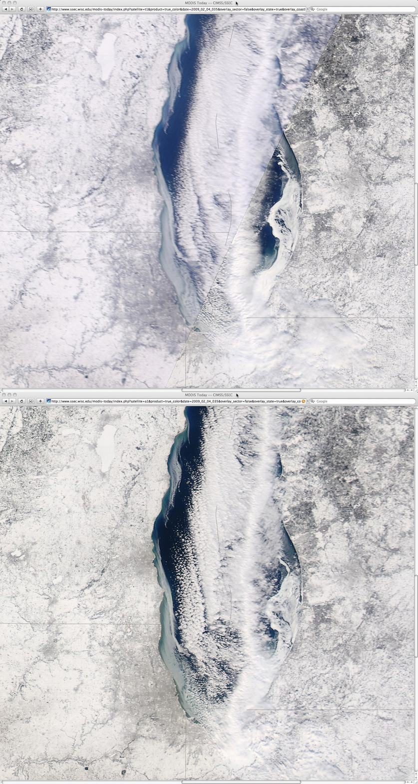
A closer view of southern Lake Michigan using 250-meter resolution MODIS true color images from the SSEC MODIS Today site (below) suggests that the ice along the eastern nearshore waters is probably thicker (and likely snow-covered as well).
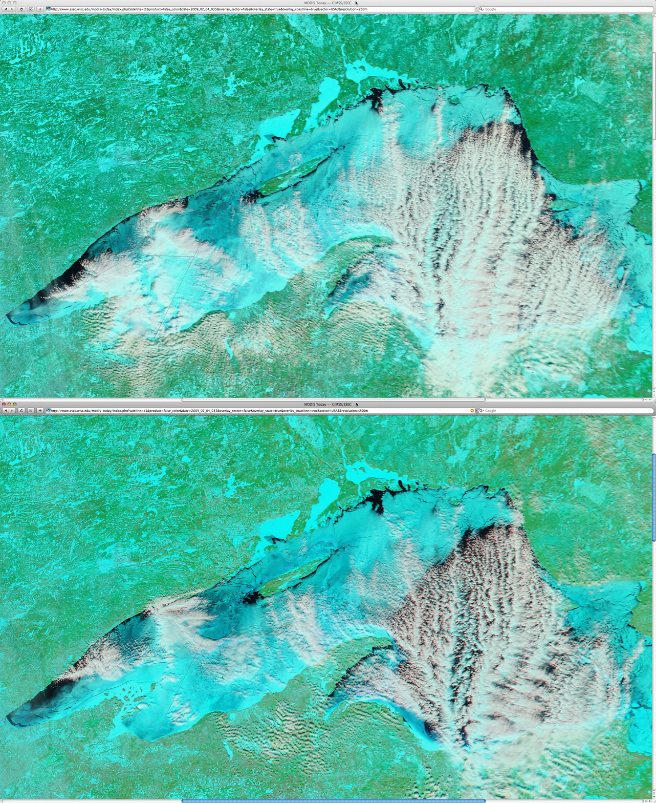
Farther to the north, cold temperatures over the northern Great Lakes region (the morning low on 04 February was -36º F or -38º C at Babbit in northeastern Minnesota, and -28º F or -33º C at Minong in northwestern Wisconsin) led to increased ice coverage over Lake Superior, as seen in 250-meter resolution MODIS false color imagery from the Terra and Aqua satellites (below). The ice in the lake appears as cyan-colored features, in contrast to supercooled water droplet clouds (which appear as varying shades of white). Note that there are more lake-effect cloud bands over the eastern portion of Lake Superior, where there is much less ice coverage — the ice covering much of the western portion of the lake reduces the amount of heat flux necessary to form the lake-effect cloud bands.
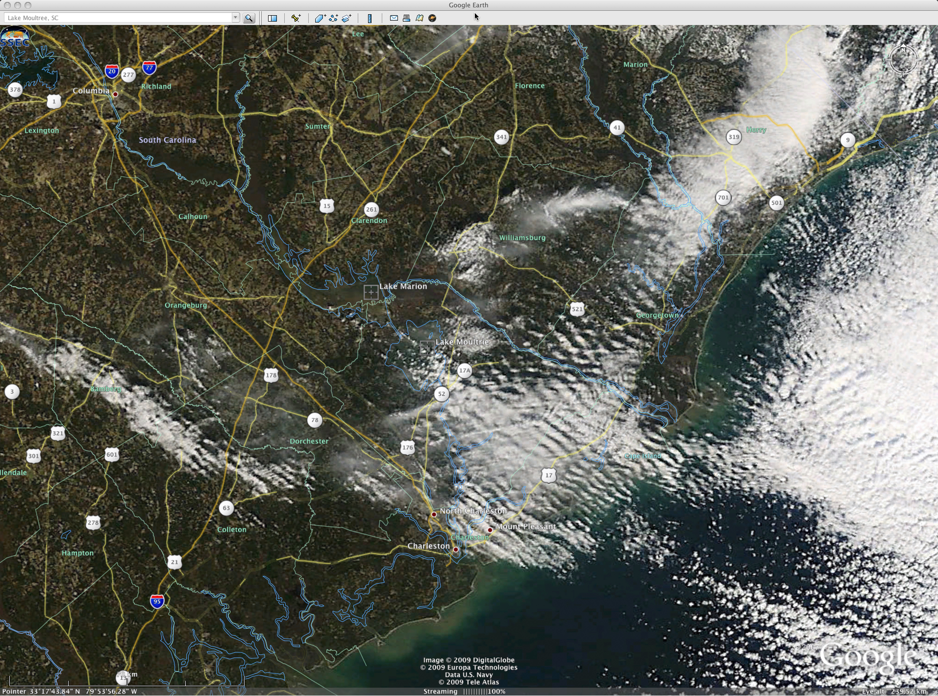
Speaking of lakes and their effect on cloud bands and snowfall, there was also an interesting case of “lake-enhanced” snow on this particular day, immediately downwind of Lake Marion and Lake Moultrie in South Carolina (hat-tip to Jon Jelsema at NWS Charleston SC for bringing this to our attention). A MODIS true color image (below, viewed using Google Earth) showed the cluster of cloud bands that were streaming southeastward from the 2 lakes, producing moderate to heavy snow that was reducing visibility as low as 1/4 mile.
It is interesting to note that a small patch of “transverse band” clouds formed for a brief time, apparently at a slightly higher altitude than the lake-enhanced cloud bands — these transverse bands were more obvious on a NOAA-17 “false color” red/green/blue (RGB) image (below). An animation of GOES-13 visible imagery shows the development of the lake-enhanced cloud bands and the higher-altitude transverse bands — they are both very subtle and appear only briefly, but they are there if you look closely!
— 05 FEBRUARY UPDATE —
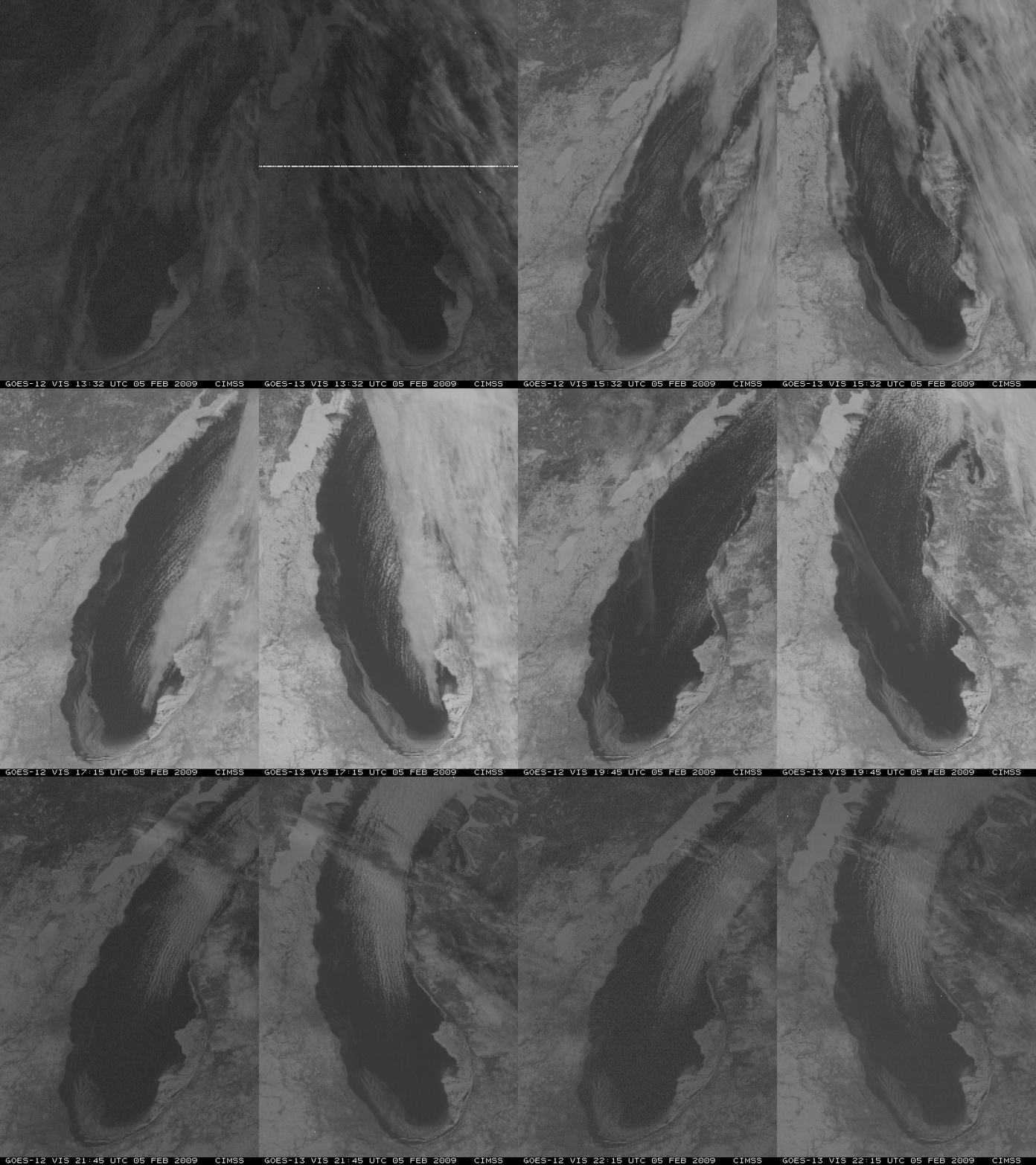
The surface winds shifted from northerly on 04 February to southerly on 05 February, which caused the ice that was floating in the nearshore areas of Lake Michigan to begin drifting northward during the day. This northward drift was clearly seen on GOES-12 and GOES-13 visible imagery (below). You can even see that the “land-fast” ice at the extreme southern end of the lake appeared to break free during the afternoon hours.


