Remnants of Hurricane Paloma
GOES-12 visible (daytime) and 3.9 µm shortwave IR (night-time) images (above) showed a distinct swirl of clouds drifting northward across the Gulf of Mexico on 13 November – 14 November 2008. This cloud swirl was actually the remnants of Hurricane Paloma, which had intensified to a Category 4 hurricane and made landfall over Cuba on 08 November. Note that there were a few weak convective bursts forming near the center of the swirl, but these were fairly short-lived.
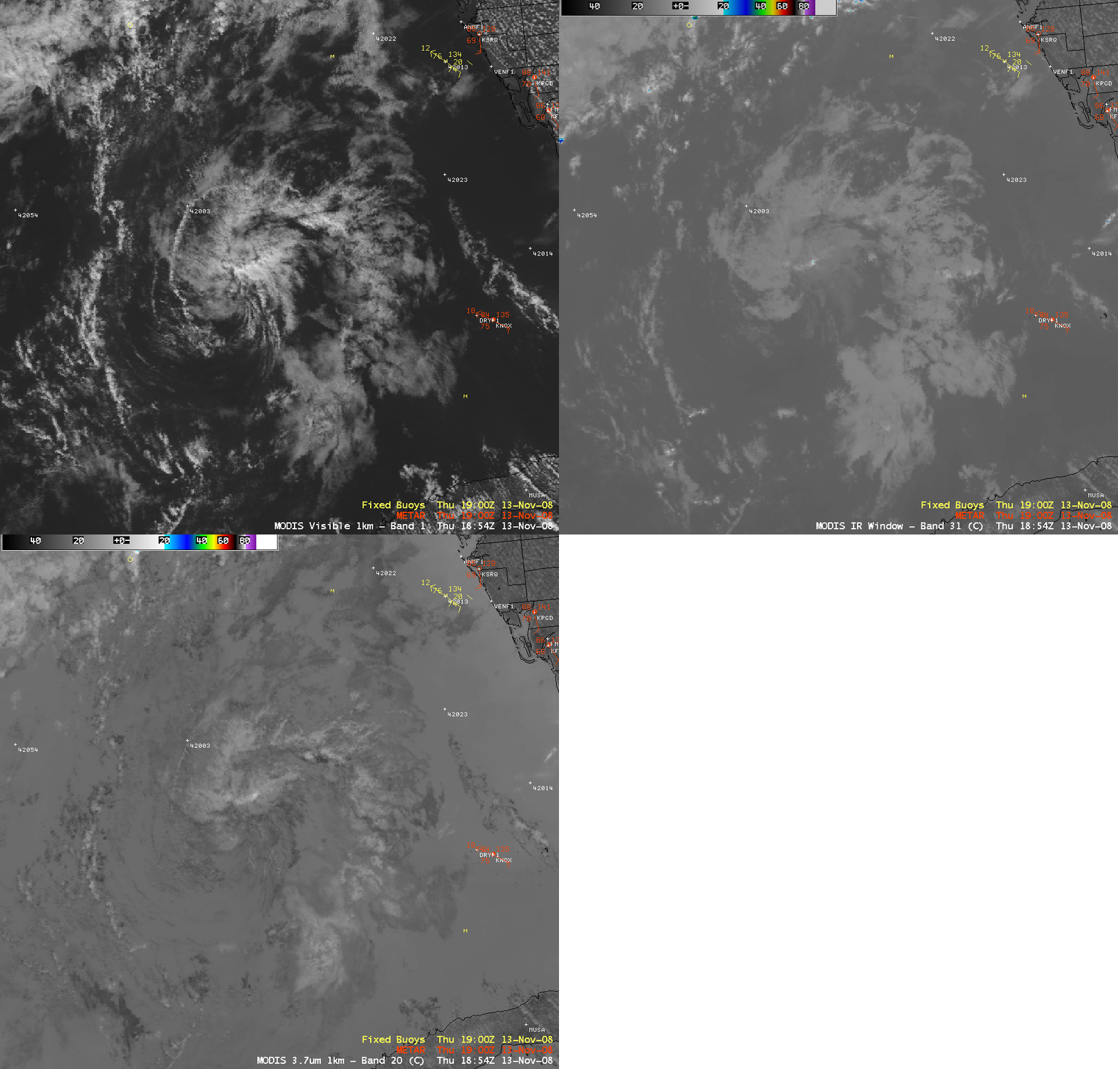
AWIPS images of the 1-km resolution MODIS visible, 11.0 µm IR window, and 3.7 µm shortwave IR images (below) indicated that the swirl was comprised of primarily low-level clouds at 18:54 UTC, with IR brightness temperatures considerably warmer than -20º C — in fact, the MODIS Cloud Top Temperature product displayed values that were generally in the 0º C to +10º C range.
The MIMIC Total Precipitable Water product (below) showed that the remnants of Paloma (which initially had drifted back southwestward over Cuba on 12 November) were embedded within a plume of higher precipitable water (30-45 mm, or 1.2-1.8 inches) as it moved northward across the eastern Gulf of Mexico.
As the remnants of Paloma reached the coast of the Florida panhandle on the morning of 14 November, explosive convective development was seen. This convection actually displayed a well-defined “enhanced-v” storm top signature on the GOES-12 10.7 µm IR imagery (below). Some back-building of the convection was also evident on the IR imagery — this convection produced a swath of heavy rainfall and flash flooding across parts of the Florida panhandle region, with a report of 9.25 inches of rain at Bloxham (located to the southwest of Tallahassee), and 2.61 inches falling at Tallahassee (setting a new rainfall record for the date). Radar-estimated storm total precipitation exceeded 14 inches.
A comparison of 1-km resolution NOAA-18 and 4-km resolution GOES-12 IR images (below) demonstrated the superior enhanced-v detection capability of higher spatial resolution data. The enhanced-v “delta-t” value (the difference between the coldest overshooting top and the warmest portion of the downstream warm wake) was an impressive 22.8º C, which would be a large delta-t value for a tornado or hail-producing supercell over the Great Plains region! This convection was also producing a good deal of cloud to ground lightning, as was noted on the early morning NWS Tallahassee Area Forecast Discussion:
AREA FORECAST DISCUSSION
NATIONAL WEATHER SERVICE TALLAHASSEE FL
410 AM EST FRI NOV 14 2008…SCATTERED SHOWERS AND THUNDERSTORMS HAVE BEEN DEVELOPING OVER OUR AREA…WITH A FEW OF THESE STORMS ALREADY EXHIBITING MARGINAL ROTATING UPDRAFTS AND IMPRESSIVE CLOUD TO GROUND LIGHTNING. THE LATEST RUC INDICATES MUCAPE FROM 350 J/KG OVER CENTRAL GA TO 1500 J/KG ALONG THE FL GULF COAST. THIS IS RATHER IMPRESSIVE FOR THIS TIME OF YEAR…
A blog post by Stu Ostro at the Weather Channel raises the interesting question of whether the energy associated with the remnants of Paloma played a role in the additional development of deadly tornadoes across North and South Carolina about 24 hours later?


