Hurricane Paloma
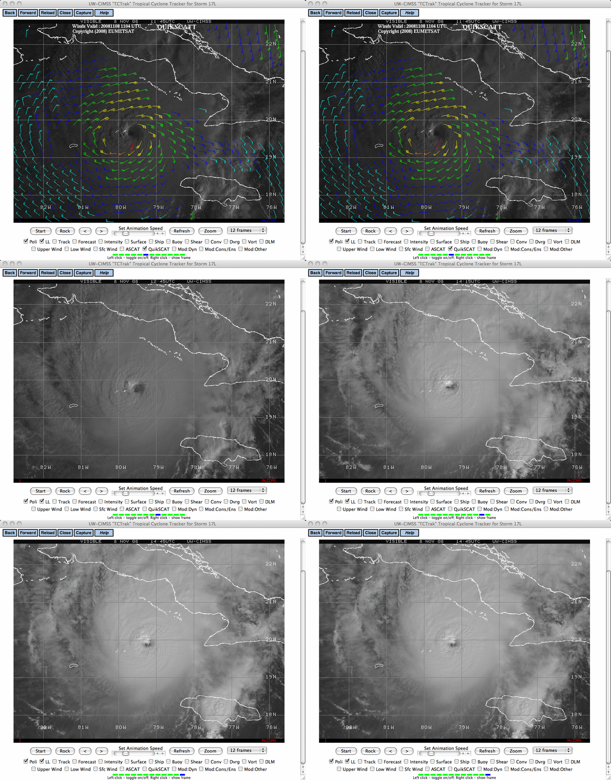
GOES-12 10.7 µm IR imagery (above) showed Category 4 Hurricane Paloma just south of Cuba on 08 November 2008. A well-defined eye was present, surrounded by cold cloud top temperatures in the -70º to -80º C range (as cold as -81º C at 16:25 UTC). GOES-12 visible images from the CIMSS Tropical Cyclones site (below, with an overlay of QuikSCAT winds on the initial image) also displayed a nice eye structure during the morning hours.
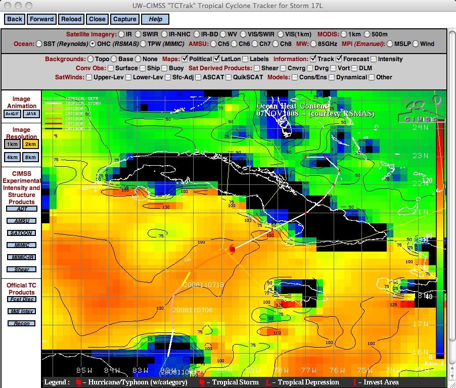
A plot of the CIMSS Advanced Dvorak Technique tropical cyclone intensity estimate (above) indicated that Hurricane Paloma experienced a period of rapid intensification late in the day on 07 November — apparently the tropical cyclone was moving over a tongue of high Ocean Heat Content (below), which may have aided such intensification. On 08 November, Hurricane Paloma became the second strongest November hurricane on record (behind Hurricane Lenny in 1999) — and it is also interesting to note that 2008 now becomes the only year on record with a major hurricane occurring in 5 separate months (Bertha in July, Gustav in August, Ike in September, Omar in October, and Paloma in November).


