Tropical Storm Bonnie downgraded to a Tropical Depression
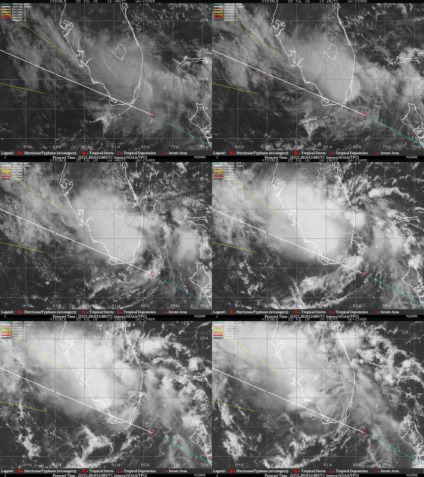
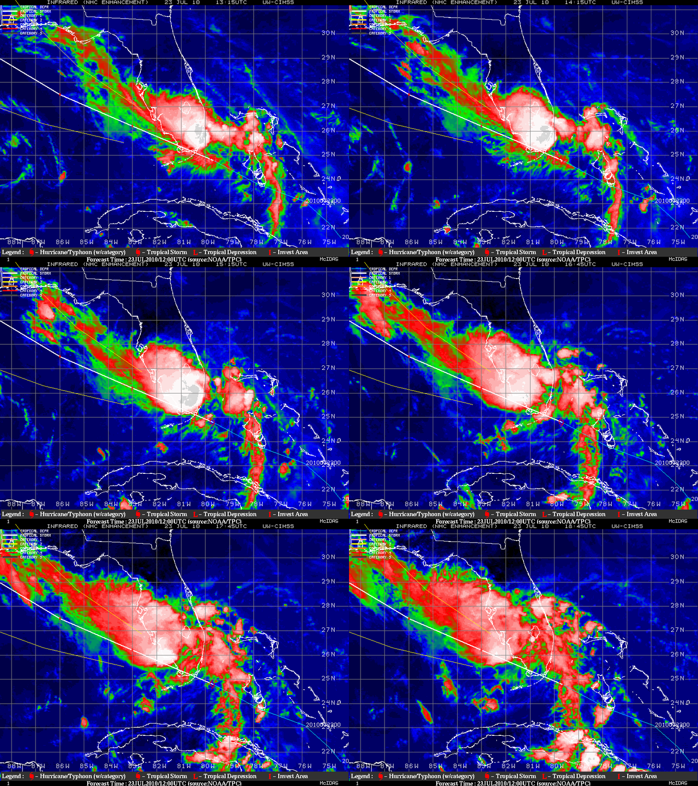
GOES-13 0.63 µm visible images (above) and GOES-13 10.7 µm IR images (below) from the CIMSS Tropical Cyclones site showed Tropical Storm Bonnie crossing southern Florida on 23 July 2010.
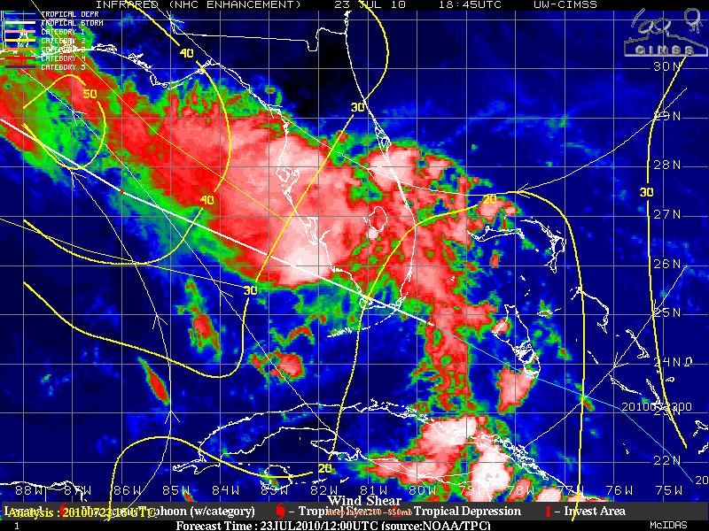
Bonnie was encountering increasing amounts of southeasterly deep layer (850-200 hPa) wind shear (below), which was acting to displace the strongest convection to the north and northwest of the low-level center of the tropical cyclone.
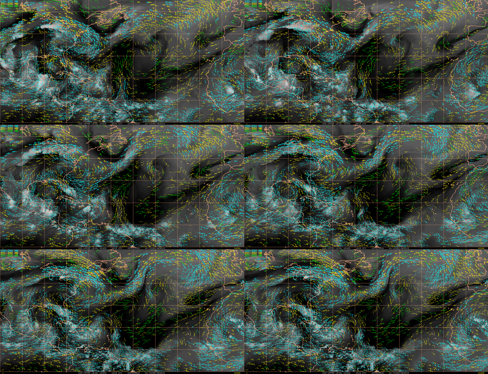
Hourly Atmospheric Motion Vectors (AMVs) produced using GOES-13 and Meteosat-9 data (below) showed that Bonnie was being steered northwestward by the flow between a strong ridge over the southeastern US and an upper level low over the western Gulf of Mexico.
============================================
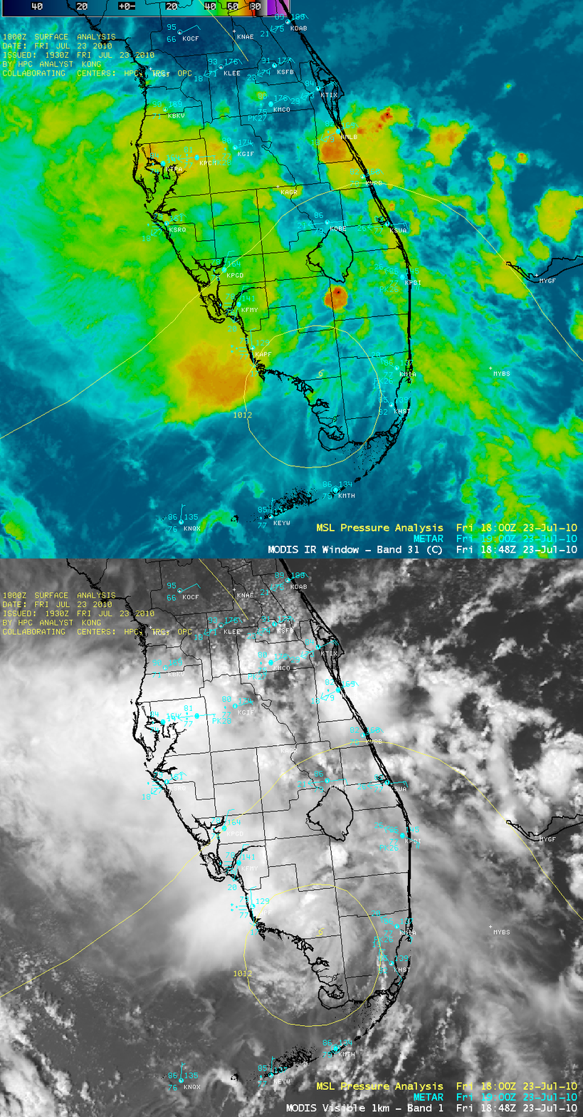
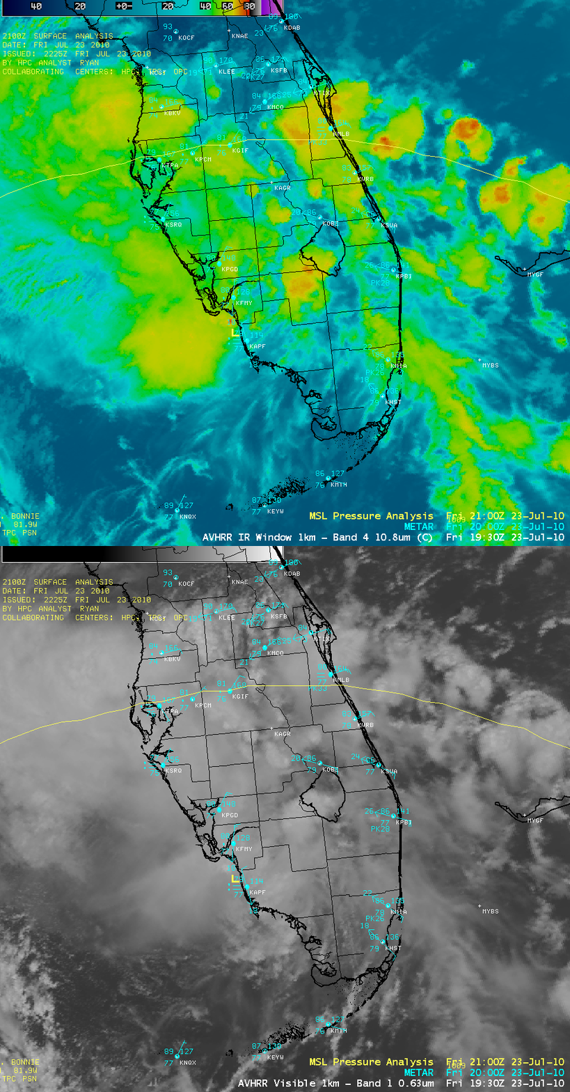
AWIPS images of 1-km resolution visible and IR channel data from MODIS (above) and POES AVHRR (below) show Bonnie as it moved across the Florida peninsula and weakened from a Tropical Storm to a Tropical Depression.


