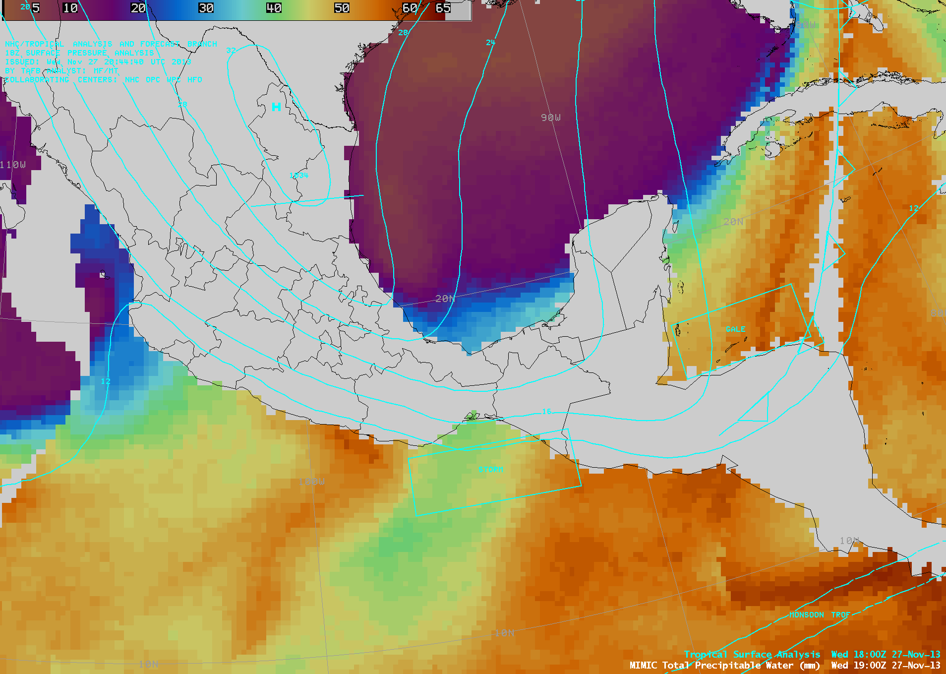
Tehuano wind event
An AWIPS-1 image of GOES-13 6.5 µm water vapor channel data (above) showed a large storm that was affecting much of the eastern US during the 26 November – 27 November 2013 period. Arctic air surging... Read More
An AWIPS-1 image of GOES-13 6.5 µm water vapor channel data (above) showed a large storm that was affecting much of the eastern US during the 26 November – 27 November 2013 period. Arctic air surging... Read More
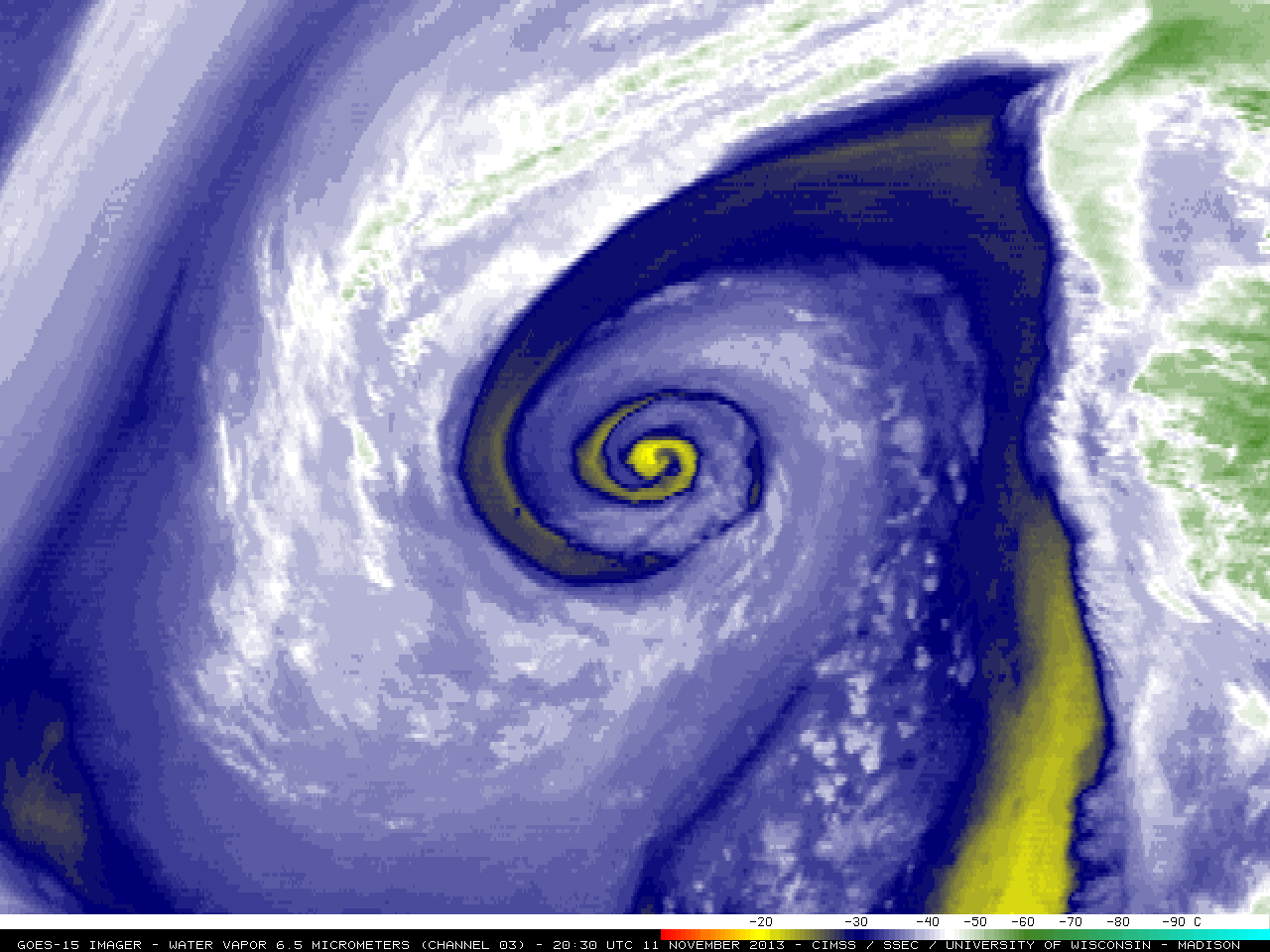
A rapidly occluding mid-latidude cyclone over the East Pacific Ocean on 11 November 2013 exhibited a classic “dry swirl” signature on McIDAS images of 4-km resolution GOES-15 6.5 µm water vapor channel data (above; click image to play animation).The dry swirl signature was... Read More
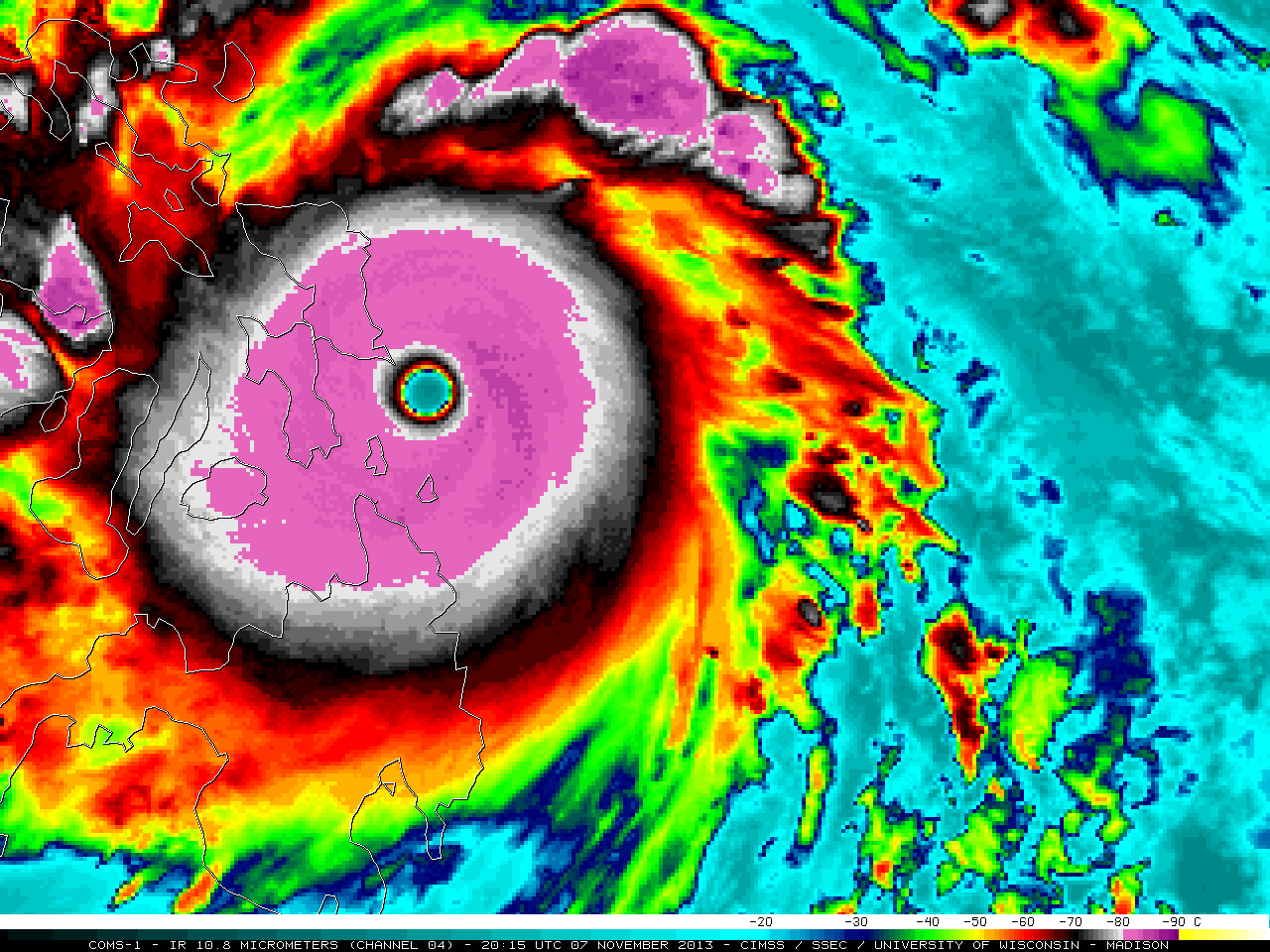
Super Typhoon Haiyan (31W) formed as a tropical depression at low latitudes in the West Pacific Ocean on 03 November 2013 — and by 18 UTC on 07 November was estimated to have peaked at an intensity of sustained 170 knot winds with gusts to 205 knots (Read More
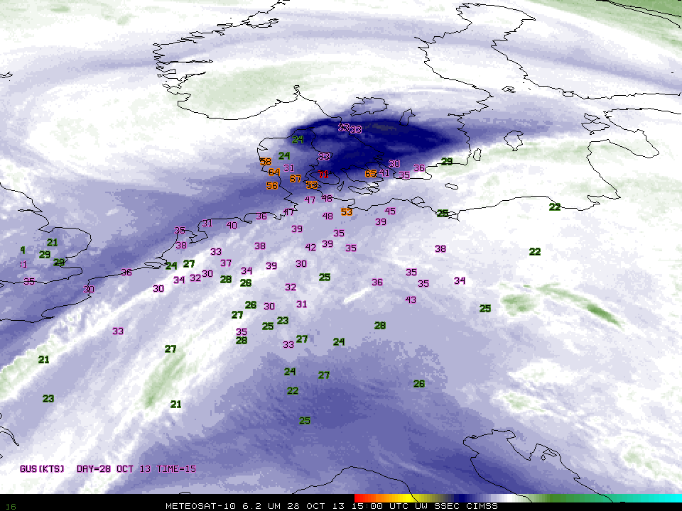
Sting jets are wind maxima near the end of bent-back fronts in cases of strong cyclones. As noted earlier on this blog, they can acquire a characteristic look in water vapor imagery, vaguely reminiscent of a scorpion’s stinger. In addition, strongly sinking air around the jet, usually associated with both a tropopause fold and a... Read More
