Possible Sting Jet Associated with strong storm in Europe
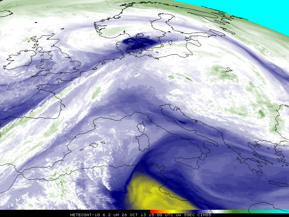
Sting jets are wind maxima near the end of bent-back fronts in cases of strong cyclones. As noted earlier on this blog, they can acquire a characteristic look in water vapor imagery, vaguely reminiscent of a scorpion’s stinger. In addition, strongly sinking air around the jet, usually associated with both a tropopause fold and a maximum in ozone, is manifest as a warm (dry) patch in the water vapor (WV) imagery. In the animation above, the sting jet is apparent moving across northern Denmark into southern Sweden between 1500 and 1800 UTC. This is in association with the ‘St. Jude’ storm that killed more than a dozen across northern Europe (Reuters news story).
The strong sinking near a sting jet can transport momentum down to the surface. You should therefore expect to see strong surface wind gusts near the water vapor satellite signature, and that was the case on October 28, as shown below.
Hourly Meteosat-10 6.2 µm WV channel images and Observed Surface Wind Gusts (click to play animation)
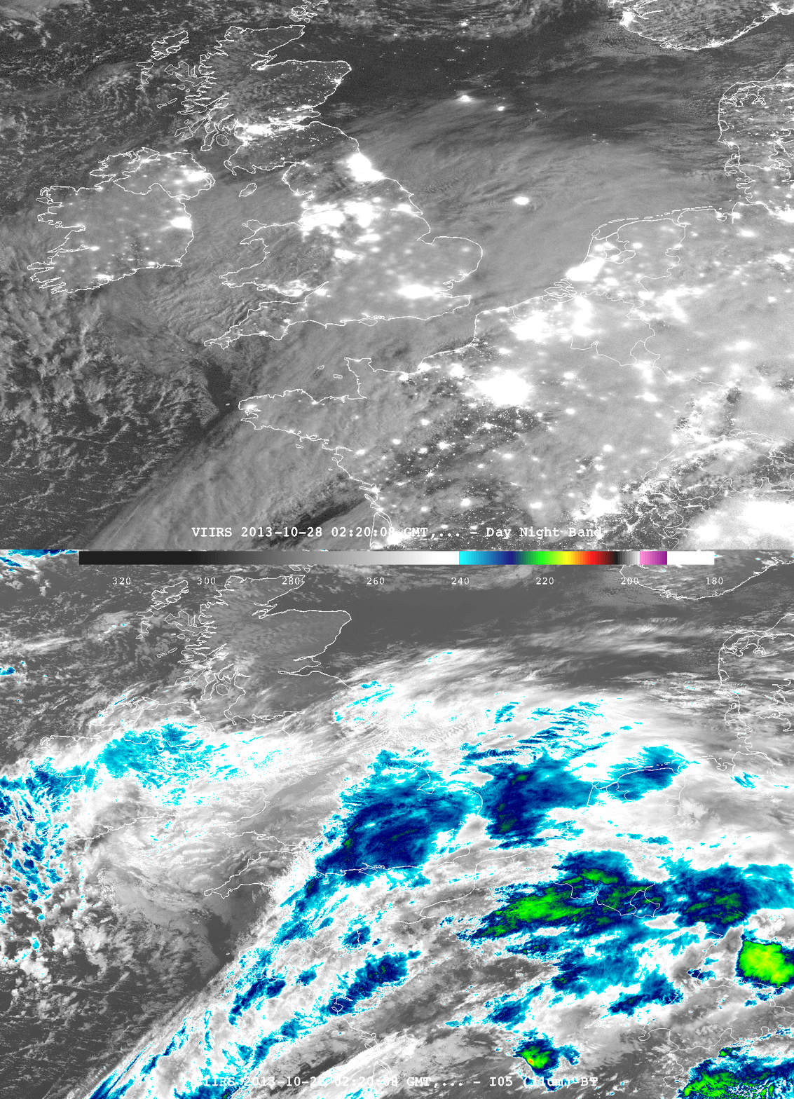
Suomi/NPP viewed this storm early in the day on 28 October. The toggle between the VIIRS Day/Night Band and the 11.45 µm IR data, below, shows a developing baroclinic leaf over the British Isles.

Toggle between VIIRS Day/Night Band and 11.45 µm IR imagery at 0220 UTC on 28 October (click to enlarge)
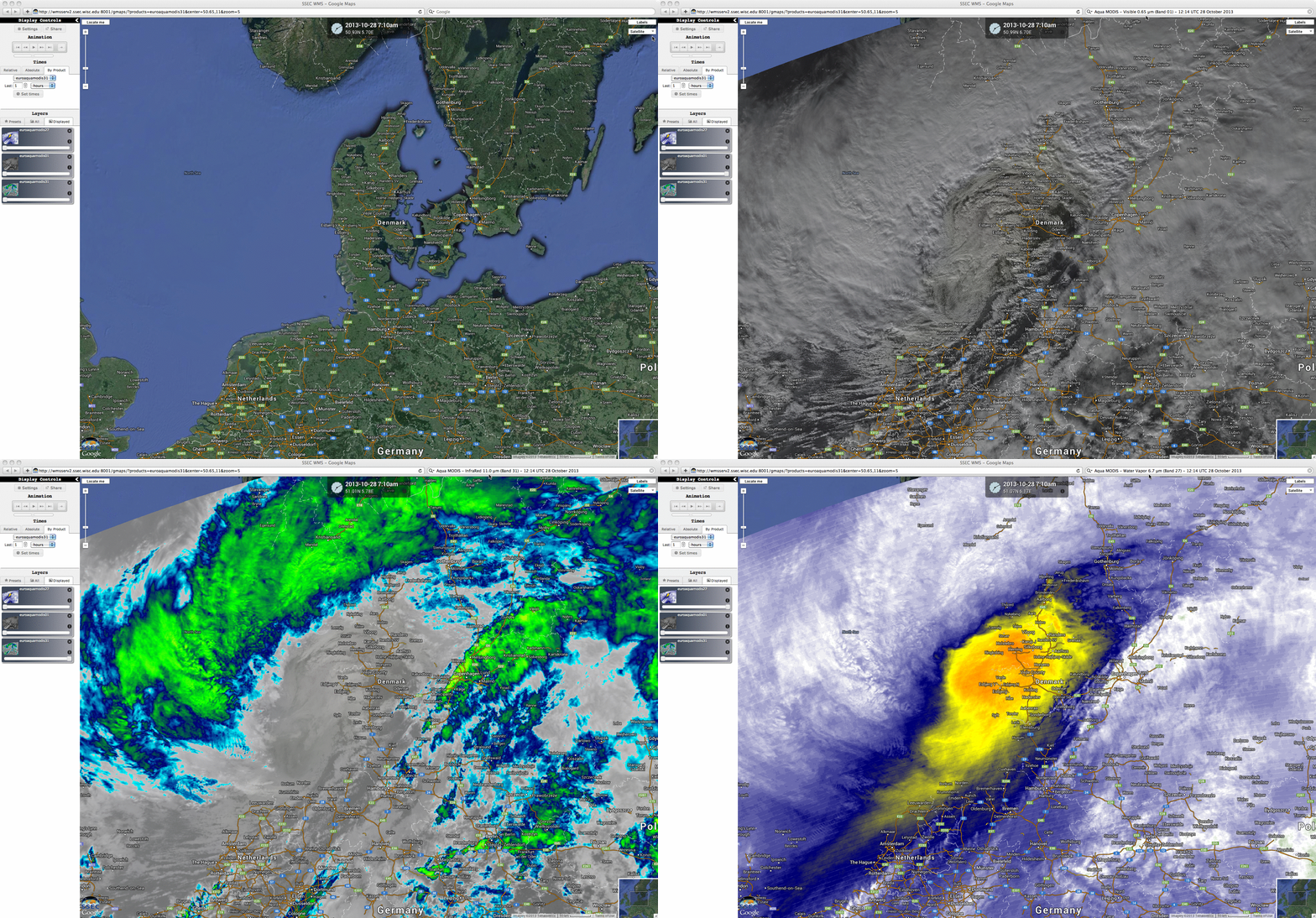
A comparison of Aqua MODIS 0.65 µm visible, 11.0 µm IR, and 6.7 µm water vapor channel images visualized using the SSEC Web map Server (below; courtesy of Russ Dengel and Kathy Strabala, SSEC) showed the storm at 12:14 UTC on 28 October. The warm/dry signature of strongly-subsiding middle to lower tropospheric air was particularly evident on the water vapor image (yellow to orange color enhancement) as it was beginning to move eastward over Denmark.
For additional satellite images of this event, see the EUMETSAT Image Library and the Wide World of SPoRT.


