Tehuano wind event
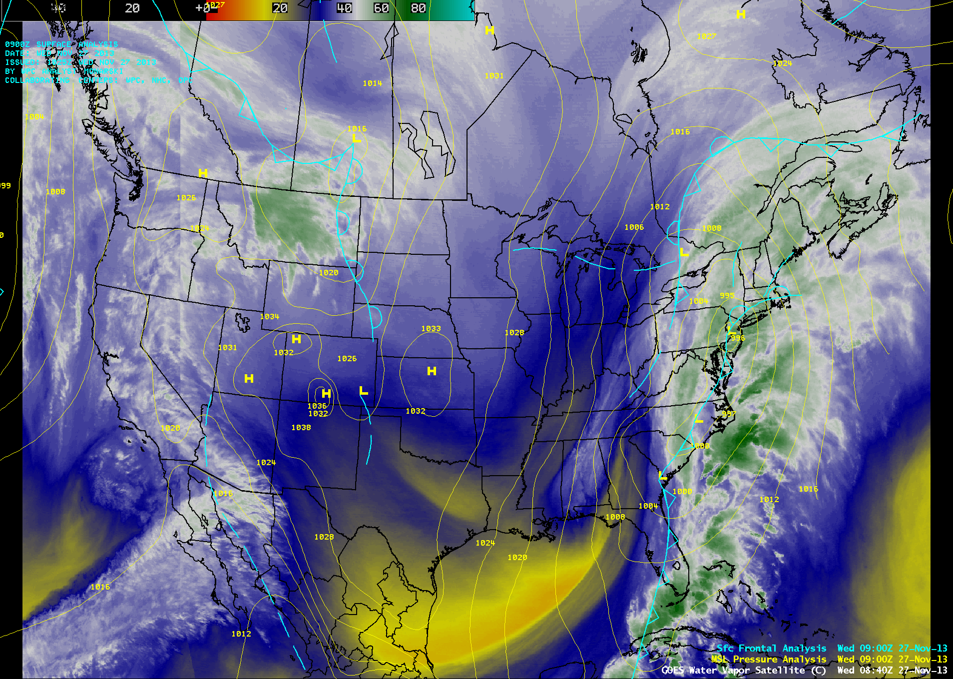
An AWIPS-1 image of GOES-13 6.5 µm water vapor channel data (above) showed a large storm that was affecting much of the eastern US during the 26 November – 27 November 2013 period. Arctic air surging southward behind this storm system crossed the Gulf of Mexico, was funnelled through the mountain passes of southern Mexico, and eventually emerged into the Pacific Ocean in the Gulf of Tehuantepec. This type of “Tehauno wind event” tends to occur a few times each year during the cold season — a few other cases have been documented on this blog.
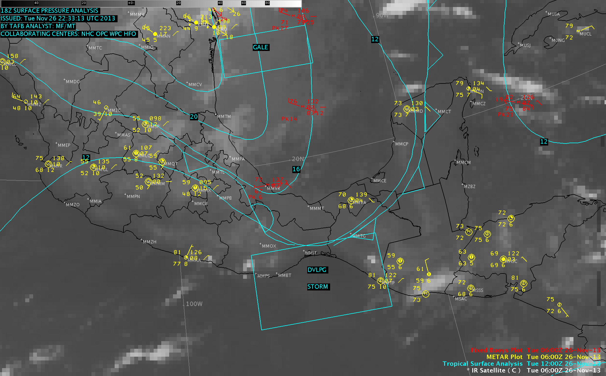
A series of AWIPS-2 images of GOES-13 10.7 µm IR channel data with overlays of surface and buoy reports and tropical surface analyses (below; click image to play animation) showed that the Gulf of Tehuantepec region was highlighted on 26 November as a region susceptible to developing Storm Force (48-55 knot) winds as the cold front approached from the north. Once the strong gap winds emerged from the southern coast of Mexico, parts of that area likely began to experience storm force winds.

GOES-13 10.7 µm IR images, with surface and buoy reports and tropical surface analysis (click to play animation)
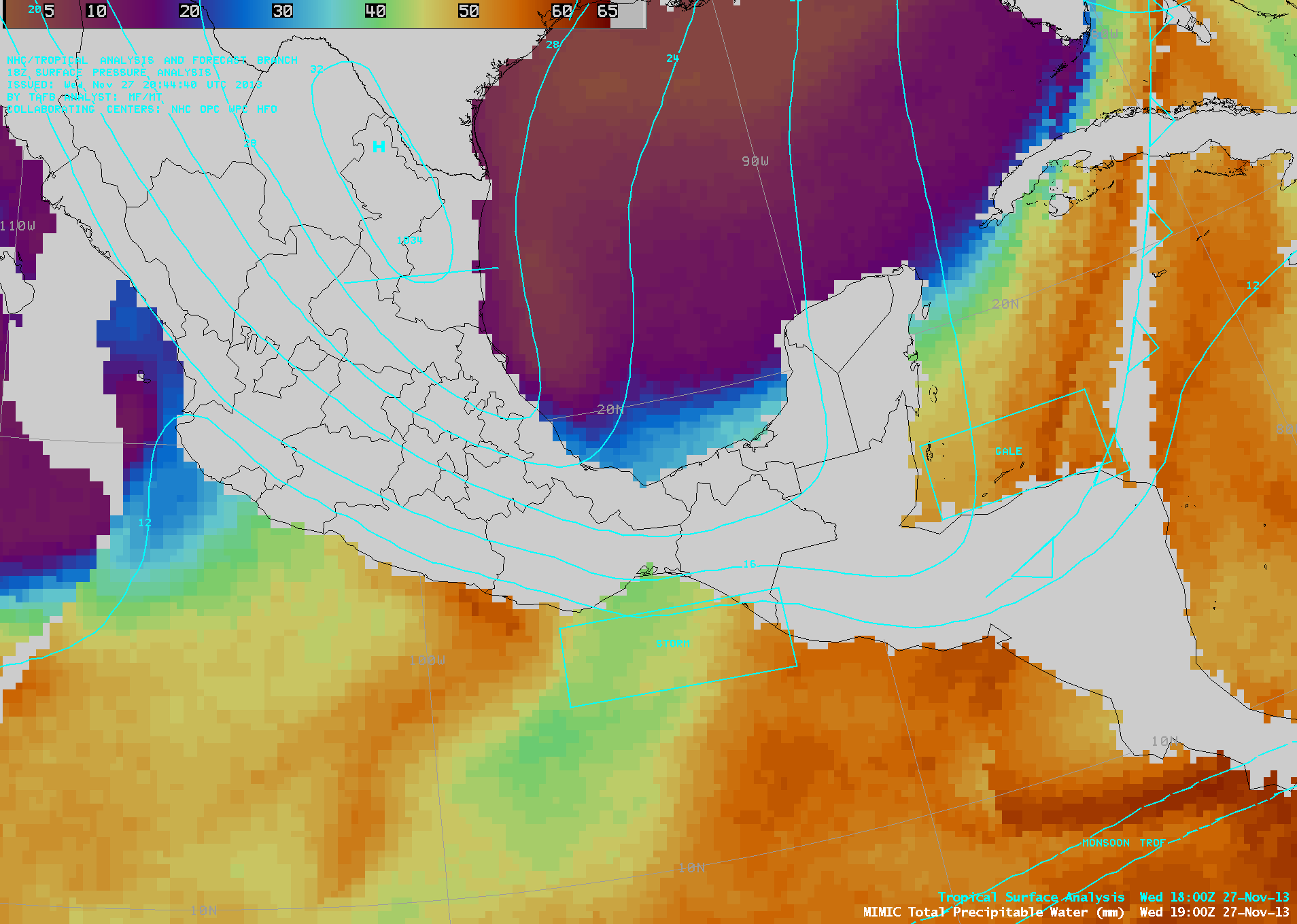
The plume of dry air associated with the Tehuano wind event could be seen on AWIPS-1 images of the MIMIC Total Precipitable Water product (below; click image to play animation).
During the day on 27 November, the hazy signature of blowing dust and sand could be seen streaming southward across the Gulf of Tehuantepec on McIDAS images of GOES-13 0.63 µm visible channel data (below; click image to play animation).


