“Sting Jet” signature associated with a high wind event in Scotland
A rapidly intensifying mid-latitude cyclone (named “Cyclone Ulli” by the Europeans | surface analysis) was responsible for a high wind event as it moved over Scotland on 03 January 2012. A sequence of EUMETSAT Meteosat-9 Water Vapor (7.35 µm) images (above) revealed two notable signatures: (1) the formation of a pronounced area of warm/dry water vapor brightness temperatures (bright yellow to orange color enhancement) over the open water north of Ireland, which indicated a strongly forced region of rapidly descending middle-tropospheric air, and (2) a classic “Sting Jet” signature (Monthly Weather Review | Wikipedia) which then moved eastward across Scotland. Just to the south of the sting jet signature, a wind gust of 78 knots (90 mph) was recorded at Glasgow at 08:20 UTC, followed by a wind gust of 70 knots (81 mph) at Edinburgh at 08:50 UTC. There were additional reports of wind gusts in excess of 87 knots (100 mph) at non-METAR sites in Scotland.
The Sting Jet signature can also be seen in EUMETSAT Meteosat-9 Infrared (10.8 µm) images (Animated GIF) and EUMETSAT Meteosat-9 Visible (0.635 µm) images (Animated GIF).
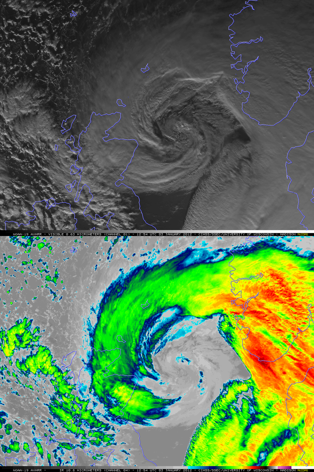
A comparison of 1-km resolution NOAA-19 Visible (0.63 µm) and Infrared (10.8 µm) images at 12:54 UTC (below) showed the structure of the cyclone as it was centered over the North Sea between the British Isles and Norway.
Additional images of this Sting Jet event are available on the EUMETSAT and NASA Wide World of SPoRT sites.


