Search results for surface water vapor
Early ABI Images from GOES-18
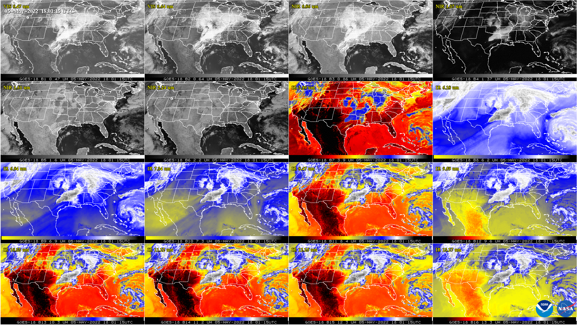
NOAA and NASA recently released the first ABI (Advanced Baseline Imager) imagery from GOES-18 (including this 2-min video). GOES-T was launched on March 1st. In fact, both GOES-16 and GOES-17 monitored the rocket signature. GOES-18 is the third in the GOES-R series and is currently located above approximately 90W. Soon GOES-18 will move to a “near West”... Read More
Blowing dust, wildfires and severe weather in the southern Plains — with blizzard conditions in the northern Plains
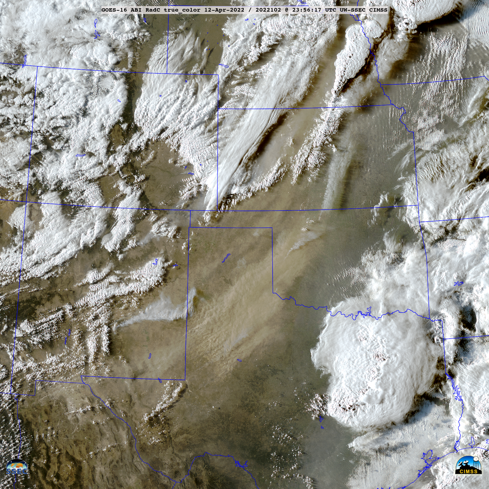
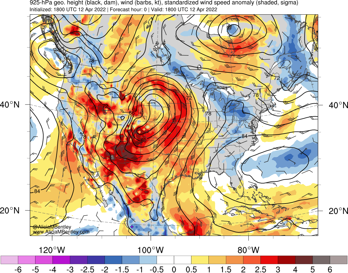
5-minute GOES-16 {GOES-East) True Color RGB images created using Geo2Grid (below) showed widespread blowing dust (shades of tan) and wildfire smoke plumes (brighter shades of white) across much of the central/southern Plains on 12 April 2022. Wind speeds were anomalously strong behind a dryline within the warm sector of an anomalously-deep surface low, which... Read More
Satellite signatures of moist soil (and patches of snow cover) across Iowa
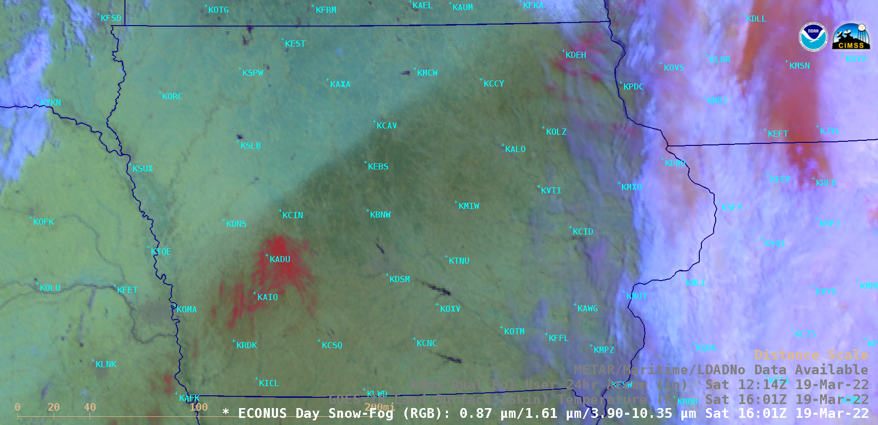
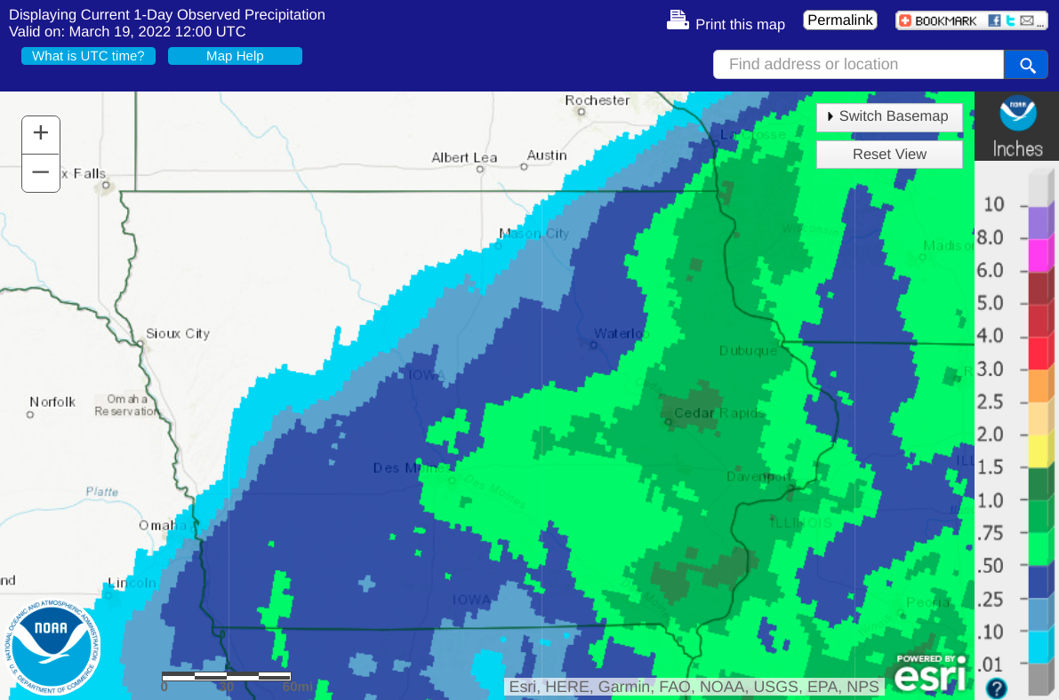
The southeastern 2/3 of Iowa received precipitation during the 24 to 48 hours preceding 12 UTC on 19 March 2022 — and GOES-16 (GOES-East) Day Snow-Fog RGB images (above) showed (1) a signature of the resultant moist soil (darker shades of green) across central and southeastern Iowa, along with (2) isolated patches of fresh snow... Read More
