Ring Structures in GOES-17 infrared imagery over the Hawai’ian peaks
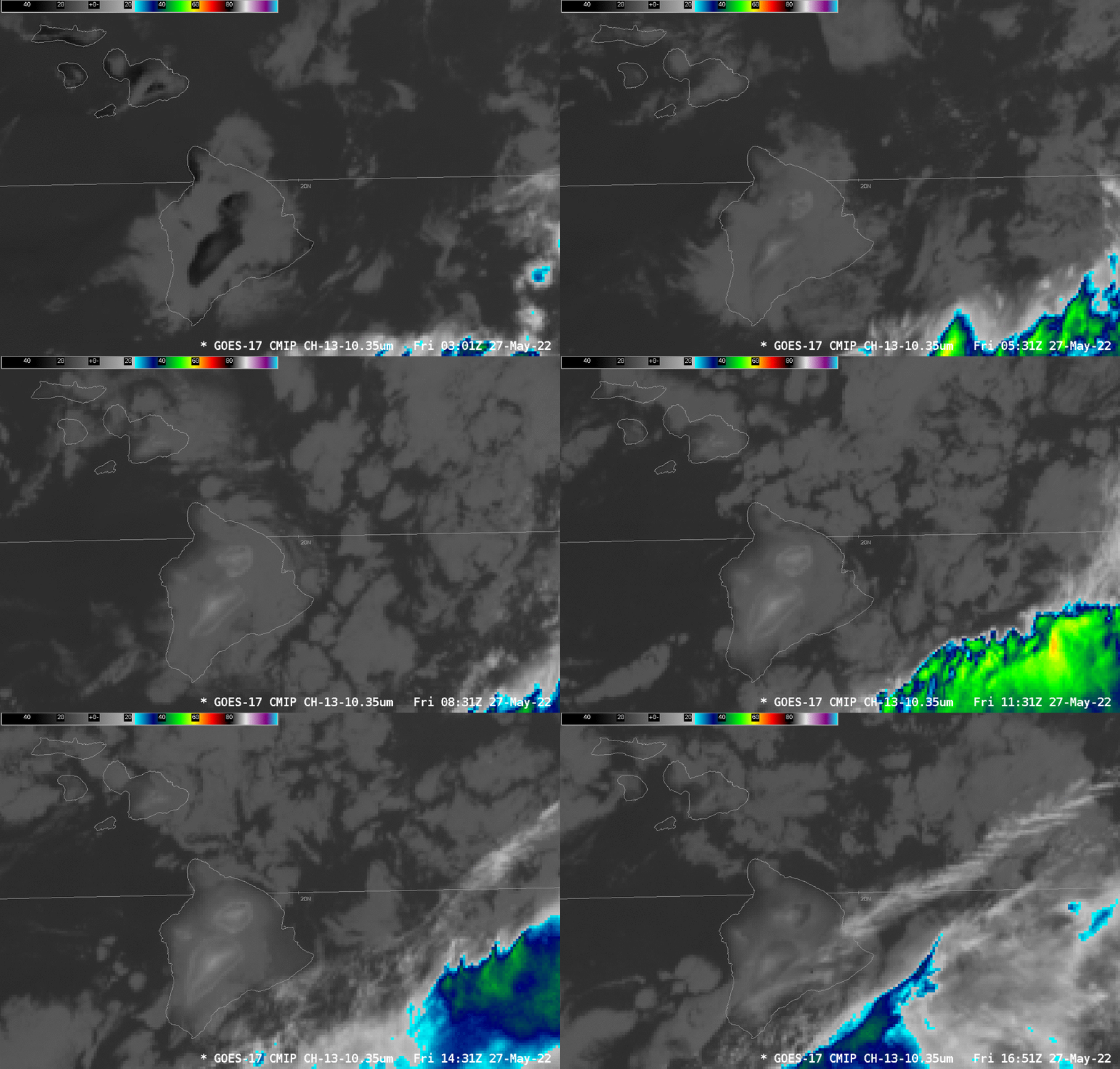
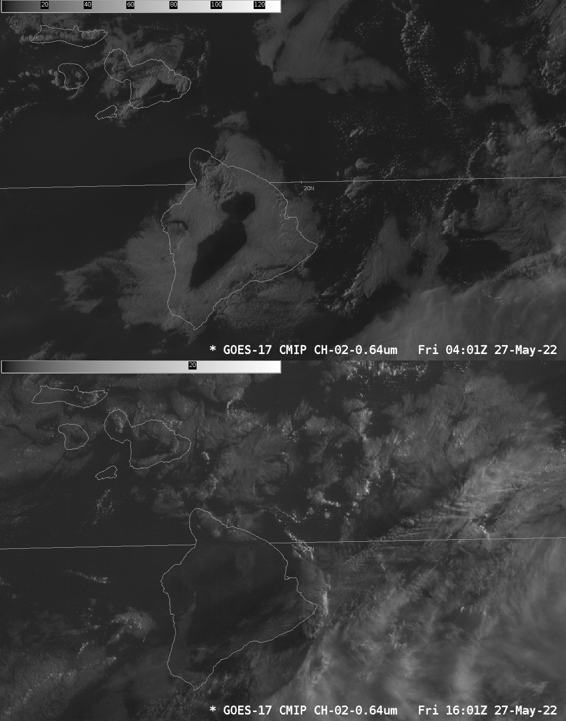
An animation of GOES-17 Band 13 10.3 µm infrared imagery, above, shows the development of concentric circles of cold, warm, cold and warm surrounding the high peaks of the island of Hawai’i (Click here to see a topographic view). The warmth apparent around the peaks at the start of the animation above (dark in the enhancement chosen) suggests that the peaks are peeking through a stratus deck; the toggle below between sunset and sunrise imagery (the sunrise imagery has been brightened considerably) shows that clouds dissipated overnight.
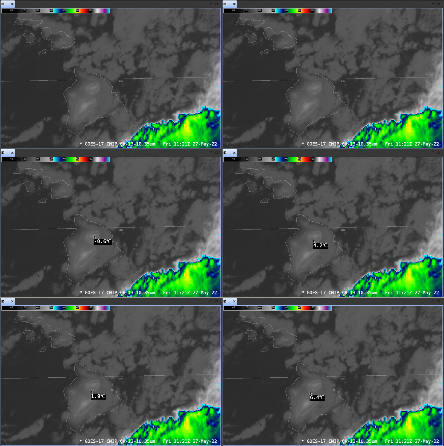
The animation below shows brightness temperatures sampled through the rings at 1121 UTC surrounding Mauna Kea. Mountain-top temperatures are sub-freezing, warming to around 5oC/41oF just off the peak, before cooling again to 2oC/36oF and then warming to 5+oC/41+oF farther down the slope. This interesting behavior results from a combination of cooling in the presence of an inversion, and cooling interrupted by the presence of cloudiness. The 1200 UTC sounding from Hilo, on the eastern part of the north coast of Hawai’i, is shown here (courtesy K. Kodama, WFO HNL).
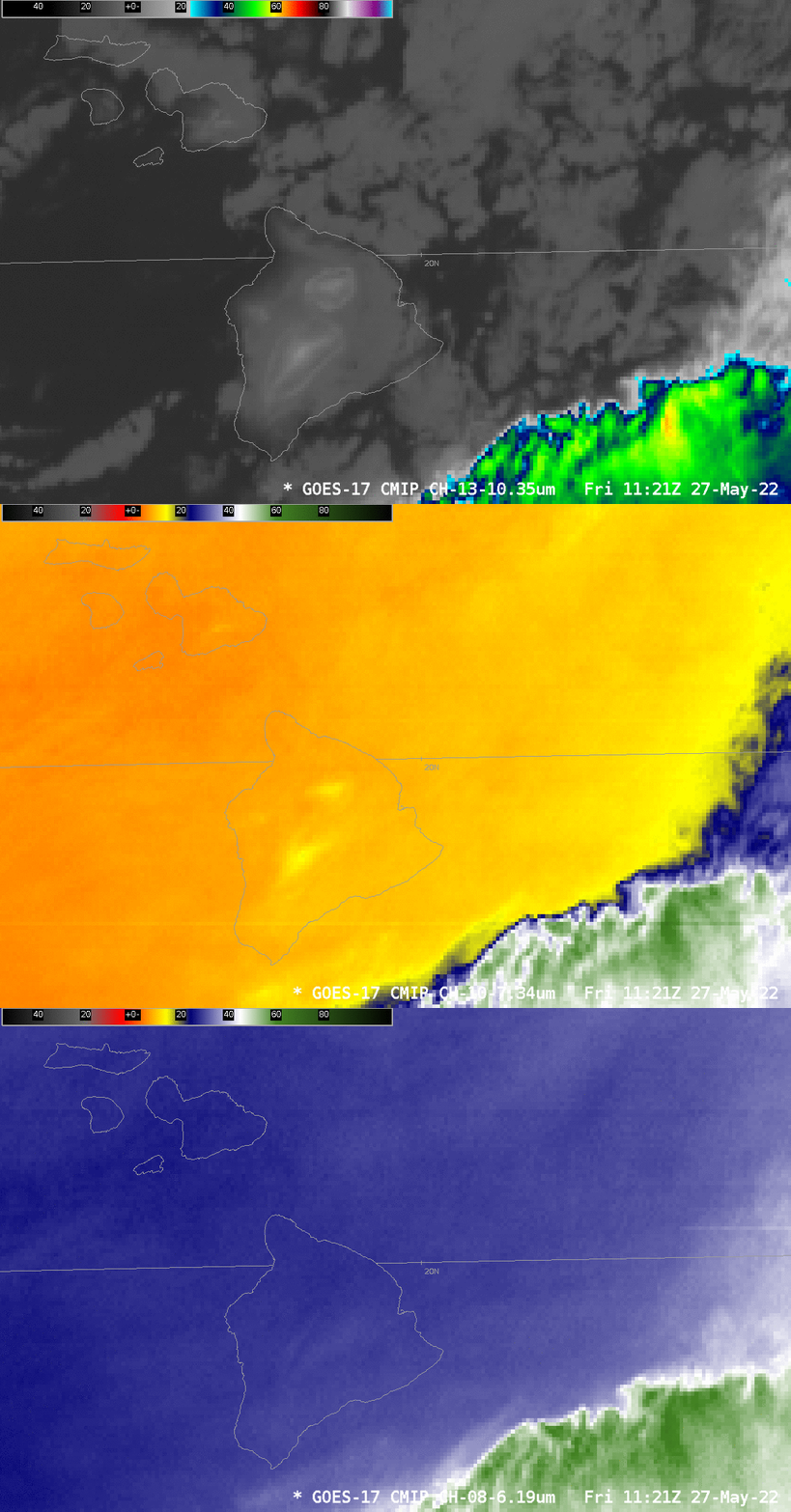
The toggle below compares GOES-17 Bands 13, 10 and 8 (10.3 µm, 7.3 µm and 6.19 µm, respectively) at 1121 UTC. The ringing is obvious in Band 13; it is not obvious in Bands 10 and 8: in those two bands any surface cooling differences are masked by water vapor emissions higher in the atmosphere, even at the high altitudes along the slopes of Mauna Kea and Mauna Loa.
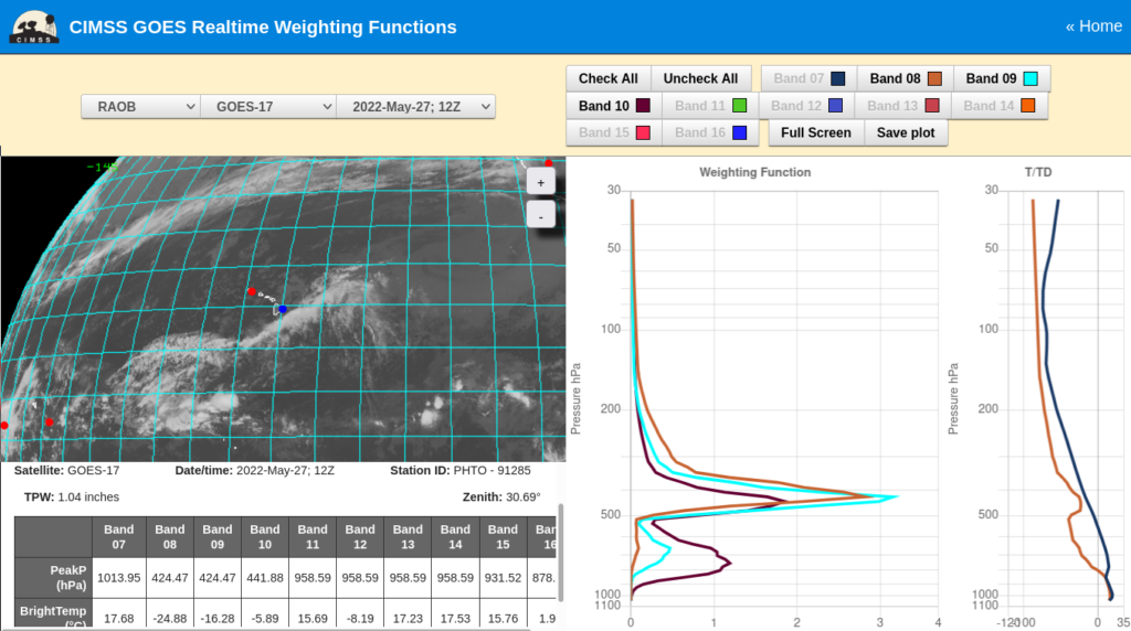
Weighting Functions for the three water vapor bands (taken from this website) underscore why ringing around the peaks is far less likely to be observed in the water vapor channels on this day. The sounding shown below (or here) shows a moist layer above 500 mb, between 6 and 8 km above ground; Mauna Loa and Mauna Kea peak at about 4.2 km. The surface-based infrared signal at wavelengths between 6.2 and 7.3 µm will be obscured by water vapor emissions from higher up in the atmosphere. If that high-altitude moist layer were missing, the cold-warm-cold-warm signal would have a better chance of appearing in the water vapor imagery.
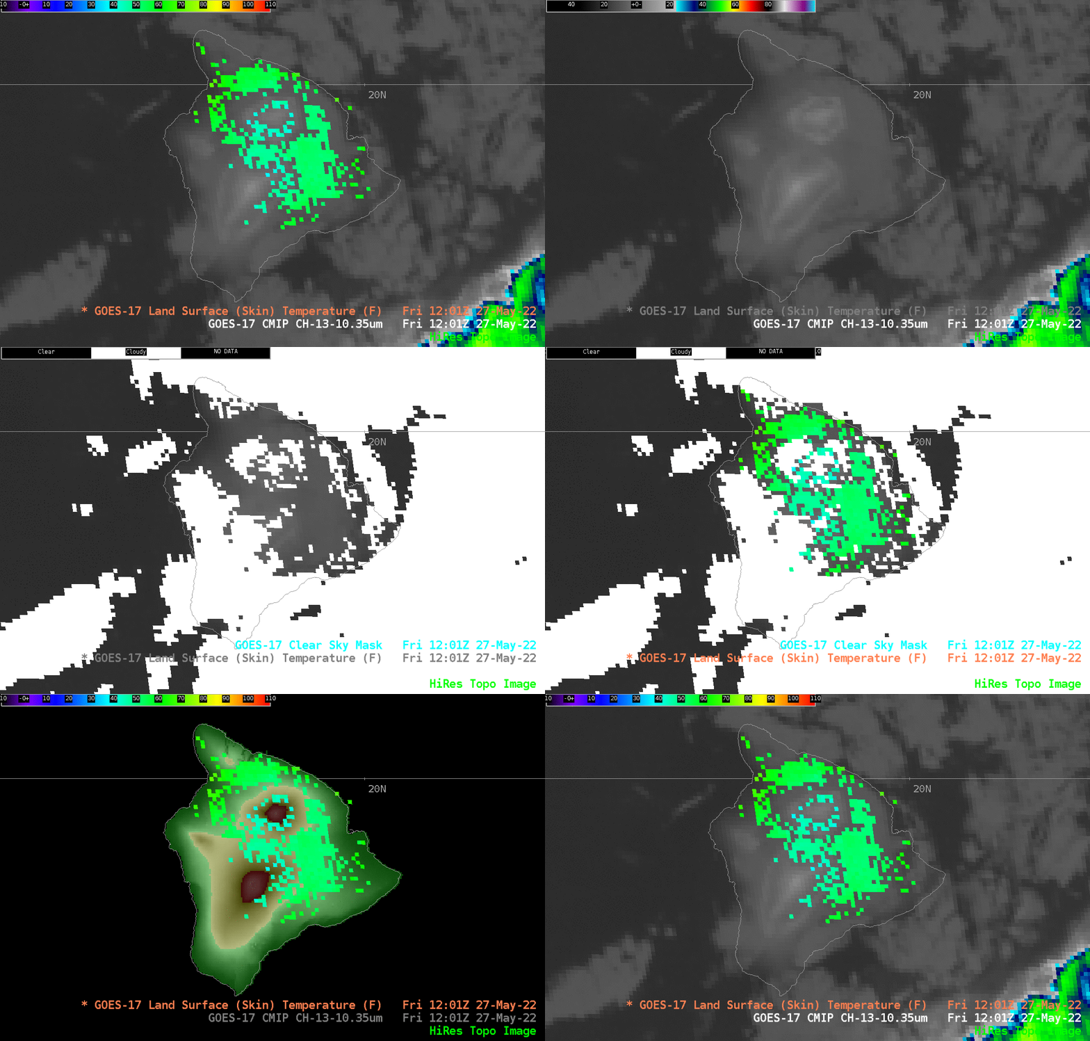
Because skies are clearing, one might expect these ring features to appear in the Land Surface Temperature field. However, a toggle that field at 1201 UTC, along with the Clear Sky Mask, shows that is not the case. Land Surface Temperature is computed in regions where skies are “Clear” or “Probably Clear”, but not where skies are “Cloudy” or “Probably Cloudy” (the four possible states in the Clear Sky Mask; note however that AWIPS displays on “Cloudy” skies as white, and all other states are transparent). Thus, the ‘warm’ parts of the rings are displayed; the cold parts are not.
Thanks very much to Kevin Kodama, WFO HNL, and Jordan Gerth, NWS/OBS, for bringing this interesting case to our attention!

