An mesoscale phenomenon that sometimes emerges out of Mesoscale Convective Systems (MCS) is the Mesoscale Convective Vortex (MCV). Intense latent heating within the rain core of an MCS can help spin up a vortex that will occasionally live on even as the MCS that spawned it withers away. The spin-up can be visualized as a potential vorticity response to latent heating in mid levels that increases static stability and therefore increases the potential vorticity, inducing spin. The spin development can also be viewed in terms of changes in height via the Quasi-geostrophic height tendency equation: latent heat above causes height falls below and the development of cyclonic spin.
Atmospheres that support the development of MCVs have things in common. Abundant moisture and low stability are important. It’s also common to have low values of vertical wind shear; that is, the wind profile is fairly uniform. The degree of uniformity together with the amount of moisture and instability help determine if the MCV will be sustained. The key to persistence is ongoing warming through latent heat release at mid levels.
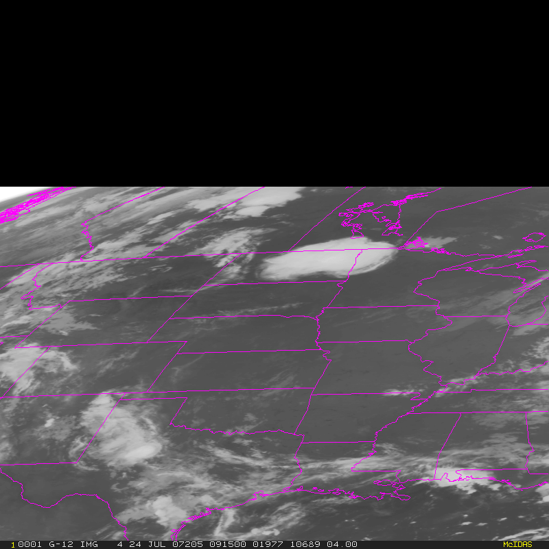
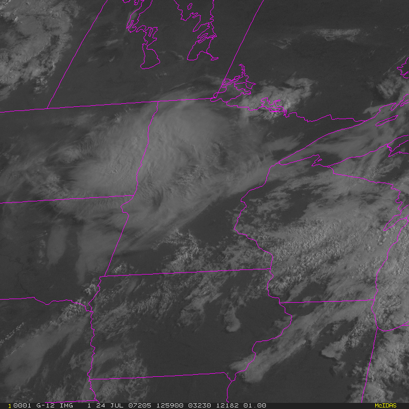
On 24 July, a large MCS over the northern Plains spawned an MCV that moved eastward and southward into Minnesota. The loop is above. Focus on the large cloud mass over the Dakotas that moves towards central Minnesota. The cyclonic spin of the MCV is subtle but present.
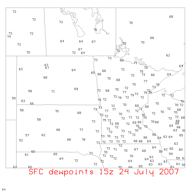
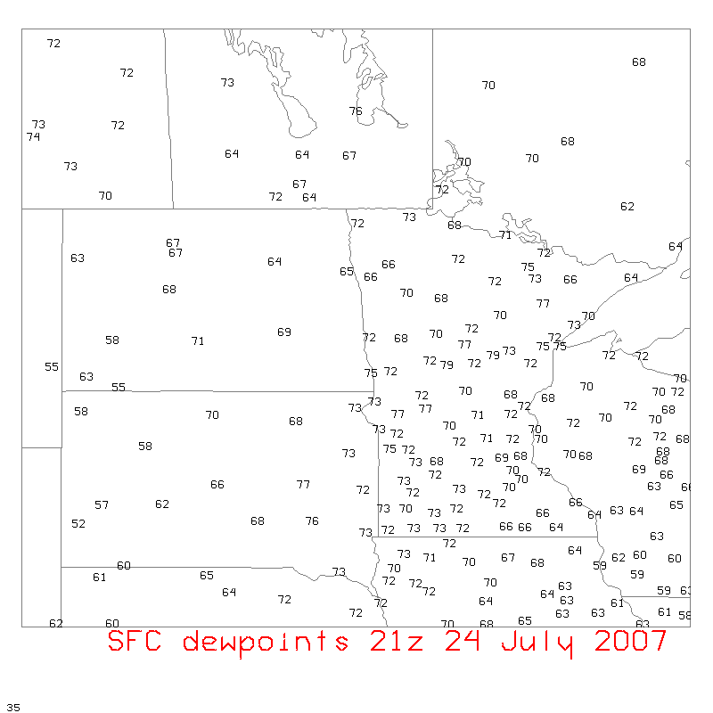
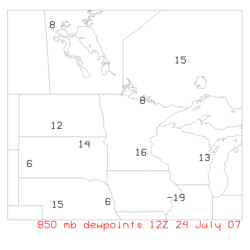
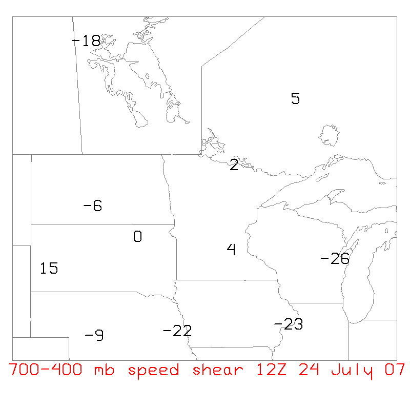
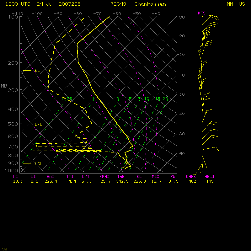
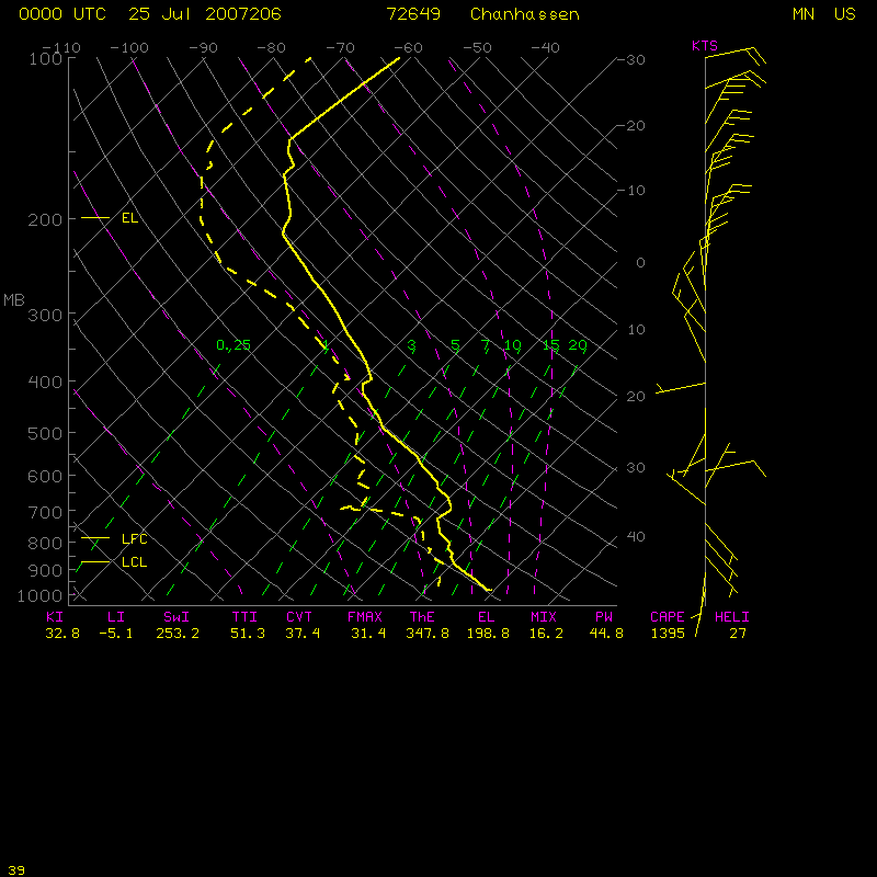
This MCV traversed a region of plentiful moisture, as shown by surface dewpoint plots at 15z and at 21z. Dewpoint plots at 850 hPa also show plenty of moisture over the upper midwest, and plots of 700-400 hPa wind speed shearshow a region of small shear over the upper midwest. You can also check out Chanhassen’s upper air sounding at 12z on the 24th and 00z on the 25th.
What do the conventional data show? Abundant moisture in a region of small vertical shear. That is precisely the kind of atmosphere that supports MCVs.
Added: A visible loop that more clearly shows the cyclonic spin of the MCV is available here. (Caution: this is a 12 megabyte animated gif)
View only this post Read Less

")


