GOES “operational” vs. “mesoscale” winds
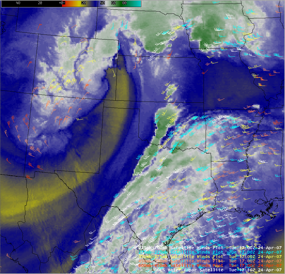
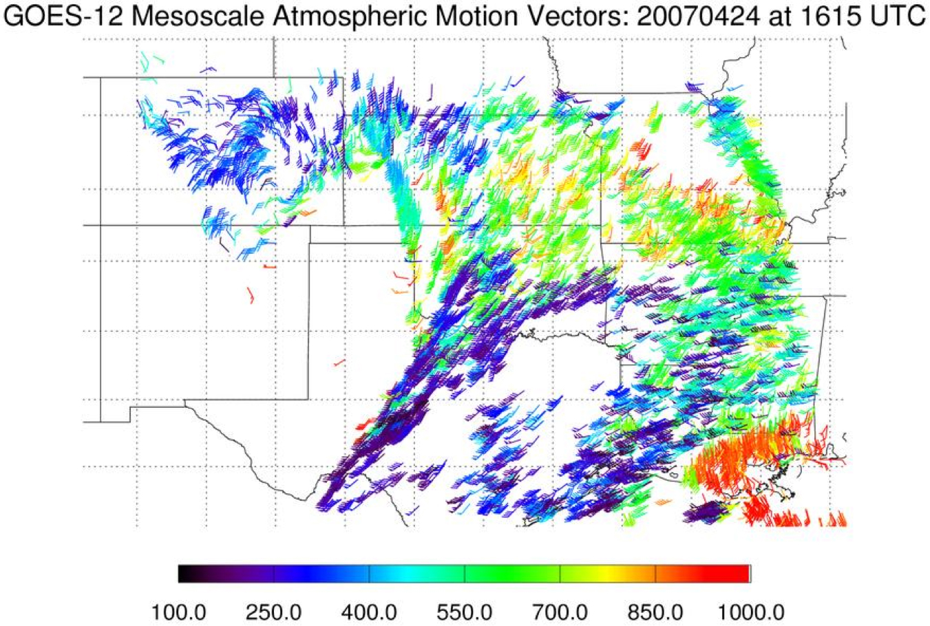
An intense upper-tropospheric cutoff low was moving across the southern Rocky Mountain region on 24 April 2007, which was very evident on GOES-12 water vapor imagery (QuickTime animation). An AWIPS image of the 17 UTC operational “GOES high density winds” overlaid on a 17:10 UTC water vapor image (above) did not adequately resolve the closed circulation; in contrast, the CIMSS “GOES mesoscale winds” (or “Atmospheric Motion Vectors”) generated at 16:15 UTC (below) did show the closed circulation of the upper low over eastern Colorado. These mesoscale winds are part of a suite of products available on the Satellite-based Nowcasting and Aviation Application Program (SNAAP) site.


