This website works best with a newer web browser such as Chrome, Firefox, Safari or Microsoft Edge. Internet Explorer is not supported by this website.

Record-setting Nor’easter

A record-setting Nor’easter storm system intensified over the eastern and northeastern US on 15 April / 16 April 2007 — this storm produced Read More

070416_ir.jpg
A record-setting Nor’easter storm system intensified over the eastern and northeastern US on 15 April / 16 April 2007 — this storm produced several tornadoes (including a fatal EF3 tornado near Mulberry, South Carolina), winds of 70-80 mph with a gust to 156 mph (Mount Washington, New Hampshire), waves to 33 feet (Buoy 44025), snowfall up to 23 inches (Locke, New York), 9.30 inches of rainfall (Riverdale, New Jersey), and widespread coastal flooding. QuickTime animations of GOES IR, water vapor, and visible channel imagery from AWIPS reveal the unusually large size of the cloud and water vapor fields associated with this powerful Nor’easter.
070416_wv.jpg

070416_vis.jpg

________________________________________________________________________________

AWIPS GOES sounder ozone image

The GOES sounder-derived total column ozone product (above) depicted very high ozone values (400-450 Dobson units, red enhancement) along the western periphery of the storm. A southwest-to-northeast cross section through the storm using GFS model fields (below) show that the dynamic tropopause — assumed to be the 1.5 Potential Vorticity Units (PVU) surface — extended below the 600 hPa pressure level in both the high ozone feature (across northwestern Virginia) and also the core of the 500 hPa low (near Long Island, New York).
AWIPS GFS model cross section

View only this post Read Less
Smoke in the Gulf of Mexico, and dust in the Gulf of California

The MODIS Aerosol Optical Depth (AOD) product from the IDEA site (above) showed elevated AOD values over the western Gulf of Mexico on 13 April 2007. This AOD signal (note the hazy appearance on Read More

IDEA MODIS AOD

The MODIS Aerosol Optical Depth (AOD) product from the IDEA site (above) showed elevated AOD values over the western Gulf of Mexico on 13 April 2007. This AOD signal (note the hazy appearance on MODIS true color imagery) was due to smoke from agricultural fires that had been burning the previous day in the Yucatan region of Mexico and also in Guatemala. The CIMSS GOES-12 Wildfire ABBA product (below) indicated an increasing number of fire pixels in that area on 12 April; the NOAA Hazard Mapping System (HMS) daily composite from that day also exhibited a significant number of fire pixels in that region (with a large smoke pall drifting over the Gulf of Mexico). A second area of elevated MODIS AOD values was observed over the Gulf of California (MODIS true color image) — this particular AOD signal was due to airborne dust that was lofted into the lower troposphere by strong winds (gusting as high as 86 mph in southern California) associated with a large storm system that was intensifying across the southern Rockies and southern Plains. A QuickTime animation of GOES-12 visible channel images indicated that the dust in the Gulf of California was being transported southward, while the smoke in the Gulf of Mexico was being transported northward.
CIMSS Wildfire ABBA product

View only this post Read Less
Mesoscale variability of snowfall

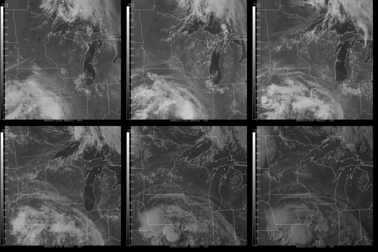
The late-season snow event that affected southern Wisconsin on 11 April 2007 dropped as much as 6-12 inches of snow across much of the region (the 7.0 inches at Milwaukee and the 5.4 inches at Madison were both daily snowfall records). However,... Read More

AWIPS GOES visible image

The late-season snow event that affected southern Wisconsin on 11 April 2007 dropped as much as 6-12 inches of snow across much of the region (the 7.0 inches at Milwaukee and the 5.4 inches at Madison were both daily snowfall records). However, an AWIPS image of the GOES-12 visible channel (above) shows a good deal of mesoscale variability to the resulting snow cover 2 days following the storm. Of particular interest was the rather large “snow hole” over some of the eastern counties, as well as the lack of snow cover in the lower elevations of the Wisconsin River Valley (MODIS true color images: Wisconsin | Madison hi-res). An AWIPS high-resolution topography image (below; Java applet to fade between the visible and topography images) shows that the large snowfall minimum (NOHRSC 72 hour snowfall reports) was in the area to the west of the higher terrain of the Kettle Moraine; with strong easterly to northeasterly winds during the event (winds gusted to 52 mph at Milwaukee), perhaps a downsloping effect may have helped to keep the area west of the higher terrain slightly warmer (surface air temperatures were near freezing during much of the snowfall period), therefore limiting snow accumulations there.
AWIPS topography image

View only this post Read Less
Sea Surface Temperatures in the Atlantic and Gulf of Mexico

An AWIPS image of the 12 April 2007 MODIS Sea Surface Temperature (SST) product over the northwestern Atlantic Ocean (above) showed a very sharp SST gradient between the cold waters of the Labrador Current (30-40º F, blue colors) and the warm waters... Read More

AWIPS MODIS SST image

An AWIPS image of the 12 April 2007 MODIS Sea Surface Temperature (SST) product over the northwestern Atlantic Ocean (above) showed a very sharp SST gradient between the cold waters of the Labrador Current (30-40º F, blue colors) and the warm waters of the Gulf Stream (55-65º F, green colors). An interactive Java applet allows you to explore the SST values over that region (click on the SST image in the applet to activate the cursor readout). A MODIS SST image farther to the south (below) reveals SST values that were significantly warmer (75-80º F, orange to red colors) in the Gulf of Mexico and along the southern portion of the Gulf Stream. SST and other Level 2 MODIS Science Products are available daily on the CIMSS MODIS Direct Broadcast Products site.
AWIPS MODIS SST image

View only this post Read Less