Parts of the Upper Midwest and Great Lakes states received unusually heavy rainfall during the first 2 weeks of June 2008, which caused widespread flash flooding and river flooding to occur — as a result, many rivers in eastern Iowa and southern Wisconsin crested at record high levels. During the 07 June... Read More

Parts of the Upper Midwest and Great Lakes states received unusually heavy rainfall during the first 2 weeks of June 2008, which caused widespread flash flooding and river flooding to occur — as a result, many rivers in eastern Iowa and southern Wisconsin crested at record high levels. During the 07 June – 08 June 2008 period, 48-hour storm total rainfall amounts included 13.50 inches at Watertown, Wisconsin, 12.36 inches at Dorchester, Iowa, and 10.10 inches at Reno, Minnesota. In southern Wisconsin, Milwaukee set a new record for 48-hour precipitation (7.18 inches), and 4.11 inches in 24 hours was a daily record for Madison (and only the 4th instance of a daily precipitation amount greater than 4 inches since records have been kept). The thunderstorms that were responsible for that 2-day heavy rain event also produced an EF2 tornado and hail up to 5.0 inches in diameter in southern Wisconsin. Lake Delton (a 267-acre man-made lake in Wisconsin Dells) was nearly drained empty in a matter of hours after a dam breach.
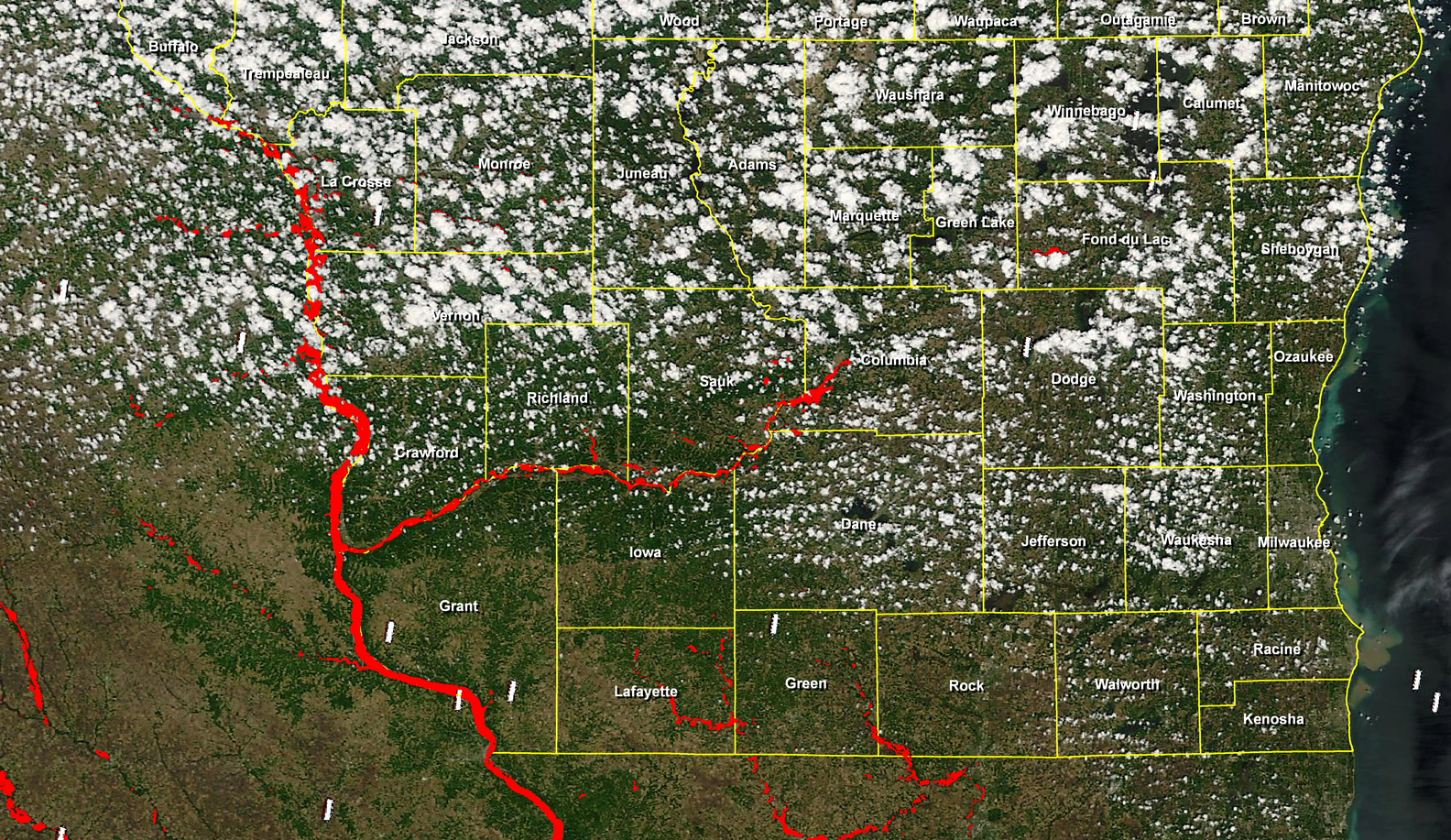
A MODIS true color image (above; courtesy of Sam Batzli, SSEC Environmental Remote Sensing Center, using data from the Dartmouth Flood Observatory) shows the rivers that were inundated or in flood (colored red) across southern Wisconsin (with counties labeled) and adjacent portions of Minnesota, Iowa, and Illinois (determined by comparing MODIS data from 01 June and 10 June 2008 where cloud-free).

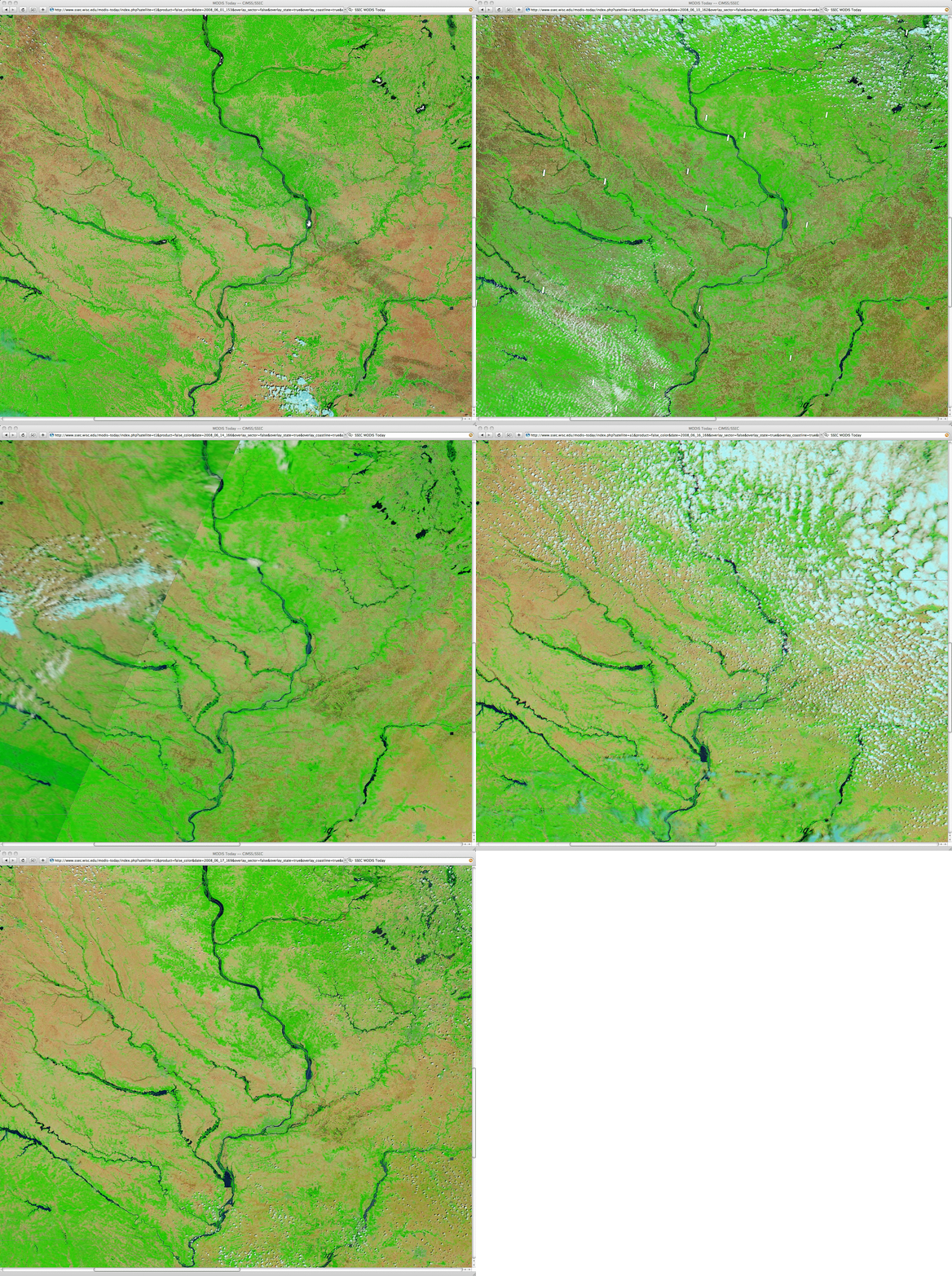
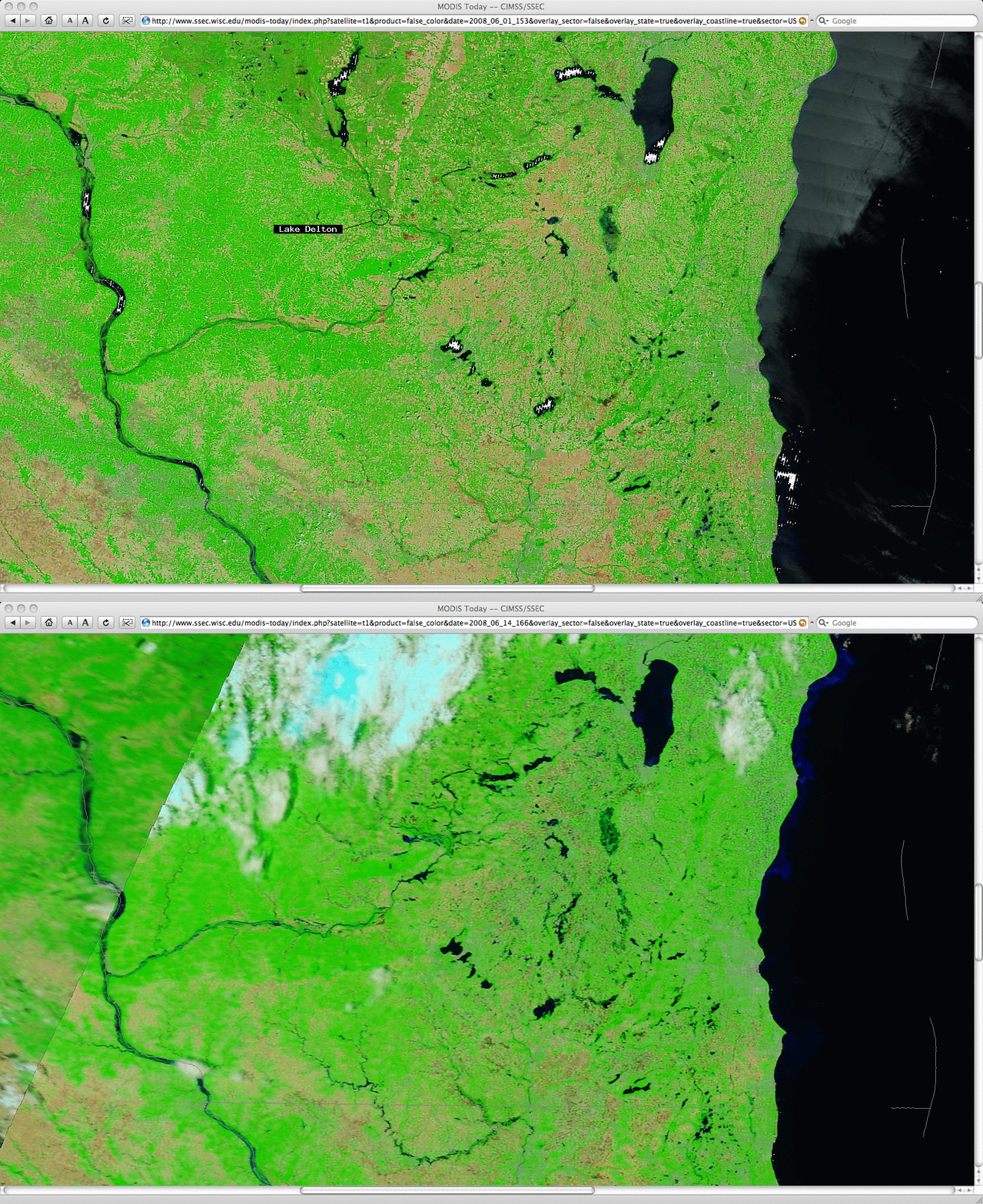
A comparison of 250-meter resolution SSEC MODIS Today false color images (above) from “before” the flooding event (01 June 2008, which was mostly cloud-free) and “after” the flooding event (14 June 2008, which had some clouds over the northern portion of the scene) reveals the changes to a few of the rivers that were experiencing major flooding (particularly evident in far southwestern Wisconsin and far northwestern Illinois). Since water has a much darker appearance in these false color images, the swollen rivers tend to stand out in contrast to the densely-vegetated areas (green colors) which were characterized by a high concentration of trees, or the sparsely-vegetated agricultural fields (tan to light brown colors) where crops had only recently been planted. The”disappearance” of Lake Delton is not very obvious in the false color imagery — the lake appeared as a dark feature on 01 June, but the drained lake bed still appeared as a similar dark feature on 14 June (due to the very high soil moisture content of the lake bed and adjacent areas).
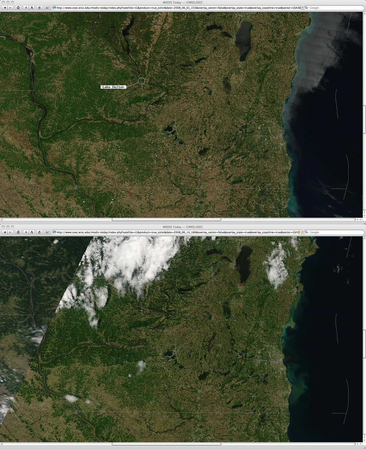
In the corresponding set of “before” and “after” MODIS true color images (below), plumes of offshore sediment flow into parts of Lake Michigan could be seen. The”disappearance” of Lake Delton is a bit more obvious in the true color imagery — the lake appears as a dark feature on 01 June, but the drained lake bed appears as a light tan to light brown colored feature on 14 June.

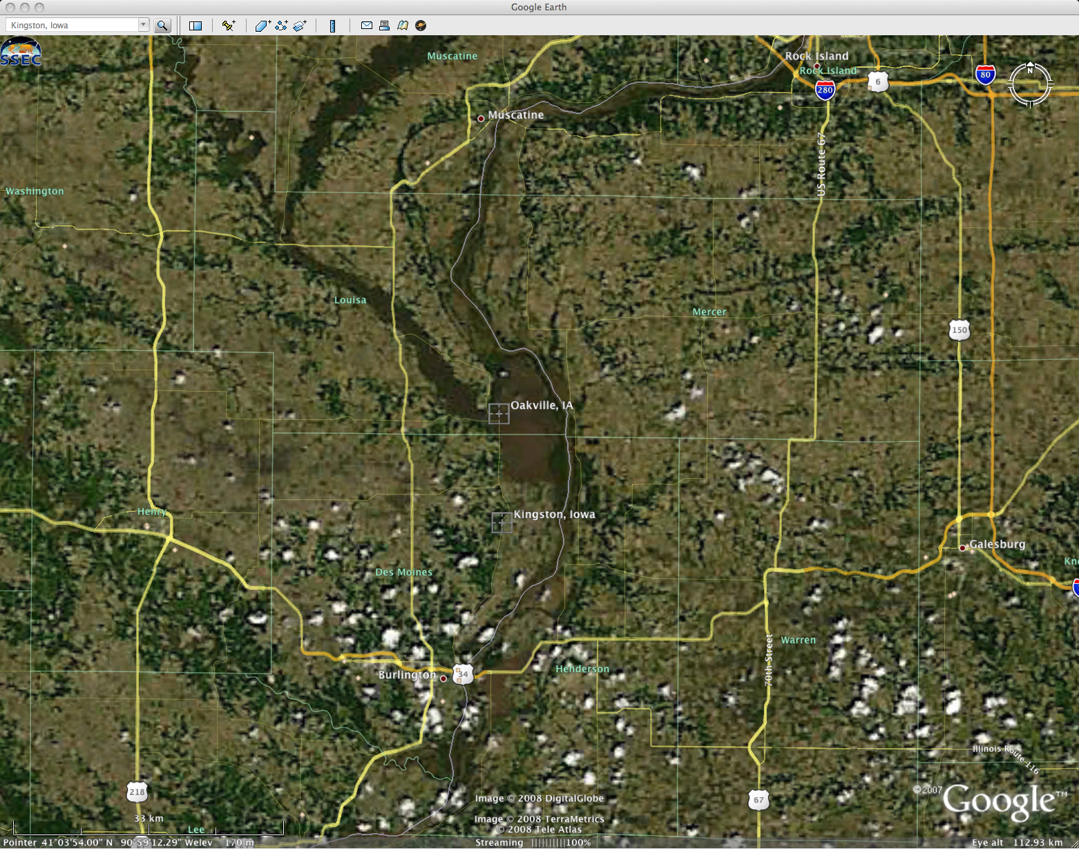
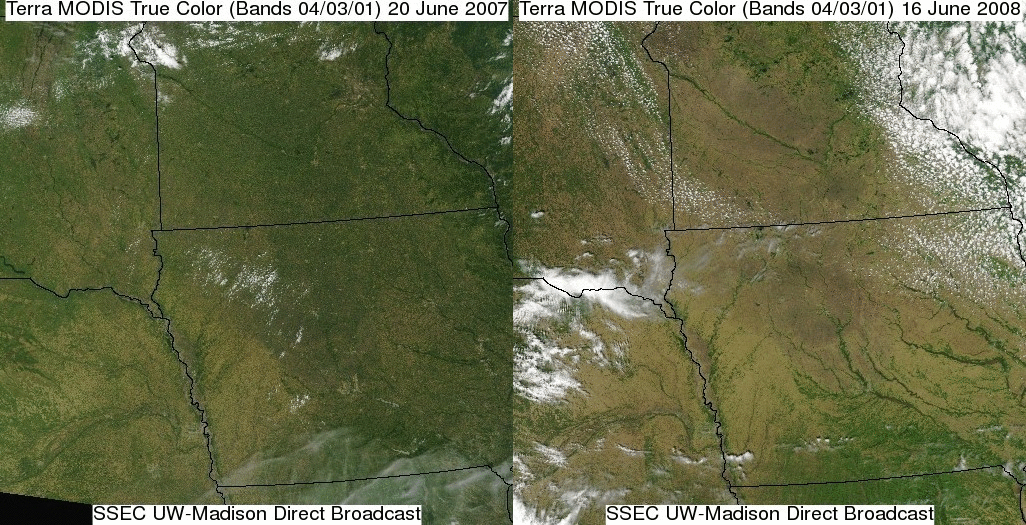
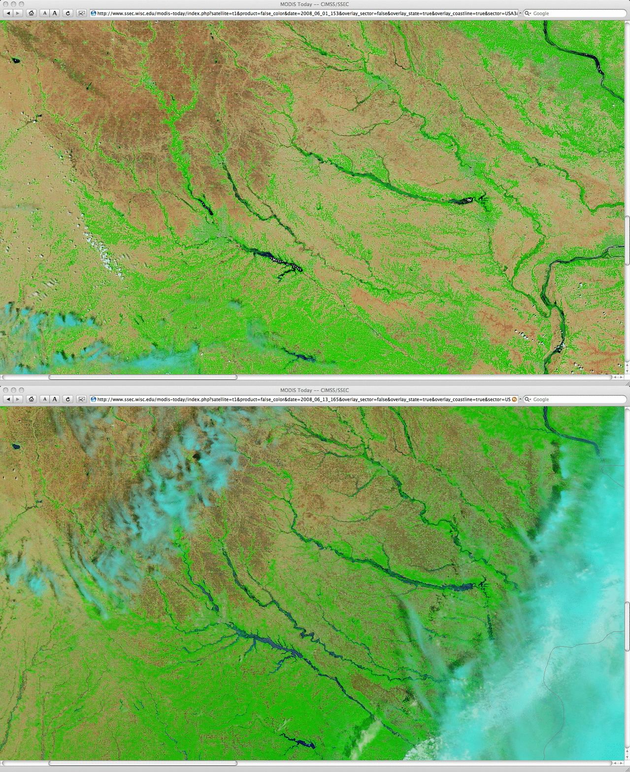
Farther to the southwest, “before” (01 June) and “after” (13 June) MODIS false-color images show the changes to many rivers due to historic flooding across much of the state of Iowa (below). The National Weather Service at Des Moines posted a similar MODIS false color image comparison showing river flooding over Iowa.

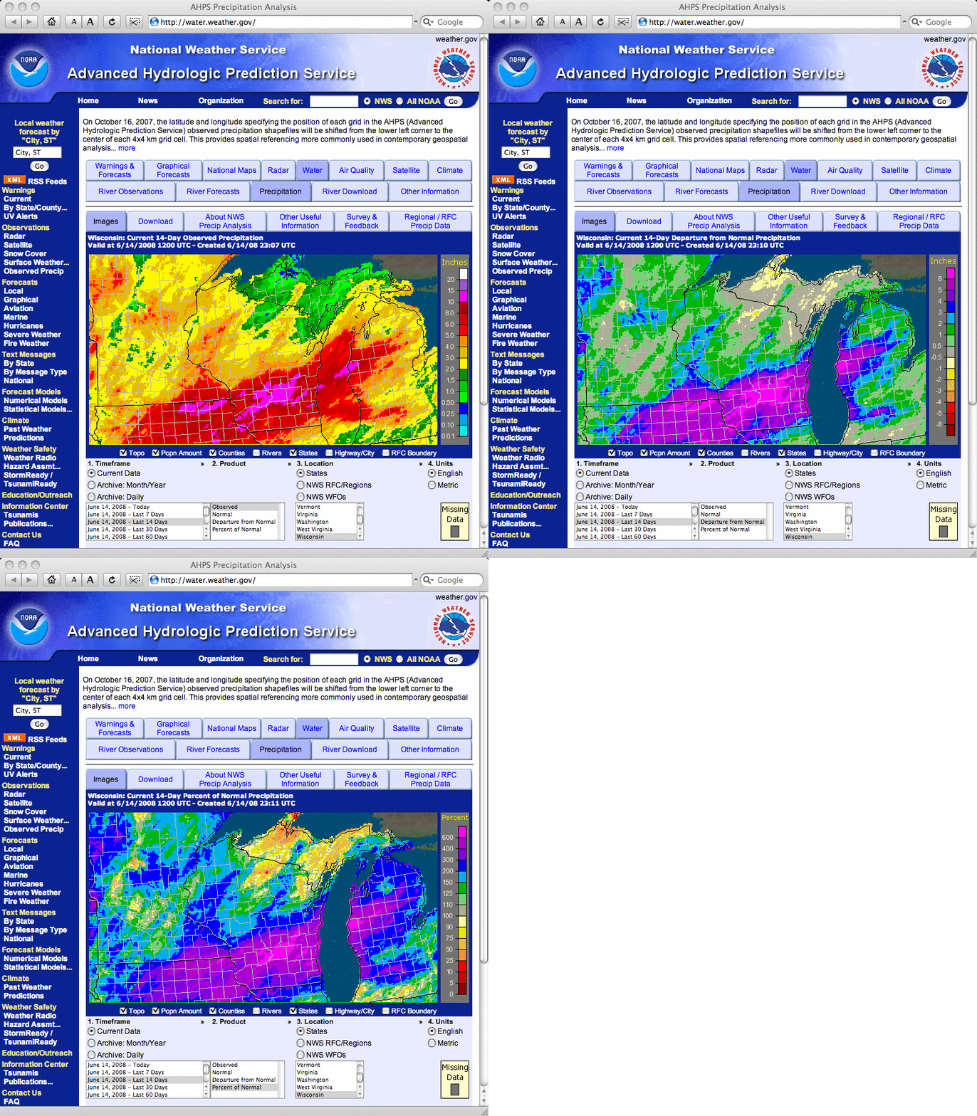
The National Weather Service Advanced Hydrologic Prediction Service Precipitation Analysis for the 14-day period ending at 12 UTC (7 AM local time) on 14 June 2008 (below) indicated that as much as 10-15 inches of rain fell over a number of counties, with a wide swath of precipitation that was 5-8 inches above normal (or over 600 percent of normal) for that 2-week period. The maximum total rainfall from 01 June to 12 June was 17.84 inches at Portage, Wisconsin.

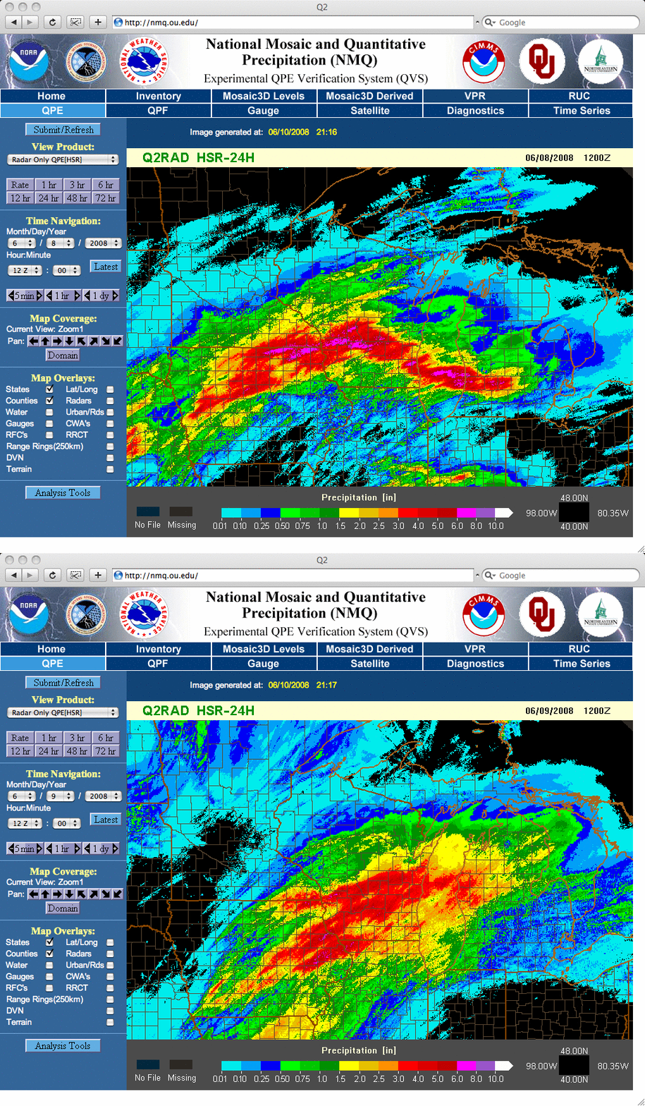
Radar-estimated precipitation products from the NOAA/NSSL/University of Oklahoma NMQ site (below) revealed that widespread rainfall amounts of 3-8 inches occurred during the two 24-hour periods ending at 12 UTC (7 AM local time) on 08 and 09 June.

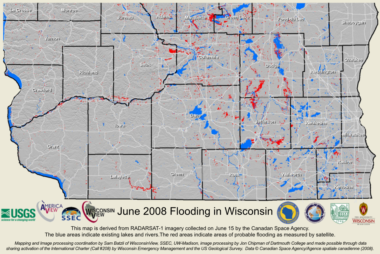
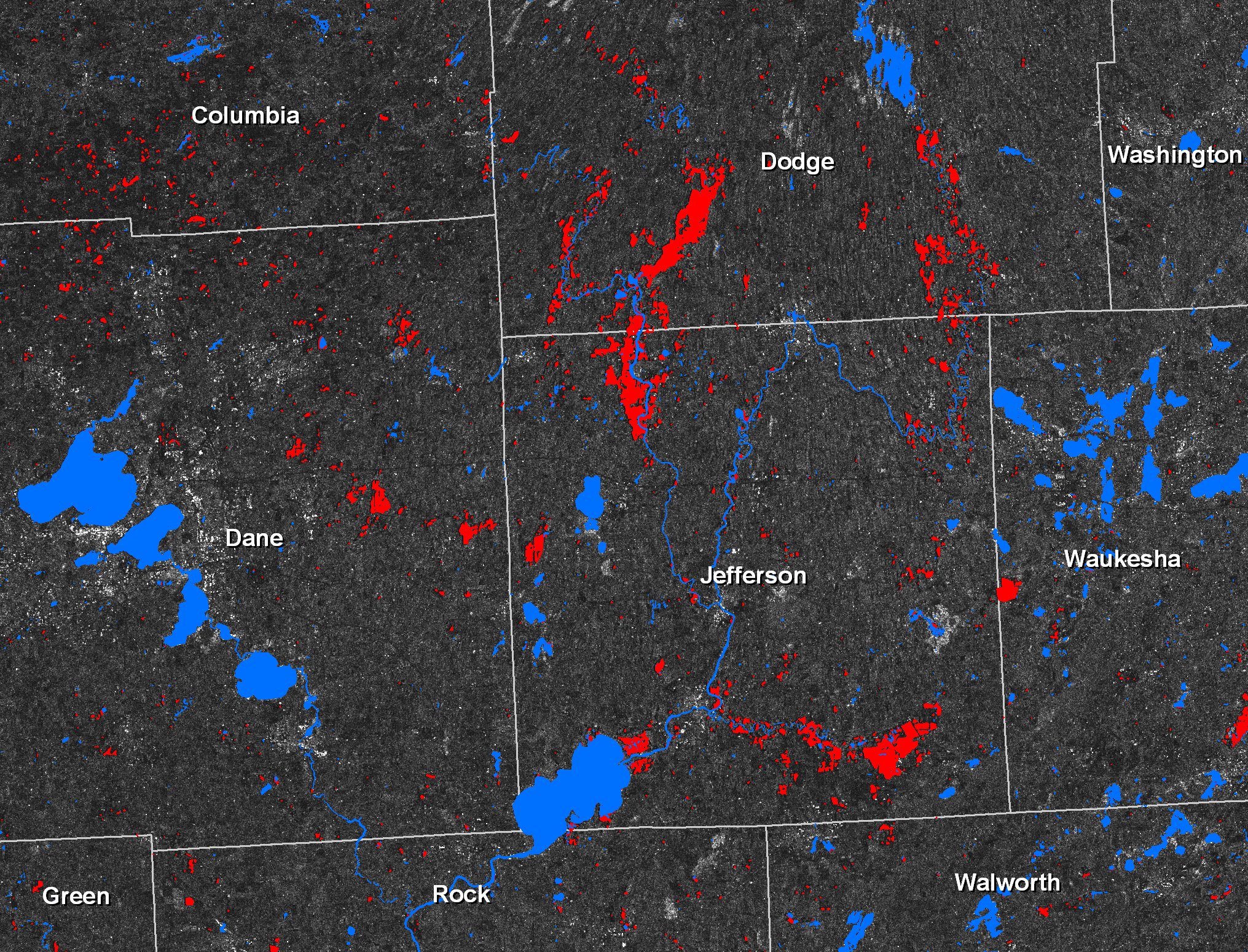
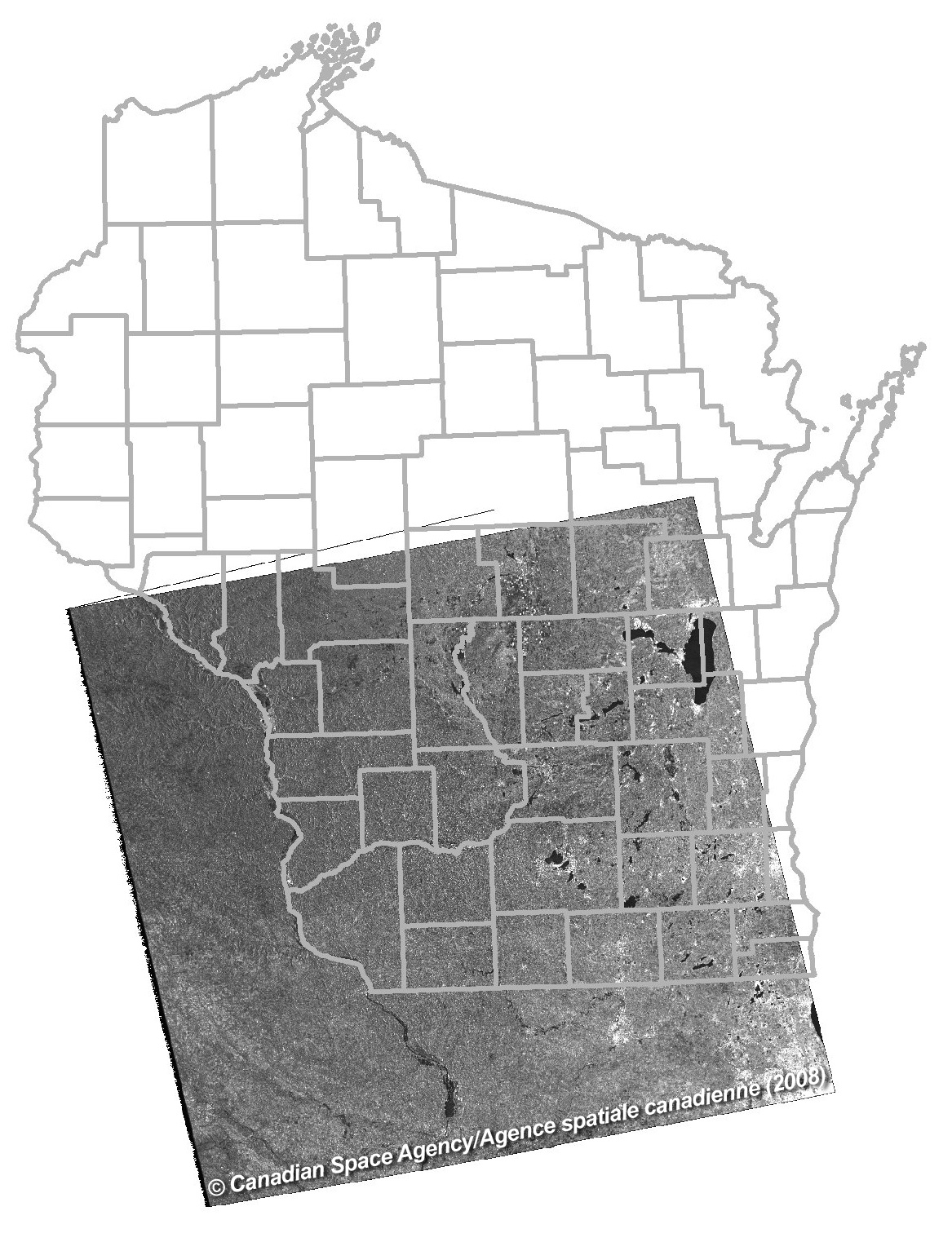
UPDATE: Sam Batzli provided maps derived from RADARSAT-1 data (below) which shows areas of probable flooding (red features) across southern Wisconsin on 15 June. This is probably the first time that RADARSAT imagery has been used to map flooding in Wisconsin, since no single agency in the state has previously been able to afford RADARSAT imagery, or known how to acquire or process this type of imagery. The collective and collaborative nature of WisconsinView and its ties to Wisconsin Emergency Management, and the activation of the “International Charter” facilitated this application of remote sensing technology in a successful way.


View only this post
Read Less


