Tropical Storm Fay
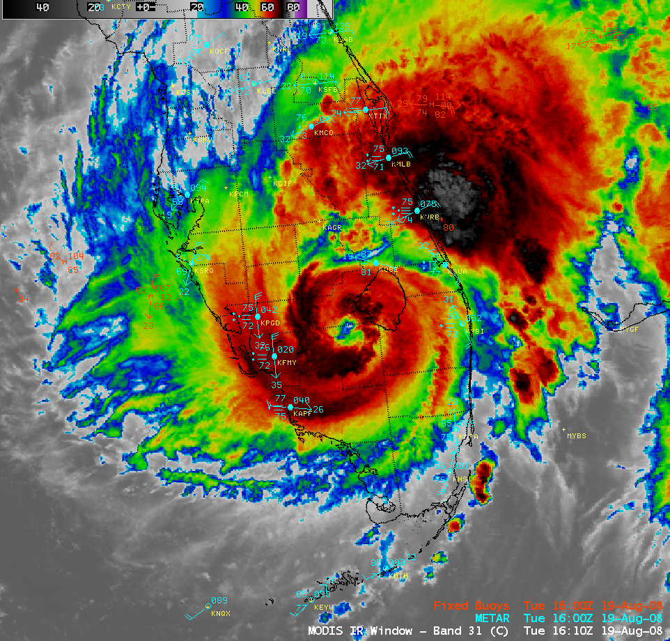
After passing over Key West on 18 August, Tropical Storm Fay made landfall along the Gulf Coast of the Florida peninsula on 19 August 2008. GOES-12 IR imagery from the CIMSS Tropical Cyclones site (above) showed that Fay was moving slowly northward toward a weakness in the deep layer mean flow. GOES-12 IR cloud top temperatures continued to cool as Fay moved inland (IR brightness temperatures near the Florida coast were as cold as -81º C at 08:40 and 09:15 UTC), with an AWIPS image of the MODIS 11.0 µm IR channel (below) showing an eye structure at 16:10 UTC.
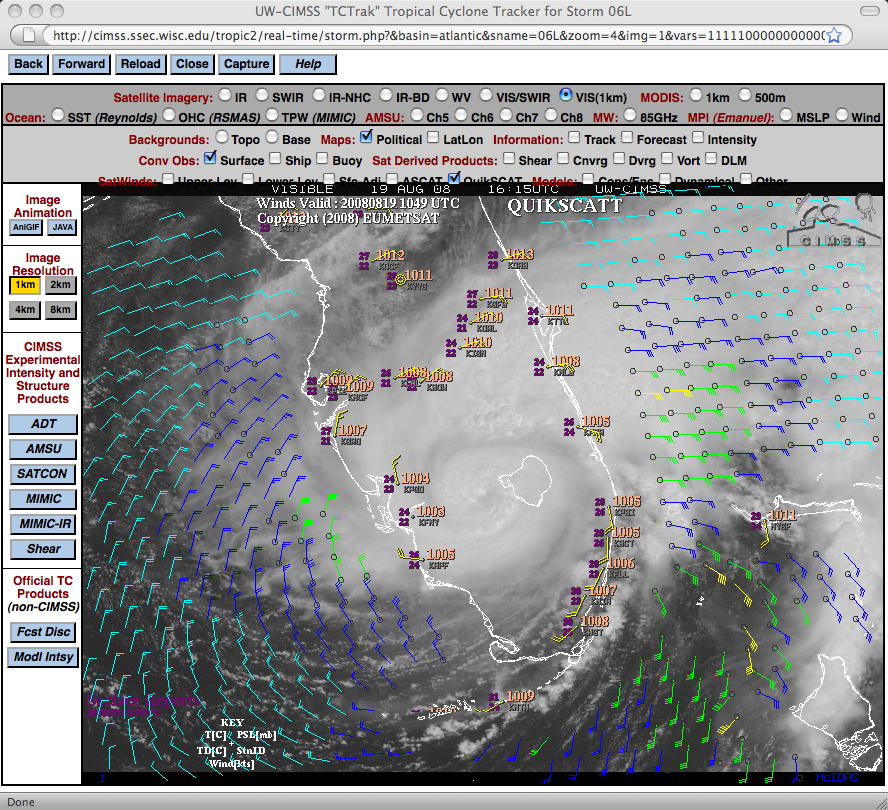
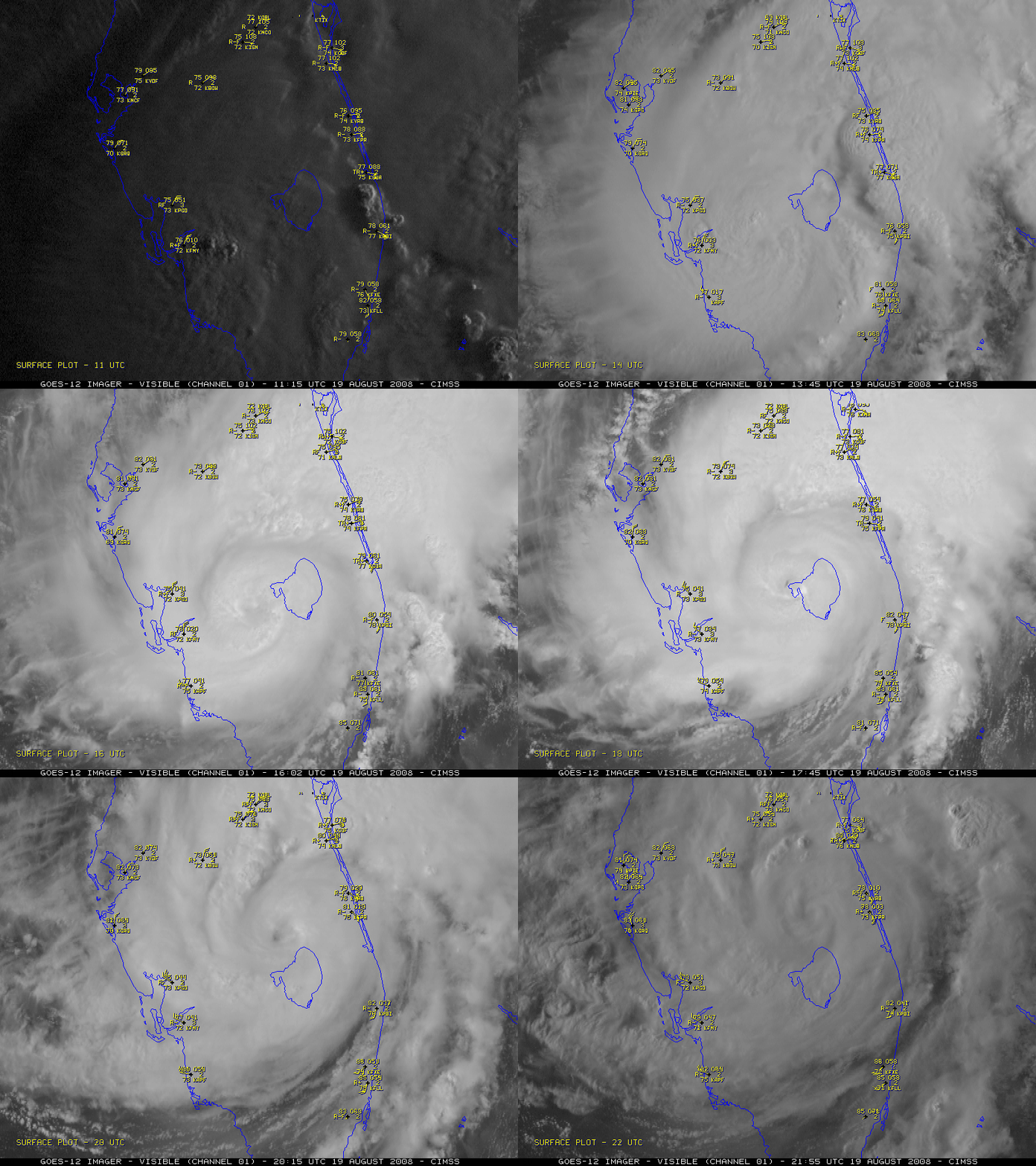
The appearance of the eye structure continued to improve on GOES-12 visible imagery (below) even as Fay remained over land during the day, and QuikSCAT winds indicated that tropical storm force winds extended out across the adjacent offshore waters of both the Gulf of Mexico and the Atlantic Ocean.
The GOES-12 satellite was placed into Rapid Scan Operations (RSO), allowing images at 5-10 minute intervals (below) as the center of Fay grazed Lake Okeechobee in southern Florida. Winds gusted to 78 mph at Moore Haven along the western shore of Lake Okeechobee (MODIS image in Google Earth). It is interesting to note that MODIS Sea Surface Temperatures in Lake Okeechobee on Sunday 17 August were as warm as 91.8 F — this large body of warm water may have acted as an additional source of evaporation and sensible heat to help fuel convection around the eye of Fay.
Note that Fay almost seemed to exhibit a slight amount of trochoidal oscillation on the GOES-12 images (though nothing like that seen with Hurricane Wilma back in 2005). However, a comparison of GOES-12 and GOES-13 RSO visible images revealed that this apparent “eye wobble” was due to irregularities in satellite navigation (the image-to-image navigation is significantly improved on the newer GOES-13 satellite, due to changes in the spacecraft design).
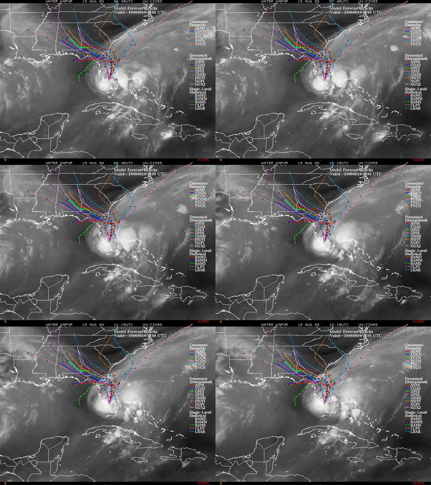
Due to the aforementioned weak deep layer mean flow regime, the future motion of Fay was very uncertain, as could be seen by the large spread of model forecast tracks (below).
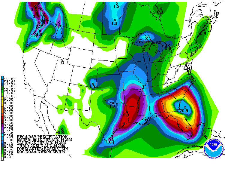
Even though Fay was not a particularly strong tropical cyclone, the slow forward motion meant an increased threat for heavy rainfall over the southeastern US; the Hydrometeorological Prediction Center 5-day total precipitation accumulation forecast (below) suggested that rainfall could approach 15-20 inches in parts of Florida and Georgia.
** 29 AUGUST UPDATE **
The Melbourne, Florida NWS office received a storm total of 19.62 inches of rain, with an amazing 27.65 inches reported 8 miles northwest of Melbourne (below).


