Long Lake, North Dakota: the Great Salt Lake of the Northern Plains?
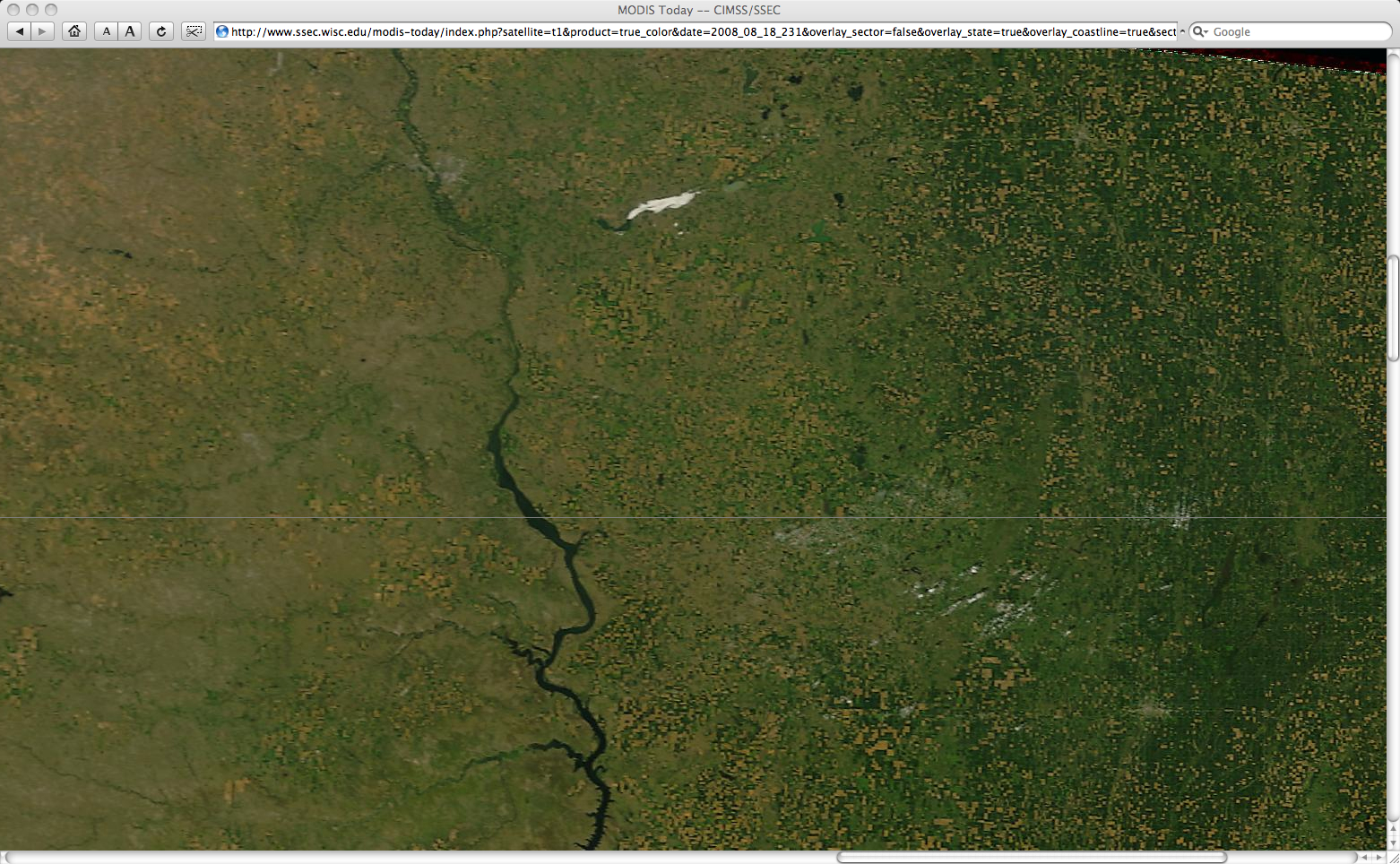
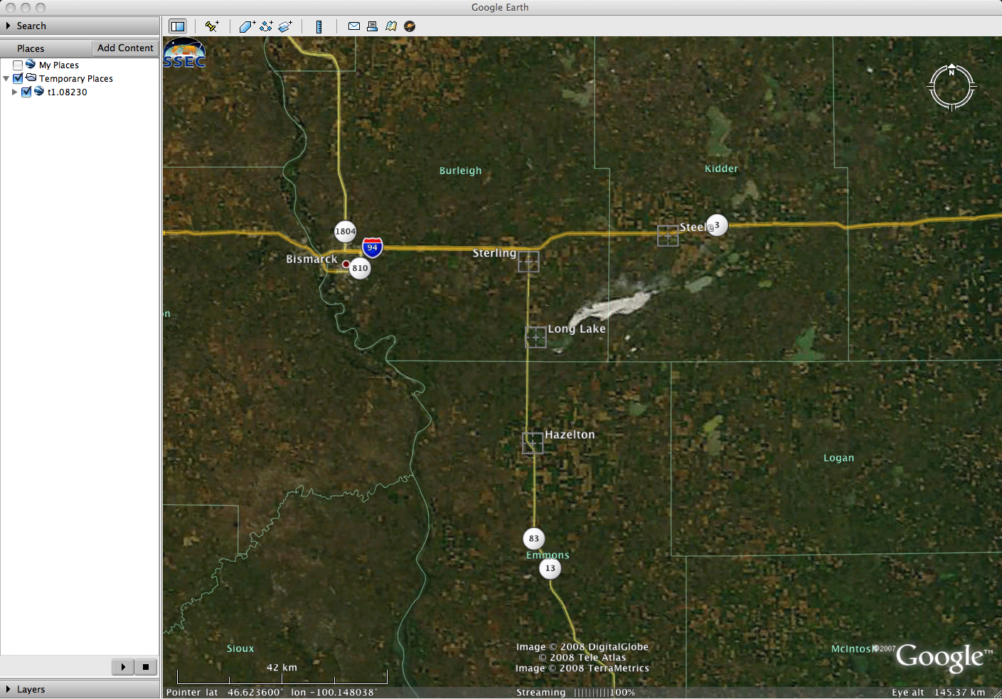
Moderate to extreme drought conditions across much of North Dakota during the Spring and Summer of 2008 had caused the water levels at Long Lake (a small alkaline lake located east-southeast of Bismarck) to become very low — as a result, bright white “salt flats” began to grow in size, becoming large enough to be seen on 1-km resolution GOES-12 visible imagery as well as on 250-meter resolution MODIS true color imagery from the SSEC MODIS Today site (above) on 18 August 2008. This feature could also be seen on MODIS true color imagery from the previous day (below, viewed using Google Earth).
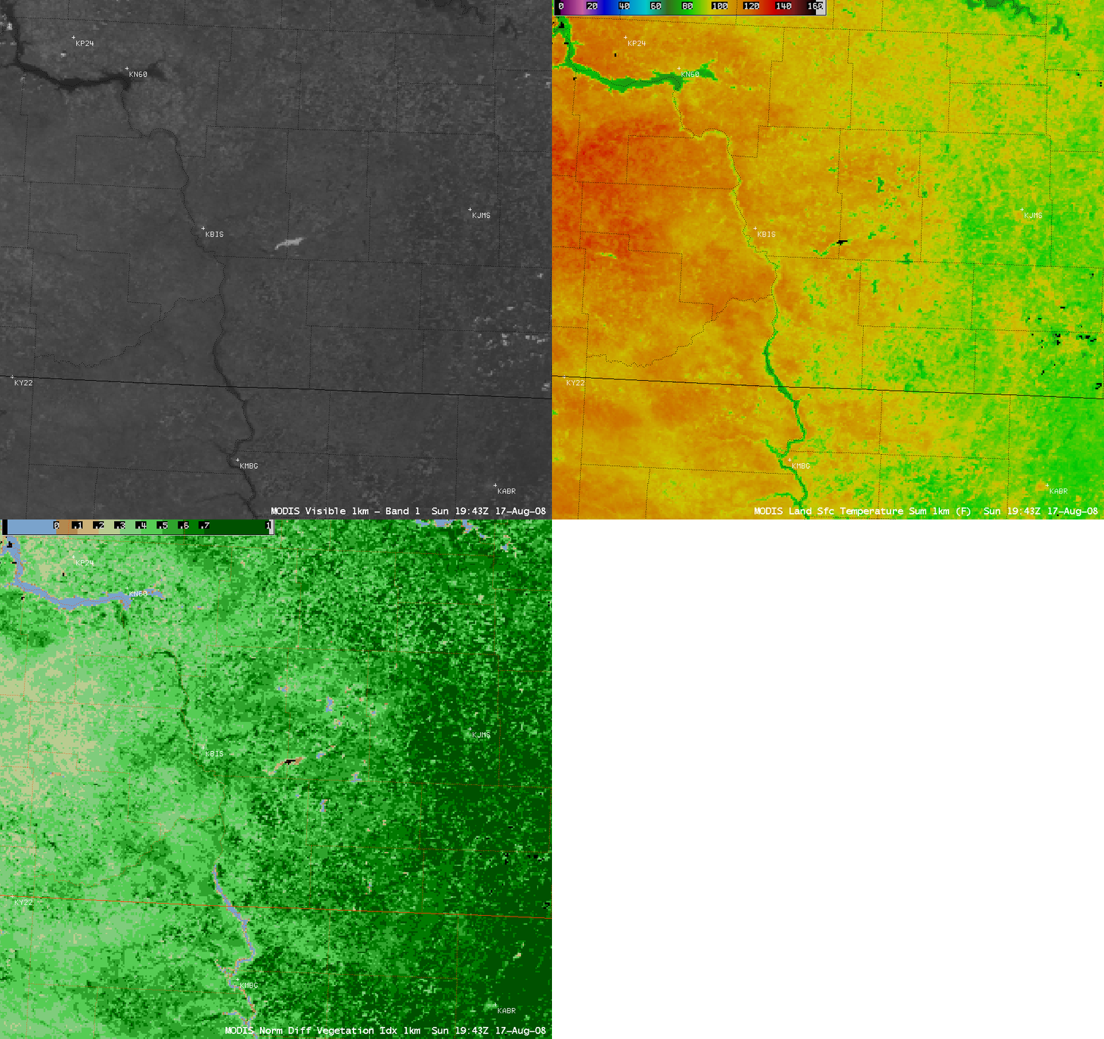
AWIPS images of the MODIS visible channel, Land Surface Temperature (LST) product, and Normalized Difference Vegetation Index (NDVI) product from 17 August (below) revealed that LST values were significantly cooler over the high albedo areas of the white “salt flats” (in the upper 70s to low 80s F, compared to 100-110 F over the surrounding areas), and NDVI values were very low over the dry lake bed (less than 0.1, compared to 0.4 to 0.6 in the surrounding areas).
** 20 AUGUST UPDATE **
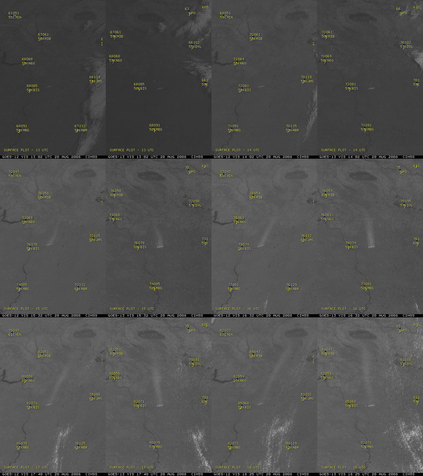
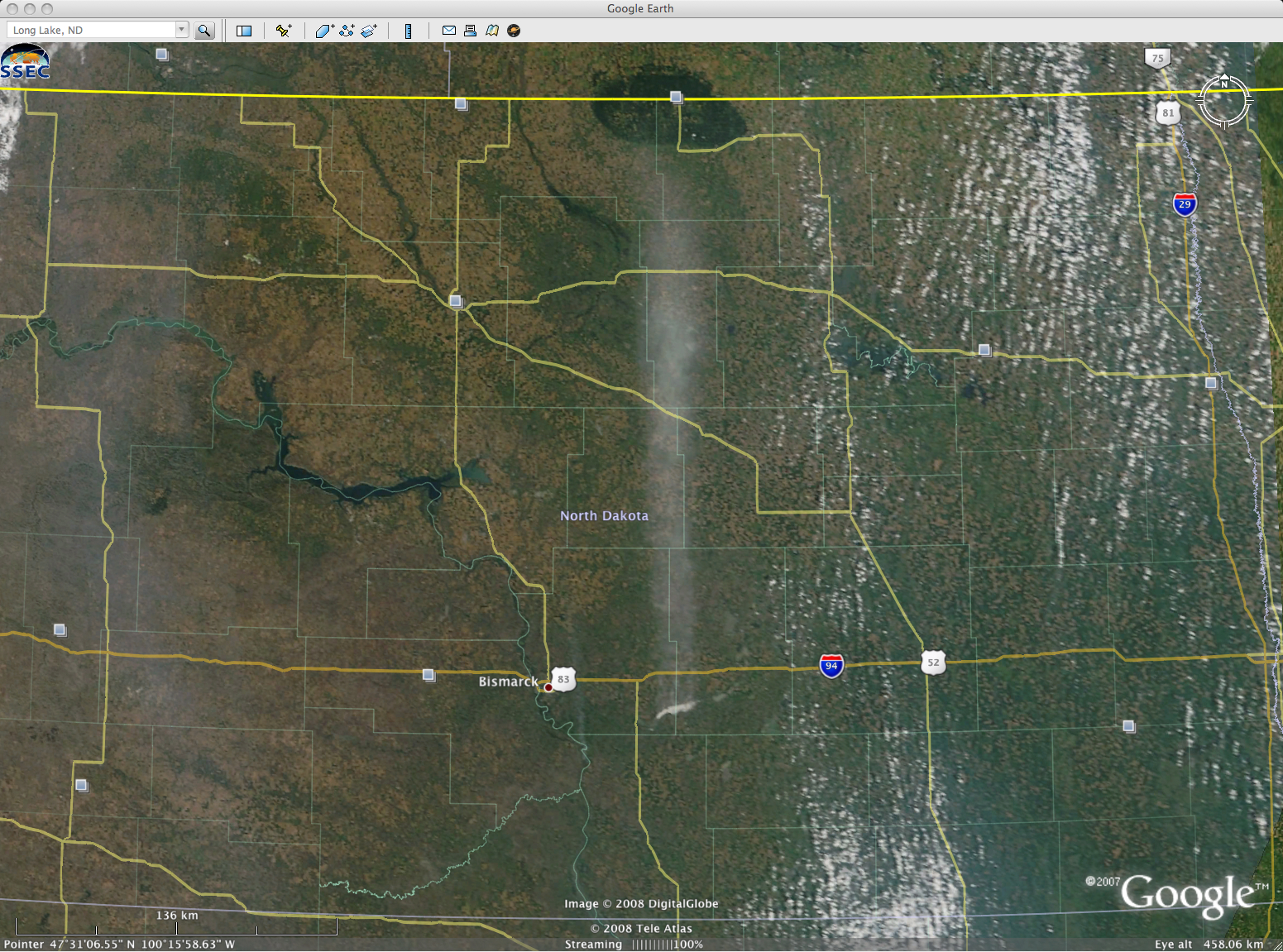
Strong southerly winds on 20 August (gusting to 40 mph at Mobridge SD, 44 mph at Jamestown ND, and 36 mph at Bismarck ND) were creating a plume of “blowing dust” off the dry lake bed of Long Lake. A comparison of GOES-12 and GOES-13 Rapid Scan Operations (RSO) visible imagery at 5-10 minute intervals (below) shows the extent of the plume. This image comparison also serves to highlight the improved navigation on the newer GOES-13 satellite — note the excellent image-to-image navigation on the GOES-13 images on the right, compared to the notable wobble on the GOES-12 images on the left.
MODIS true color imagery (below, viewed using Google Earth) showed that the plume extended northward to the Turtle Mountain plateau (the darker green feature) along the North Dakota/Canada border! A forecaster from Rapid City SD spoke to his nephew via telephone, who was driving an agricultural combine harvester south of Martin and west of Harvey in central North Dakota — this location appeared to be right in the middle of the plume — and the nephew reported 2-3 miles visibility, but no apparent smell or odor.Â
Hat-tip to Lee Czepyha, Meagan Holm, and Matthew Bunkers of the National Weather Service forecast office at Rapid City, SD for first noting this interesting feature and bringing it to our attention (and getting ground truth reports)!


