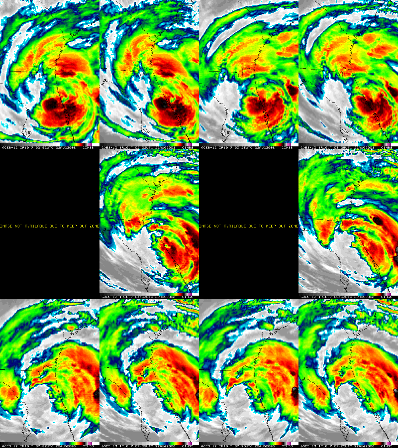
Tropical Storm Fay: GOES-13 images during GOES-12 KOZ
On the current operational GOES-11 and GOES-12 satellites, data losses occur for several hours each day during the weeks centered around the Spring and Autumn equinox due to (1) Keep-Out Zones (KOZ), and (2) Eclipse. During KOZ, sunlight impinging upon the optical path of the instrument detectors requires the GOES Imager and Sounder to be turned off; during Eclipse, the satellite is in the Earth’s shadow, so the solar panels cannot generate power for the Imager and Sounder instrument packages. On the animation of GOES-12 and GOES-13 10.7 µm IR imagery (above) from 22 August 2008, you can see the period of no data from GOES-12 during such a KOZ — however, data continued to be available using the GOES-13 satellite, due to changes in the spacecraft design that mitigate the KOZ problem.
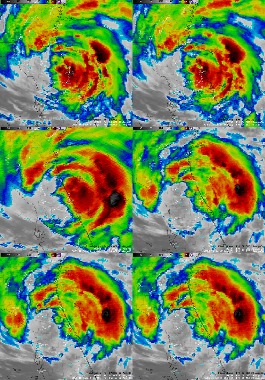
On AWIPS, data from the GOES-11 (GOES-West) satellite are remapped and used to replace the missing GOES-12 (GOES-East) data during such KOZ and Eclipse periods. During this particular KOZ period, a strong rain band associated with Tropical Storm Fay was moving inland across the Jacksonville, Florida region, creating wind gusts up to 60 mph with heavy rainfall, severe street flooding, and multiple power outages due to downed trees and power lines. On the AWIPS IR images from the KOZ period (below) you can see that the re-mapped GOES-11 data at 05:00 and 06:00 UTC appear somewhat “distorted” due to the large satellite viewing angle (GOES-11 is positioned at 135º W longitude over the Pacific Ocean), and the high-altitude cold cloud top features are shifted significantly eastward due to the associated satellite parallax error.
The GOES-13 satellite had recently been brought out of on-orbit storage for a period of operational testing. Real-time GOES-13 images are available here and here; GOES-13 sounder derived products are available under the “GOES-Central” heading.


