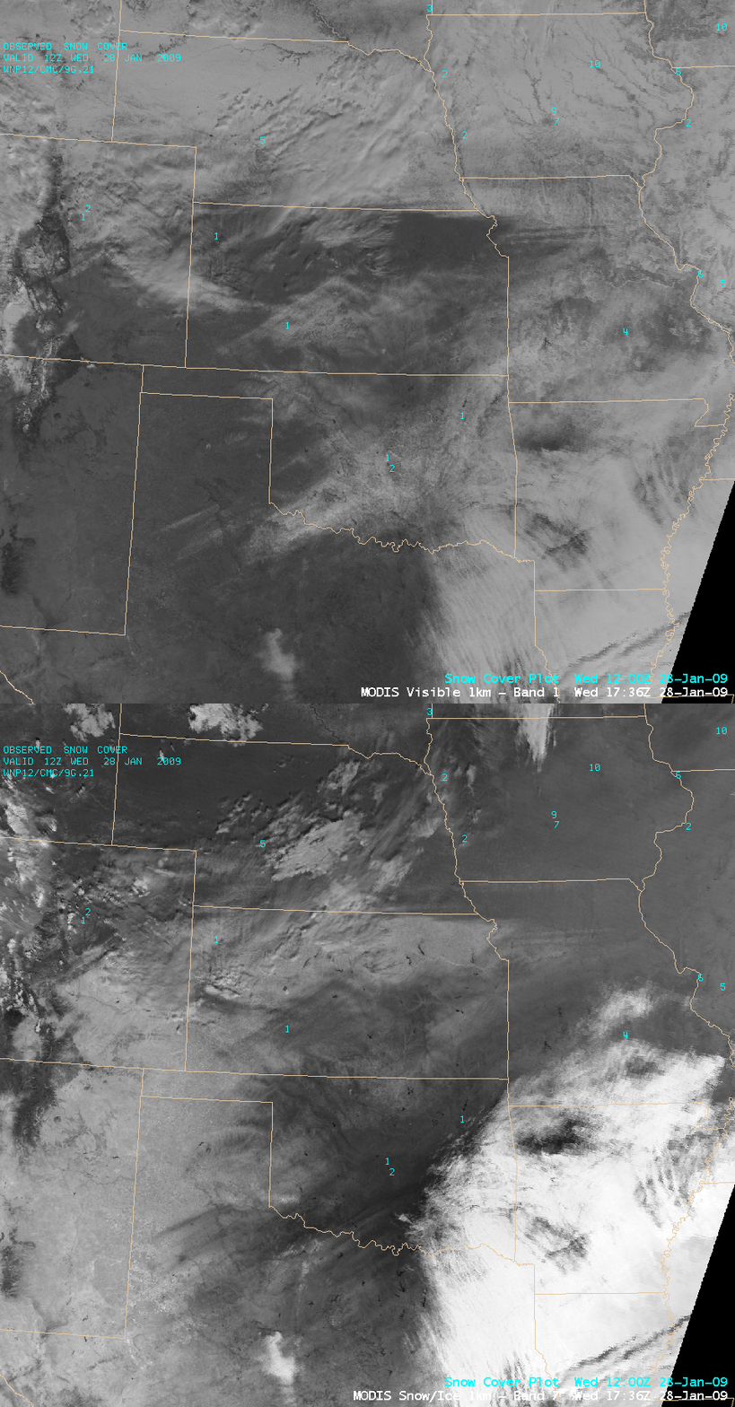
AWIPS images of the MODIS visible channel and the 2.1 µm near-IR “snow/ice discrimination” channel (above) showed the areal coverage of surface snowfall and ice accrual across much of the southern Plains on 28 January 2009. Many locations across that region received a significant accumulation of ice from freezing rain (1-2 inches of ice were reported in parts of Oklahoma and Arkansas) or sleet (3-4 inches of sleet were reported in parts of Oklahoma), downing trees and powerlines and causing power outages for several hundred thousand people (for more details, see Jesse Ferrell’s WeatherMatrix blog). As the storm departed, it left a light accumulation of snow on top of some of the ice and sleet that was already on the ground.
Snow and ice on the ground are strong absorbers at the 2.1 µm wavelength, so those surface features appear darker on the MODIS Snow/Ice image — and since ice is an even stronger absorber, a surface accrual of ice appears even darker than a layer of snow on the ground. In contrast, supercooled water droplet clouds appear as brighter white features on the Snow/Ice image. Also, note that Oklahoma (where there was only 1-2 inches of snow on the ground) appeared significantly darker on the MODIS Snow/Ice image than areas in the far northern portion of the image (where there was 5-10 inches of snow cover). One rather curious feature on the imagery: the thin mesoscale streaks of snow on the ground across northern Missouri, oriented almost exactly west-to-east.
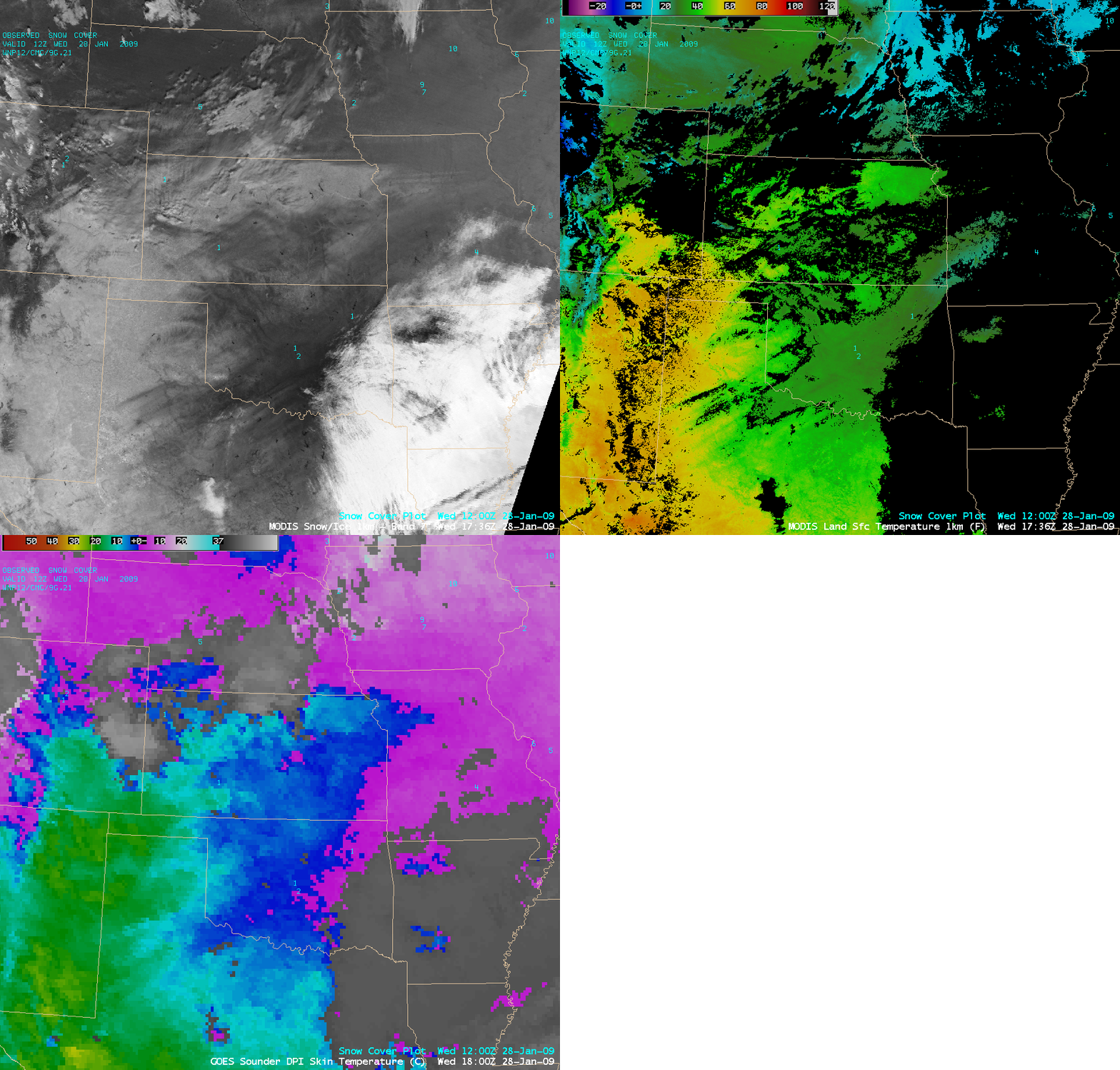
A comparison of the 1-km resolution MODIS Snow/Ice image with the 1-km resolution MODIS Land Surface Temperature product and the 10-km resolution GOES-12 sounder Skin Temperature product (below) revealed the effect that the snow and ice were having on keeping the ground (surface) temperatures down. While the MODIS LST product indicated that the vast majority of Oklahoma was at or below freezing at that time (darker green color enhancements), the corresponding GOES-12 sounder Skin Temperature product suggested that much of the western half of Oklahoma had surface temperatures that were a few degrees above freezing.
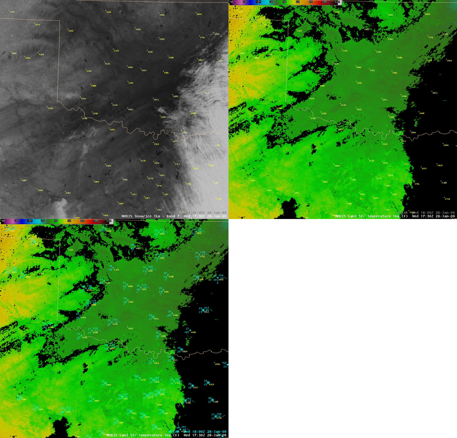
A closer view of the MODIS Snow/Ice image and the MODIS Land Surface Temperature product (below) showed a swath of colder LST values (darker green colors) across southwestern, central, and northeastern Oklahoma, roughly corresponding to the areas with a more significant accrual of ice (darker enhancement on the Snow/Ice image). Note from the surface METAR reports that the air temperatures appeared to be a few degrees F colder within the swath of colder MODIS LST values — presumably due to the fact that there was a thicker ice accrual (or ice covered with snow) on the ground in that region.
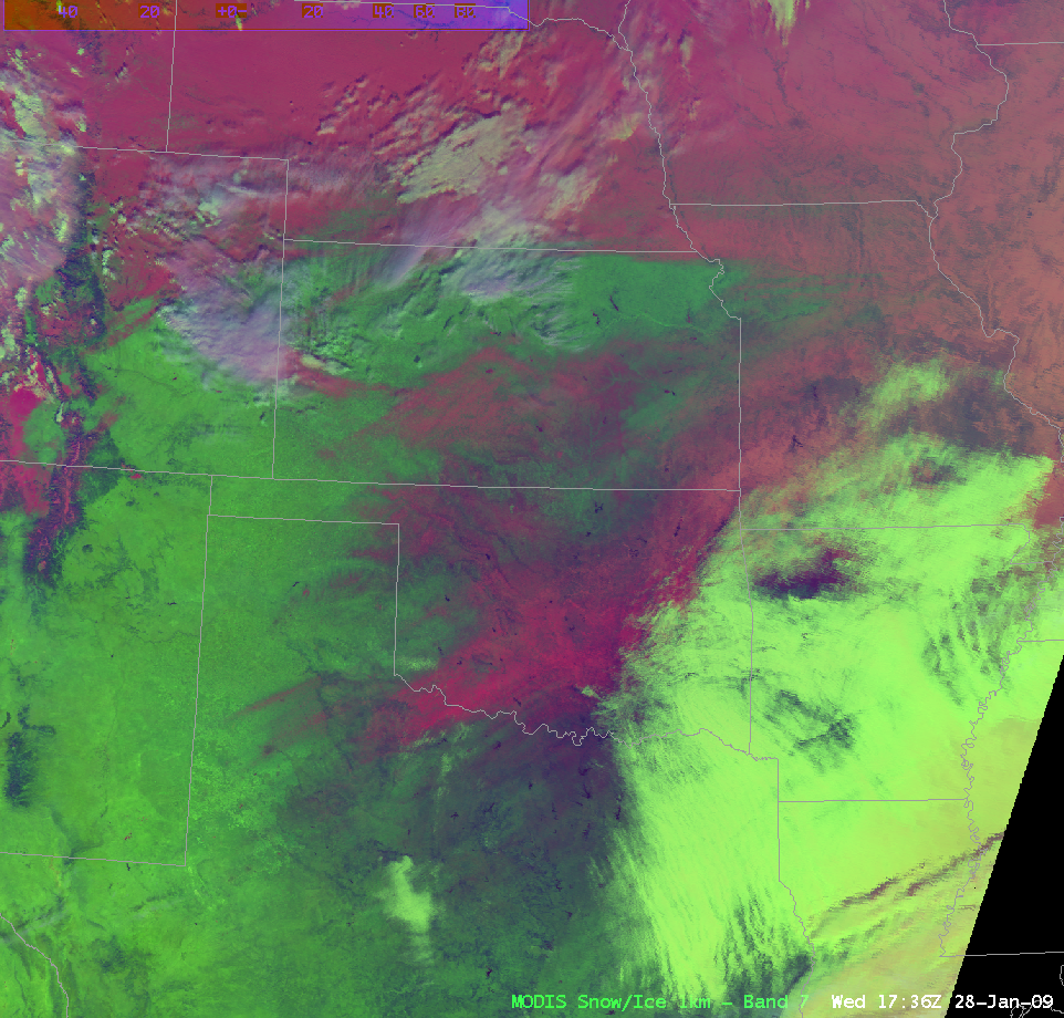
A false color RGB composite image using MODIS channel 01 (visible), channel 06 (near-IR), and channel 31 (IR window) is shown below, which gives another depiction of the coverage of the snow and ice on the ground. The brightest pink areas are those which had the thickest accrual of ice (with a light layer of snow on top of the ice).
False color red/green/blue (RGB) composite images using MODIS channel 01 (visible), channel 06/07 (near-IR), and channel 31 (IR window) generated using McIDAS imagery (above) and AWIPS imagery (below) gives another depiction of the coverage of the snow and ice on the ground. The brightest pink areas in Texas and Oklahoma are those which had the thickest accrual of ice (with a light layer of snow on top of the ice).
With the enhanced graphics capabilities of the next generation of AWIPS (“AWIPS-2” or “AWIPS Migration”), these kinds of RGB composite images will hopefully be easy to create on a routine basis.
— 30 JANUARY UPDATE —
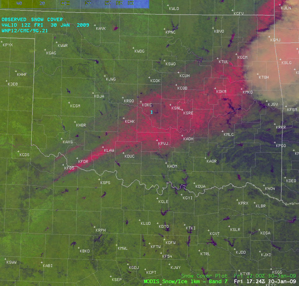
Following the storm, sunshine and warmer temperatures began to melt some of the snow cover and ice cover on the ground. An AWIPS MODIS “false color RGB image (above) shows the extent of the ice and snow (pink-colored features) that remained on the ground on 30 January 2009.
View only this post Read Less


