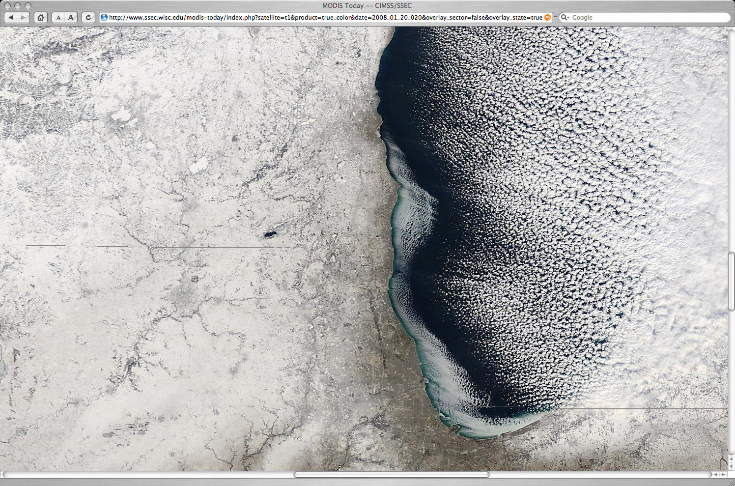
Ice forming in Lake Michigan
The coldest arctic air of the 2007/2008 winter season (so far) settled in over the Great Lakes region on 19-20 January 2008. Most reporting stations in Wisconsin experienced a daytime maximum temperature below 0ºF on 19 January, with the coldest overnight minimum temperature on 20 January of -34ºF at Nekoosa in central Wisconsin. As this cold air streamed eastward across Lake Michigan, ice began to form along parts of the western and southern nearshore waters as seen on the MODIS true color image (above) from the SSEC MODIS Today site. Also note that the four larger lakes in the Madison area (located toward the upper left corner of the image) had all frozen solid again — they had all frozen completely by late December, but then the largest of Madison’s lakes (Lake Mendota) began to partially open during a brief warm period in early January 2008.
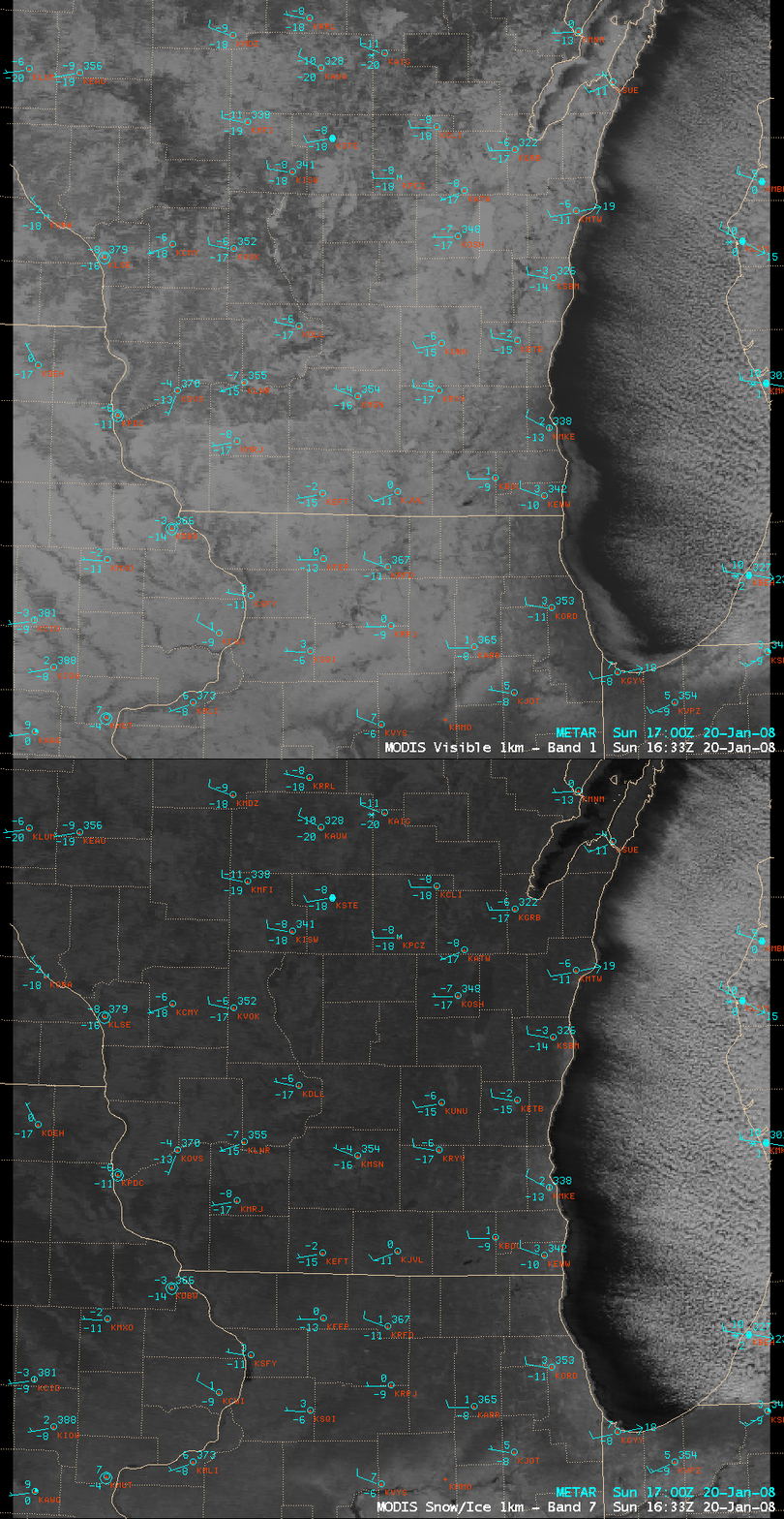
In a comparison of AWIPS images of the MODIS visible and 1.6µm “snow/ice channel” (below), the lake ice (and adjacent snow-covered land surfaces) exhibited a darker signal on the snow/ice image, in contrast to the brighter signal exhibited by the supercooled water droplet lake-effect snow cloud bands that covered much of the central and eastern portion of Lake Michigan.


