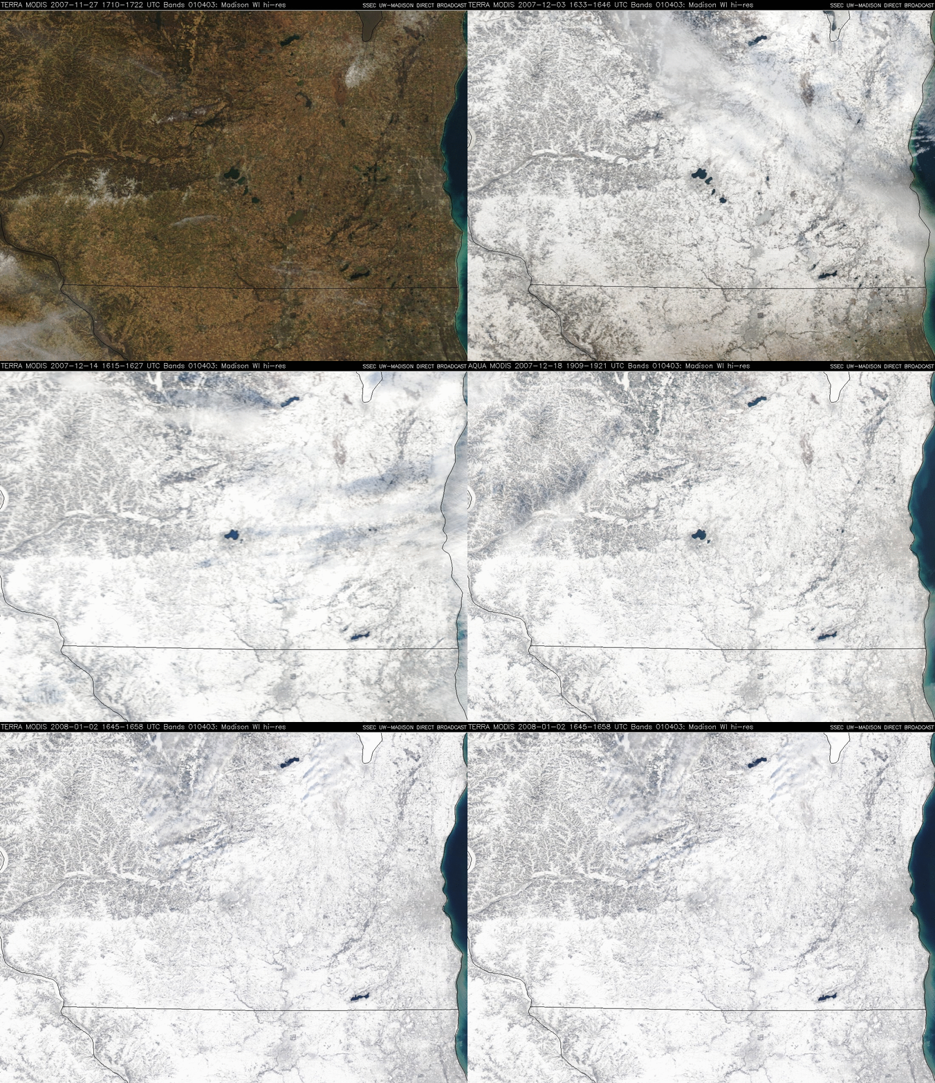
The transition to Winter across southern Wisconsin
A sequence of MODIS true color images (from the SSEC MODIS Direct Broadcast site) covering the period from 27 November 2007 to 02 January 2008 (above) shows the transition from predominantly bare ground (with only isolated patches of thin snow cover) at the end of November to widespread deep snow cover across all of southern Wisconsin during the month of December 2007. Madison, Wisconsin (located at the center of the images) experienced its second snowiest December on record, with 33.5 inches falling during the month. The maximum snow depth at the Madison airport was 12 inches (on both 12 and 16 December), but NWS Cooperative Observers in the Madison metro area reported snow depths as high as 16 inches; across southern Wisconsin, a maximum snow depth of 22 inches was reported at Germantown and Jackson.
While the official temperature at the Madison airport did get as low as -10ºF on 06 December, the month as a whole was only 1.8ºF below normal (average temperature: 21.2ºF); as a result, the lakes in the Madison area froze within about a week of their median freeze dates. The images above show that several of the more shallow lakes southeast of Madison were the first to freeze, with the largest of the Madison lakes (Lake Mendota) appearing totally frozen and white with deep snow cover on the final 02 January 2008 true color image. Contrast this to the previous winter season, when Lake Mendota did not freeze until 20 January 2007 (the second latest freeze date on record!).


