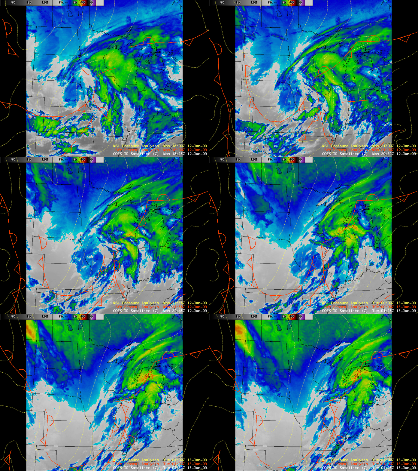
A strong “Alberta Clipper” system ushered in some of the coldest air of the 2008/2009 winter season on 12 January 2009 — in fact, it was so cold that AWIPS images of the GOES-12 10.7 µm IR channel data (above) showed that surface brightness temperatures as cold as -20º to -40º C (cyan to green color enhancement) were surging southward from south-central Canada into the north-central US in the wake of the clipper.
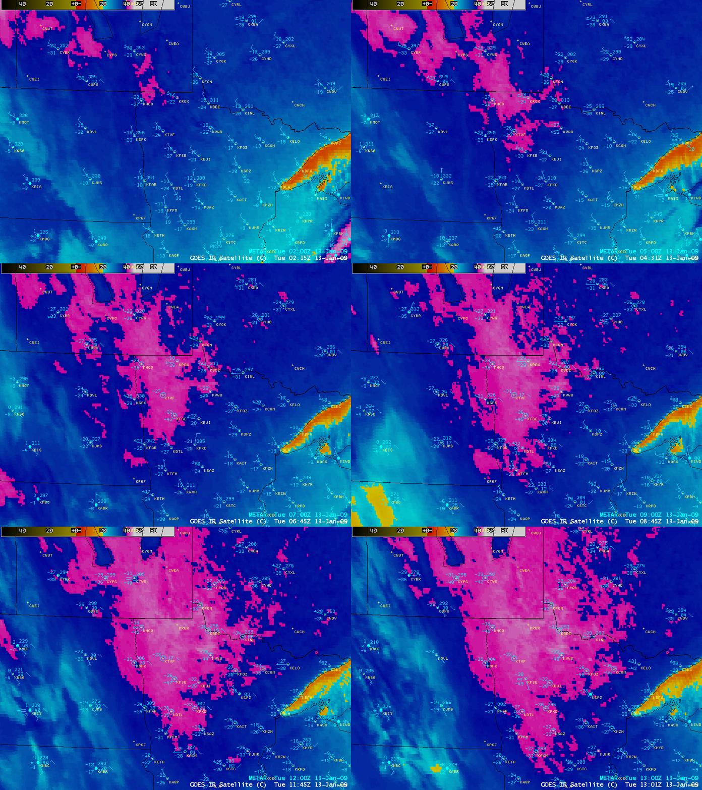
A closer view using GOES-12 IR imagery with a different color enhancement (below) displayed a large area of surface IR brightness temperatures colder than -40º C (violet colors) across much of eastern North Dakota and northwestern Minnesota during the pre-dawn hours of 13 January. The coldest GOES-12 IR brightness temperature values seen were -47º C (-53º F) at 13 UTC (7 AM local time) just to the north of Waskish (station identifier KVWU) in northeastern Minnesota.
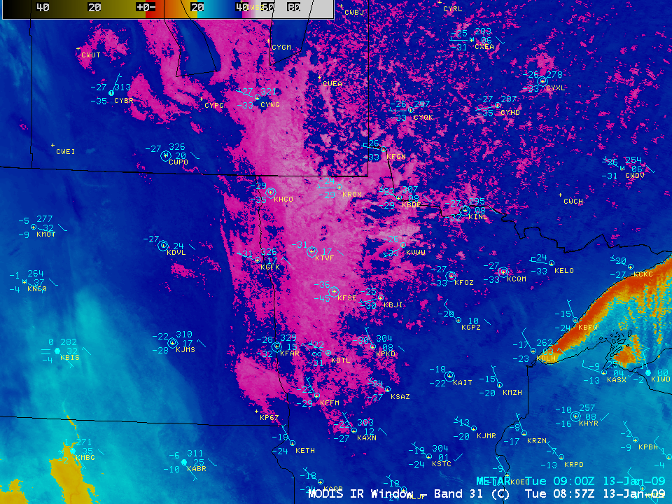
The 1-km resolution MODIS 11.0 µm IR image at 08:57 UTC (3:57 AM local time) on 13 January (below) showed similar values of cold IR brightness temperatures, with a minimum of -48º C (-54º F). The coldest surface air temperature reported that morning was -42º C (-44º F) by the Cooperative Observer at Embarrass in northeastern Minnesota, with lows of -41º C (-42º F) at Babbit, Bigfork, Effie, and International Falls. Prior to this date, the coldest temperature recorded in the Lower 48 states this 2008/2009 winter season was -39º C (-38º F) at Simpson, Montana on 21 December 2008.
— 15 January Update —
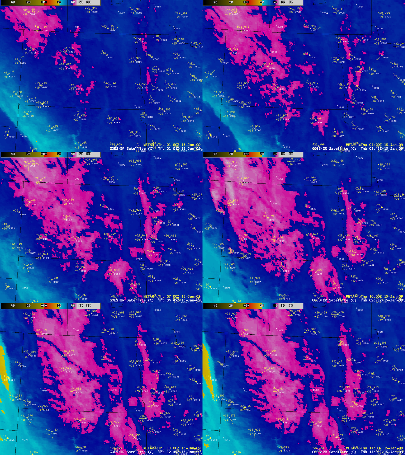
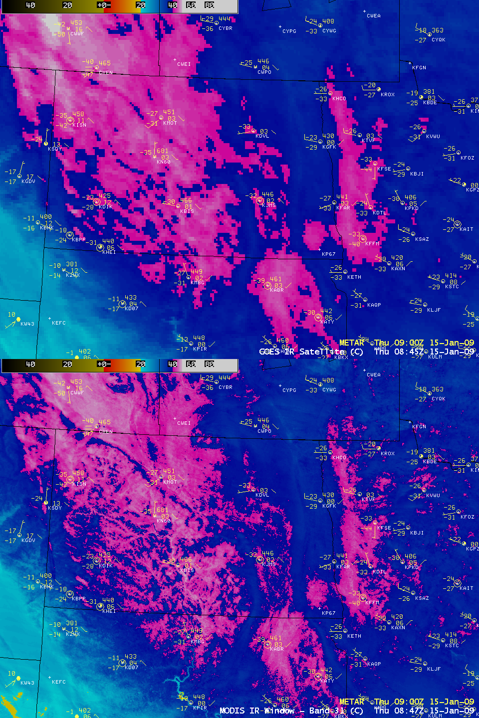
The coldest temperature recorded in the Lower 48 states during this particular cold outbreak was -44º C (-48º F) at Babbitt in northern Minnesota on 14 January. On the morning of 15 January, the core of the coldest air in the north-central US was found farther to the west, from central North Dakota into northeastern South Dakota: Garrison, North Dakota had a minimum temperature of -44º C (-47º F), Bismarck, North Dakota dropped to -42º C (-44º F) (only 1 degree F shy of their all-time record low), and Aberdeen, South Dakota recorded a low of -41º C (-42º F) (which was only 4 degrees F shy of their all-time record low). However, GOES-12 10.7 µm IR images (above) displayed surface IR brightness temperatures as cold as -47º C (-53º F) in North Dakota.
A comparison of 1-km resolution MODIS and 4-km resolution GOES-12 surface IR brightness temperatures at around 08:45 UTC or 3:45 AM local time (below) displayed very similar minimum values of -48º C (-54º F) and -47º C (-53º F), respectively.
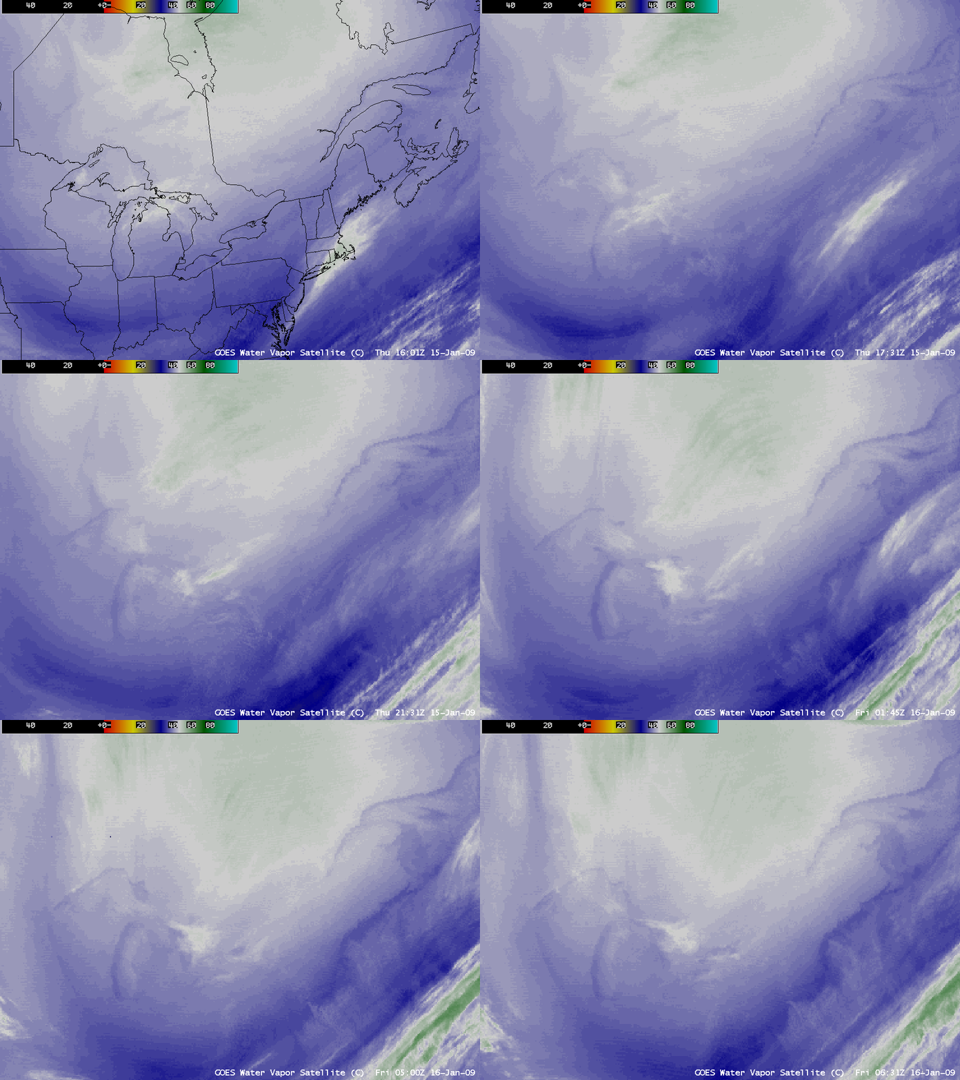
With such a cold and dry air mass in place over the north, the GOES-12 6.5 µm “water vapor channel” imagery (below) was able to display a signature of the large surface temperature contrast between the relatively warm waters of the Great Lakes and the St. Lawrence River and the surrounding colder land surfaces. GOES-12 water vapor weighting functions calculated using the Detroit MI rawinsonde data indicated that many of the GOES imager and sounder water vapor channels were peaking at unusually-low altitudes.
MODIS true color imagery showed that ice formation was rapidly increasing over far western and southern Lake Michigan with the presence of the cold air over the Great Lakes region.
— 16 January Update —
The cold air continued to move eastward, and on the morning of 16 January had settled over the northeastern US.
PUBLIC INFORMATION STATEMENT
NATIONAL WEATHER SERVICE CARIBOU ME
0955 AM EST FRI JAN 16 2009**POTENTIAL STATEWIDE RECORD MINIMUM TEMPERATURE**
AT 0730 AM EST THIS MORNING A USGS GAGE AT BIG BLACK RIVER RECORDED A LOW TEMPERATURE OF -50F. THIS EXCEEDS THE CURRENT STATEWIDE RECORD LOW TEMPERATURE OF -48F SET ON JANUARY 19TH…1925 AT VAN BUREN. THIS REPORT IS CONSIDERED UNOFFICIAL UNTIL A REVIEW OF THE EQUIPMENT AND DATA BY THE STATE CLIMATE EXTREMES COMMITTEE AS TO THE VALIDITY OF THIS REPORT. IF THE COMMITTEE ASCERTAINS THAT THIS IS INDEED A VALID REPORT…A SEPARATE PUBLIC INFORMATION STATEMENT WILL BE ISSUED AT THAT TIME.
Several hours prior to this, 1-km resolution NOAA-18 10.8 µm IR imagery (below) showed cold air drainage into the valleys of northern Maine, with surface IR brightness temperatures as cold as -45.4º C (-49.7º F) at 06:41 UTC (02:41 AM local time). The low that morning of -38º C (-37º F) at Caribou, Maine was the coldest temperature recorded at that location for the entire month of January.
View only this post Read Less


