Rare January tornadoes in southern Wisconsin
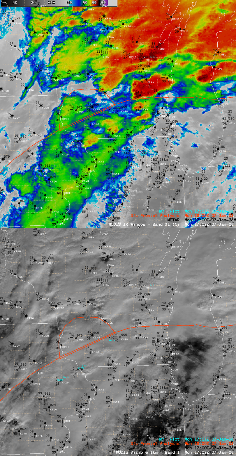
Tornadoes are very rare in the state of Wisconsin during the month of January; however, severe convection did produce at least two tornadoes that moved across far southeastern Wisconsin during the afternoon hours on 07 January 2008. AWIPS images of the MODIS 11.0 µm IR and visible channels (above) depicted one of the early rounds of thunderstorms that produced several reports of hail around 17:00 UTC (11:00 AM local time). Note the unusually warm temperatures and high dew points that were surging northward behind a warm frontal boundary — new daily record maximum temperatures were set for 07 January at Milwaukee (63ºF; this was also Milwaukee’s warmest temperature on record for the entire month of January) and at Madison (50ºF). As this warm and moist air mass began to move over the deep snowpack (NOHRSC modeled snow depth) that was still in place on the previous day (06 January), new daily record high minimum temperature records were also set (39ºF at Milwaukee and 37ºF at Madison), and dense fog formed that afternoon which reduced visibilities to near zero and contributed to a series of chain-reaction accidents (involving around 100 vehicles) along Interstate 90 near Madison, Wisconsin.
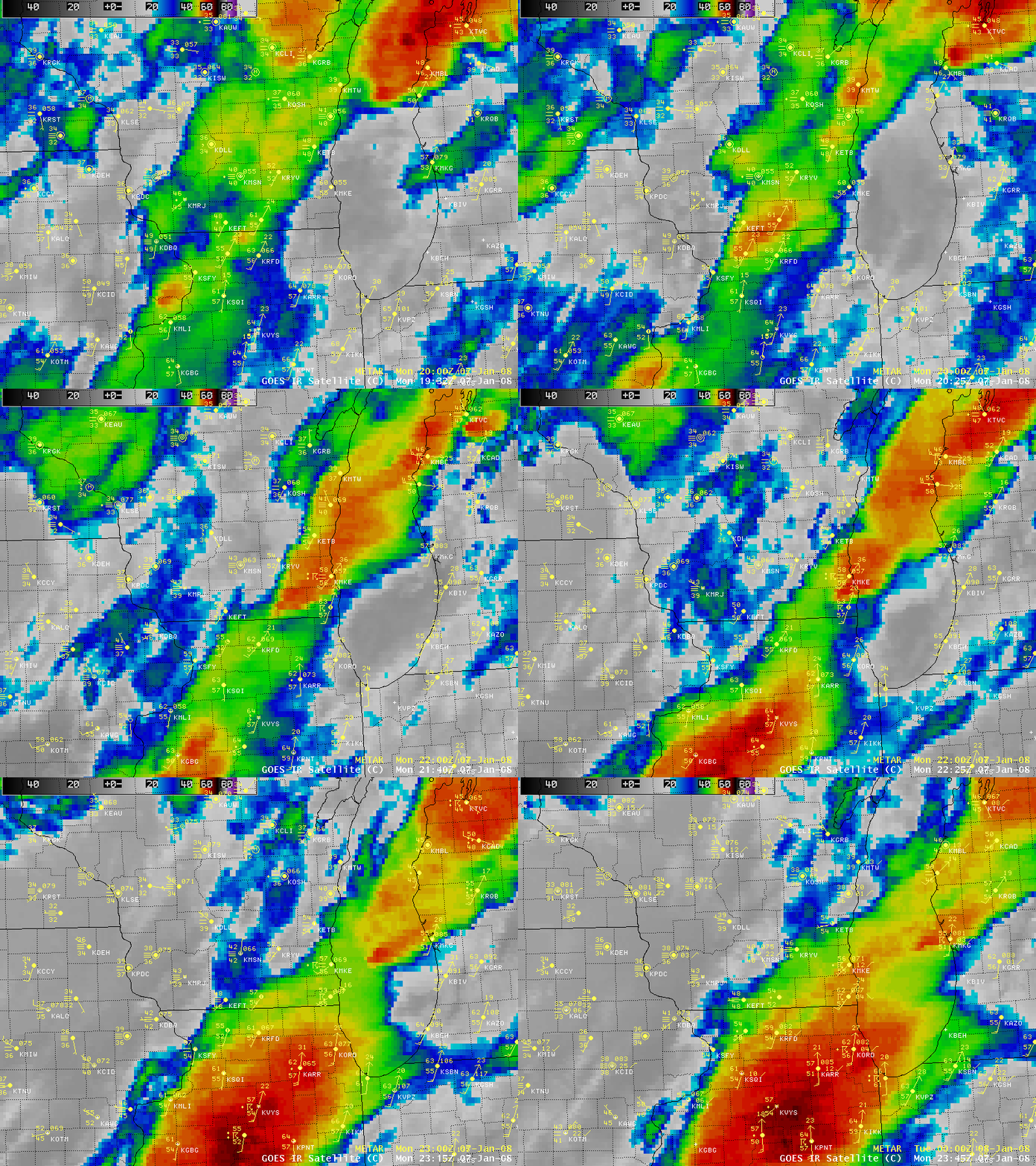
AWIPS images of the GOES-12 10.7 µm IR channel (below) showed the evolution of the severe convection that produced the tornadoes in southeastern Wisconsin between about 21:45 UTC and 22:45 UTC. The corresponding radar imagery from NWS Milwaukee/Sullivan revealed a well-defined hook echo as the tornado moved across Kenosha county in extreme southeastern Wisconsin (producing EF-3 damage).
Prior to this event, only one January tornado had ever been recorded in the state of Wisconsin — a long-track F3 in Green and Rock counties on 24 January 1967.


