Warm and cold conveyor belts
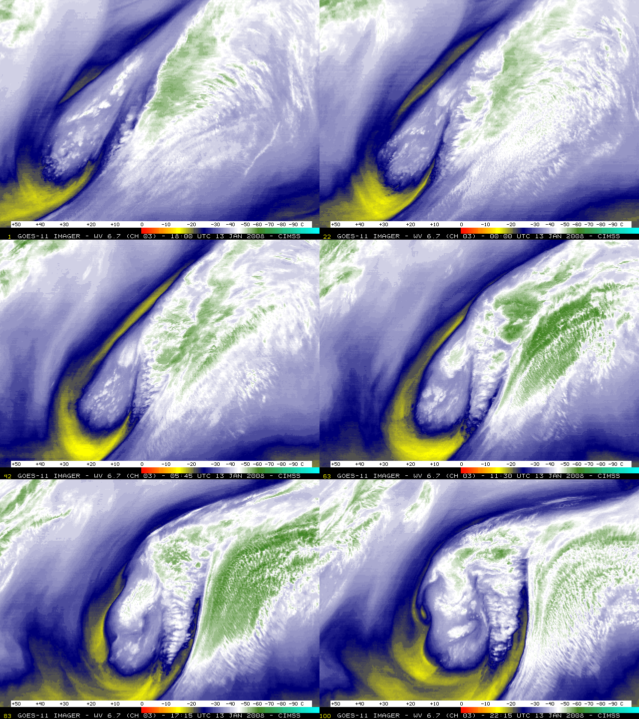
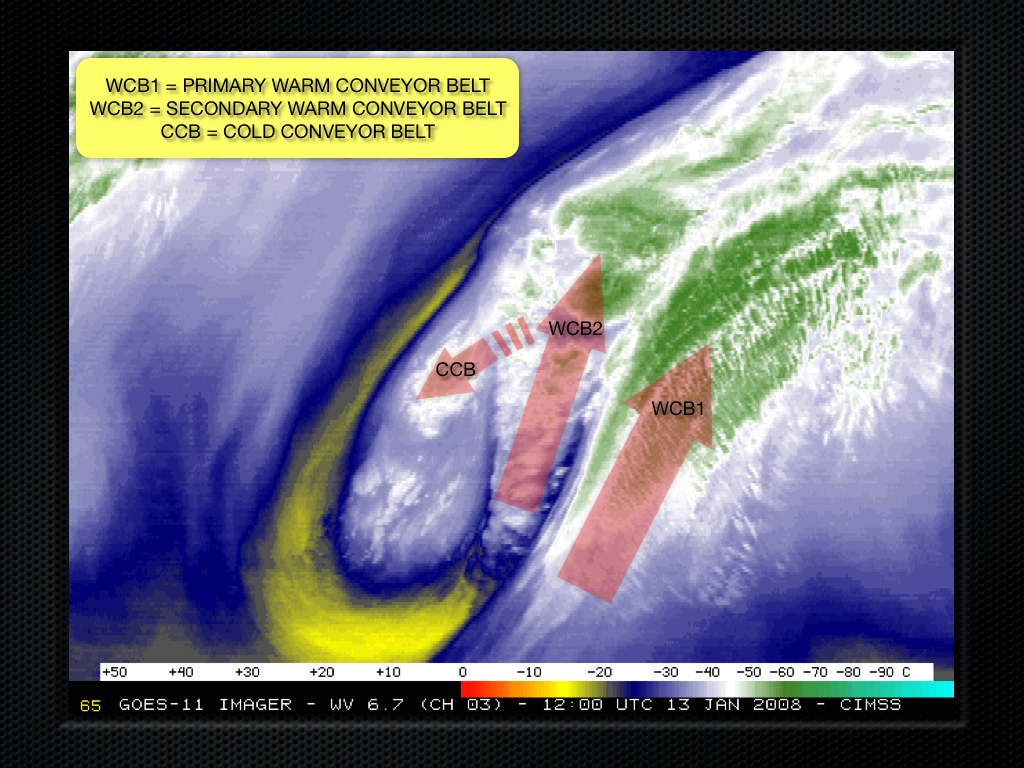
An animation of GOES-11 6.7 µm “water vapor channel” imagery (above) shows the development and intensification of a mid-latitude cyclone over the eastern North Pacific Ocean on 13 January 2008. Of particular interest in the water vapor imagery is the appearance of well-defined satellite signatures of an initial warm conveyor belt (WCB1), with a secondary warm conveyor belt (WCB2) later forming; a cold conveyor belt (CCB) is also seen emerging from beneath the secondary warm conveyor belt (as shown on the annotated image below). The “conveyor belt model” was developed and refined (most recently by authors such as Browning, Carlson, and Young) to help visualize the airflow through mid-latitude cyclones (schematic 1 | schematic 2); the flow is ascending in all 3 conveyor belts (producing the enhanced moisture and cloud signatures seen on the water vapor imagery), but the air rises to higher altitudes in the two warm conveyors than in the cold conveyor.
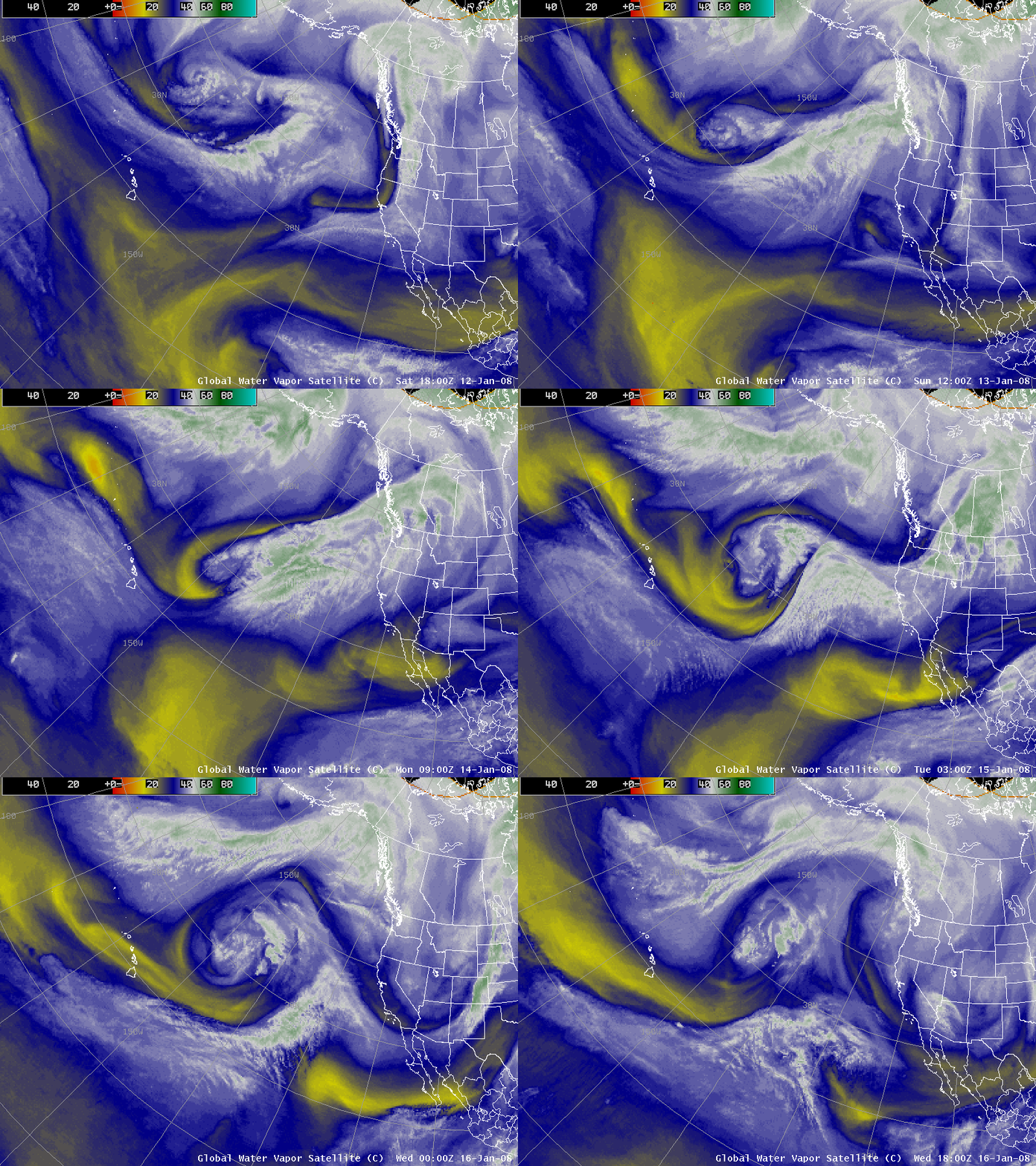
AWIPS images of the GOES-11 water vapor channel at 3-hour intervals (below) show that during the following 2-3 days this cyclone rapidly occluded, became quasi-stationary, and then eventually transitioned to a “cut-off low” which began to slowly retrograde to the northwest on 15-16 January.


