This website works best with a newer web browser such as Chrome, Firefox, Safari or Microsoft Edge. Internet Explorer is not supported by this website.

Archive: May 2024

Severe thunderstorms across Kansas

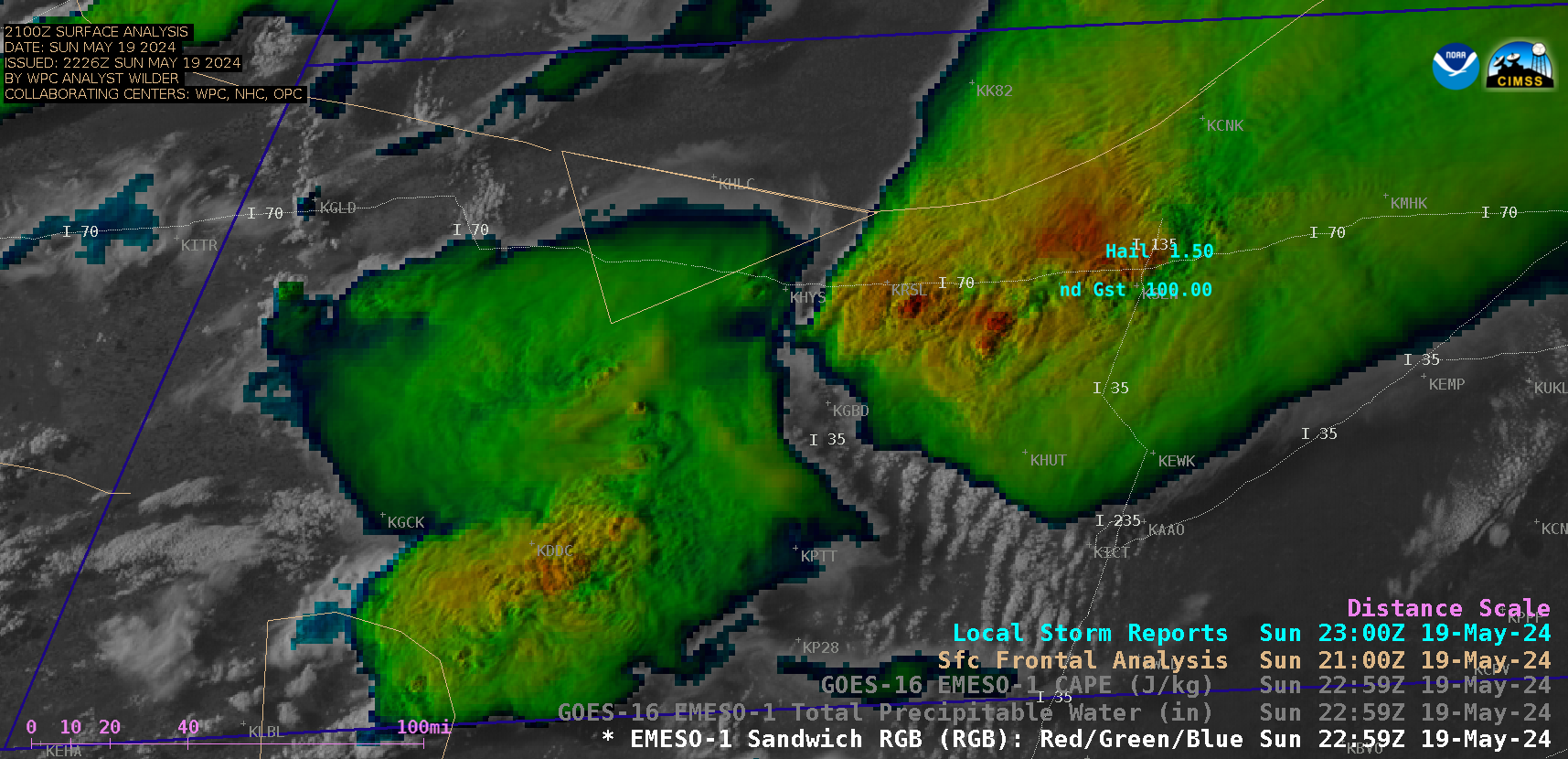
While much of Kansas was under a “Particularly Dangerous Situation” Severe Thunderstorm Watch, 1-minute Mesoscale Domain Sector GOES-16 (GOES-East) Visible/Infrared Sandwich RGB images (above) showed thunderstorms that produced tornadoes, large hail (to 3.00 inches in diameter) and damaging winds (gusts of 90-100 mph) (SPC Storm Reports) across parts of Kansas on 19 May 2024. Some flash flooding was also reported, with water covering portions of... Read More

30-second images of thunderstorms that produced tornadoes and damaging winds (with some fatalities) in the Houston, Texas area

Overlapping 1-minute Mesoscale Domain Sectors provided 30-second interval GOES-16 (GOES-East) “Red” Visible (0.64 µm) and “Clean” Infrared Window (10.3 µm) images (above) — which showed thunderstorms that produced two EF1-rated tornadoes as well as damaging winds (resulting in some fatalities) across the Houston area (SPC Storm Reports) on 16 May 2024. Widespread structural damage occurred in downtown Houston — and there were also... Read More

Blowing dust in West Texas

5-minute CONUS Sector GOES-16 (GOES-East) Ash RGB images (above) showed a pulse of blowing dust — lofted by thunderstorm outflow winds gusting as high as 70 kt (81 mph) — that was moving southward across West Texas late in the day on 16 May 2024. This dust reduced surface visibility to 1-1/4 mi... Read More

Flooding Rains on Oahu

A 16-hour animation using 5-minute GOES-18 PACUS imagery, above (saved from the Geosphere site) shows persistent convection along the east coast of Oahu on 13 May. MIMIC estimates of Total Precipitable Water on 13 May, below, show the state of Hawai’i surounded by abundant moisture, although the richest moisture within the... Read More