Wildfire in British Columbia produces 2 pyrocumulonimbus clouds
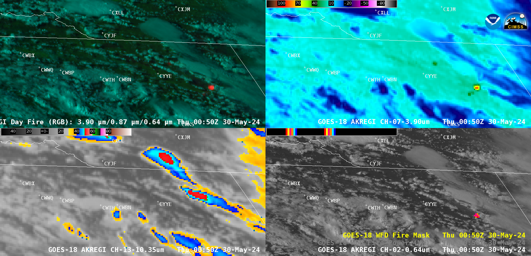
10-minute Full Disk sector GOES-18 (GOES-West) Day Land Cloud Fire RGB, Shortwave Infrared (3.9 µm), “Clean” Infrared Window (10.3 µm) and “Red” Visible (0.64 µm) images with an overlay of the Fire Mask derived product (a component of the GOES Fire Detection and Characterization Algorithm FDCA) (above) displayed signatures of a wildfire in far northeastern British Columbia, which produced... Read More