Severe thunderstorms across Kansas

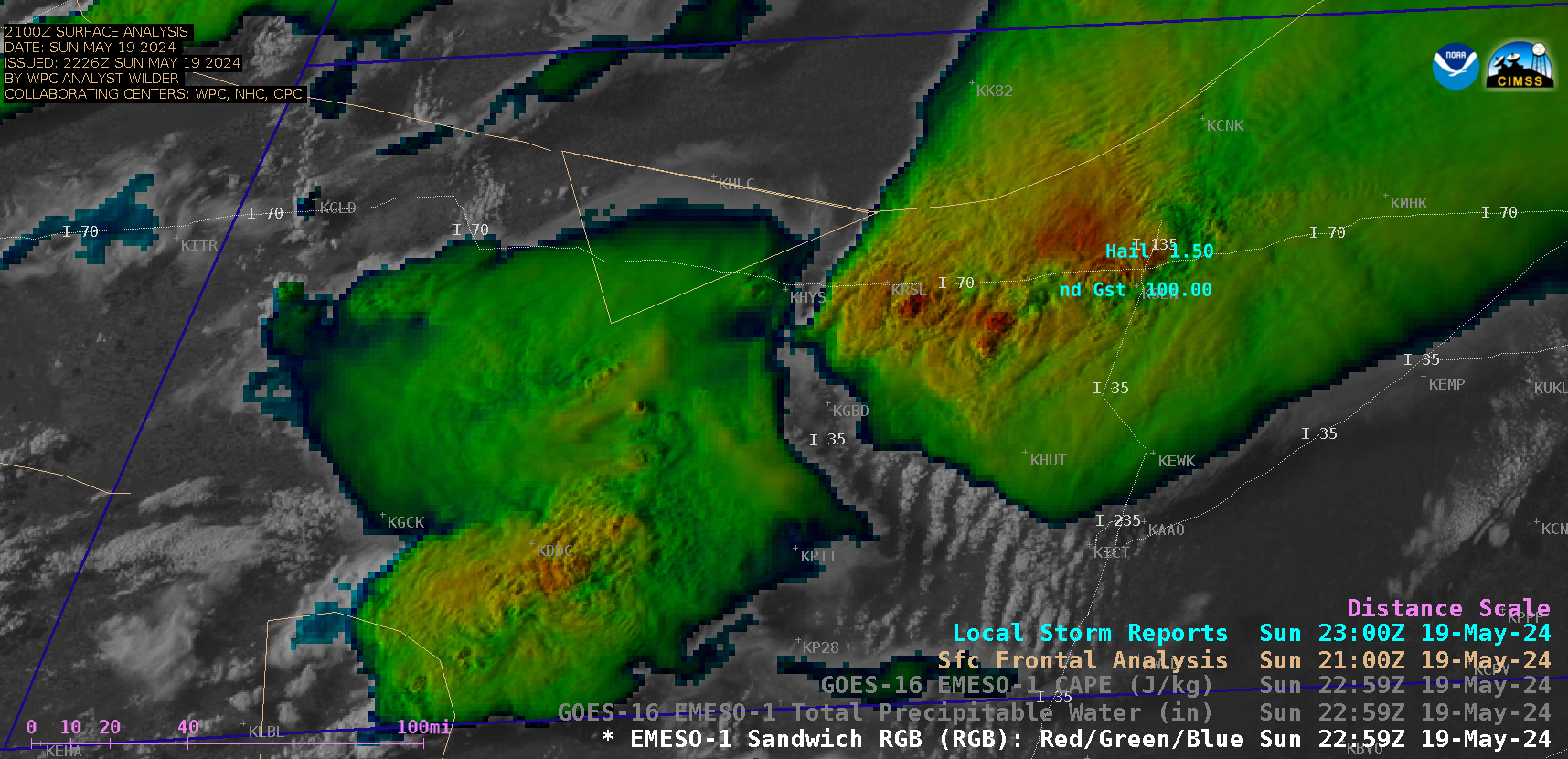
1-minute GOES-16 Visible/Infrared Sandwich RGB images with time-matched Local Storm Reports plotted in cyan [click to play animated GIF | MP4]

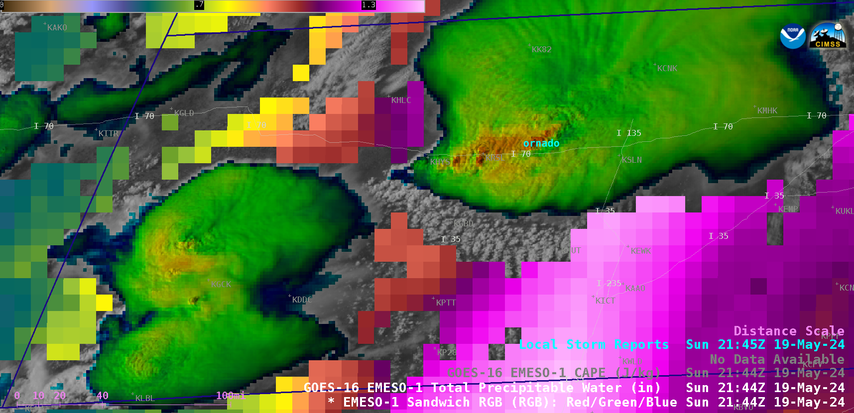
1-minute GOES-16 Visible/Infrared Sandwich RGB images combined with the Total Precpitable Water derived product in cloud-free areas, with time-matched Local Storm Reports plotted in cyan [click to play animated GIF | MP4]

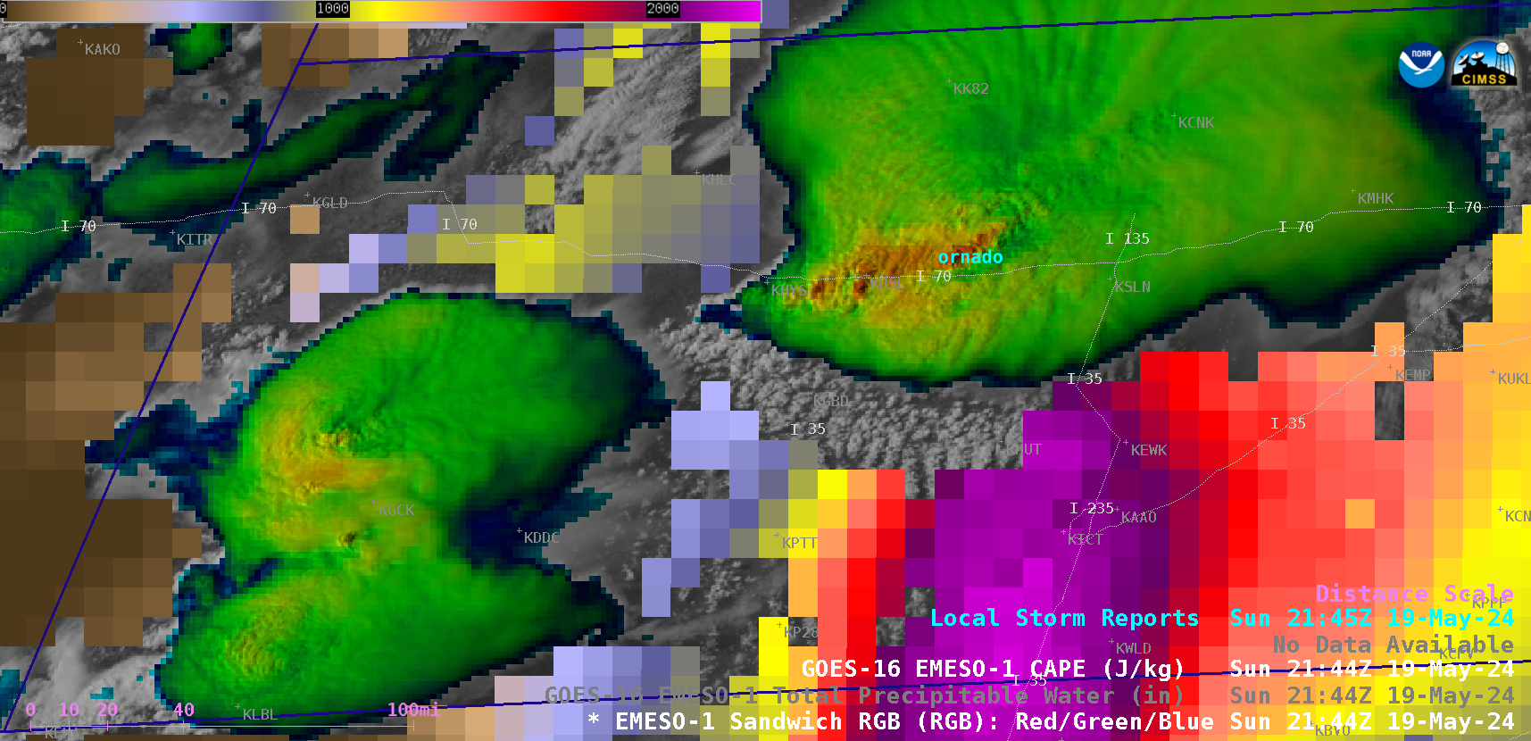
1-minute GOES-16 Visible/Infrared Sandwich RGB images combined with the Convective Available Potential Energy (CAPE) derived product in cloud-free areas, with time-matched Local Storm Reports plotted in cyan [click to play animated GIF | MP4]

