This website works best with a newer web browser such as Chrome, Firefox, Safari or Microsoft Edge. Internet Explorer is not supported by this website.

Archive: Apr 2024

30-second imagery of severe thunderstorms over Oklahoma and Kansas

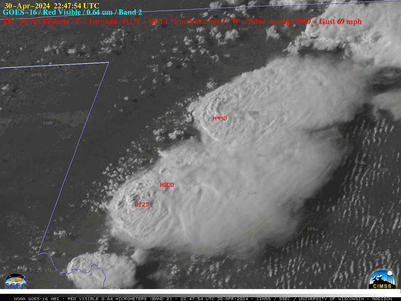
Overlapping 1-minute Mesoscale Domain Sectors provided 30-second interval GOES-16 (GOES-East) “Red” Visible (0.64 µm) images (above) — which showed thunderstorms that produced tornadoes, large hail (up to 4.4 inches in diameter) and damaging winds (SPC Storm Reports) across western Oklahoma on 30 April 2024. Pulses of overshooting tops and evidence of Above-Anvil Cirrus Plumes (reference | VISIT training | blog posts) were... Read More

Another explosive eruption of Mount Ruang in Indonesia

12 days after its powerful eruption on 17 April, 10-minute JMA Himawari-9 AHI Infrared Window (10.4 µm) images (above) showed another explosive eruption of Mount Ruang in Indonesia on 29 April 2024. The coldest cloud-top infrared brightness temperatures reached -90ºC (internal yellow pixels) at 1850 UTC, shortly after eruption onset. Note that the volcanic umbrella cloud exhibited concentric... Read More

Severe thunderstorms across Nebraska and Iowa

1-minute Mesoscale Domain Sector GOES-16 (GOES-East) Visible/Infrared Sandwich RGB images (above) showed thunderstorms that produced tornadoes, large hail and damaging winds (SPC Storm Reports) across eastern Nebraska and western Iowa on 26 April 2024.1-minute GOES-16 Visible/Infrared Sandwich RGB images with an overlay of GLM Flash Extent Density (below) showed the lightning activity associated with this convection — which included some notable lightning jumps as tornadic thunderstorms moved through the... Read More