Geosphere views of Smoke over Canada and the northern USA
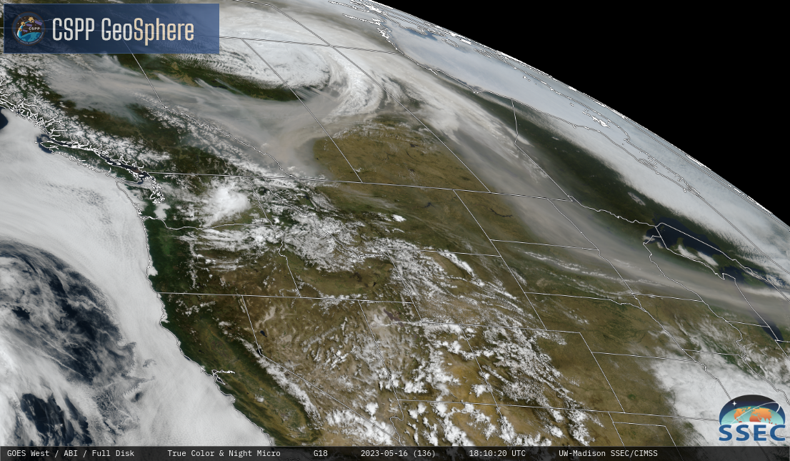
True-Color imagery from GOES-East (above, from the CSPP Geosphere site) and GOES-West (below, also from the CSPP Geosphere site) from 1720-1910 UTC show multiple active fires in British Columbia, Alberta and Manitoba, and a wide plume of smoke entrained into a storm centered just north of Saskatchewan (one wonders if the rain from the storm... Read More