SAR Winds over Tropical Storm Mawar to the southeast of Guam
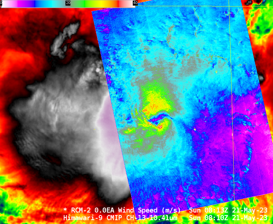
Himawari-9 Band 10 (Low-level water vapor, 7.3 µm) infrared imagery, above, shows Tropical Storm Mawar to the southeast of Guam. At 0600 UTC, Mawar’s center was about 400 miles south-southeast of the island of Guam. The short water vapor animation above shows an expanding cirrus shield with outflow in all... Read More
