This website works best with a newer web browser such as Chrome, Firefox, Safari or Microsoft Edge. Internet Explorer is not supported by this website.

Archive: Sat May 2023

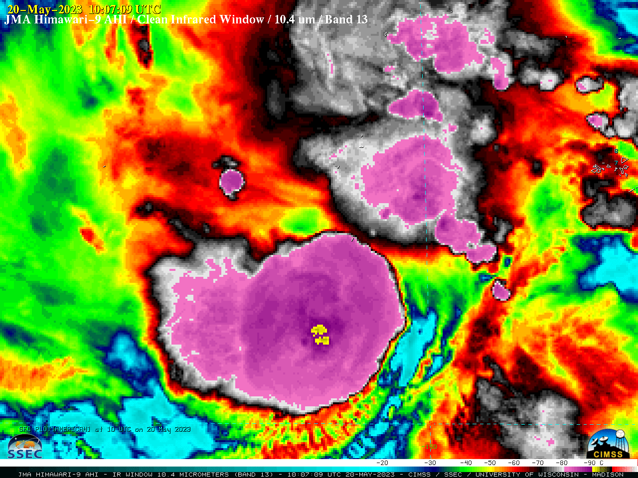
1-minute imagery of wildfires and pyrocumulonimbus clouds in British Columbia

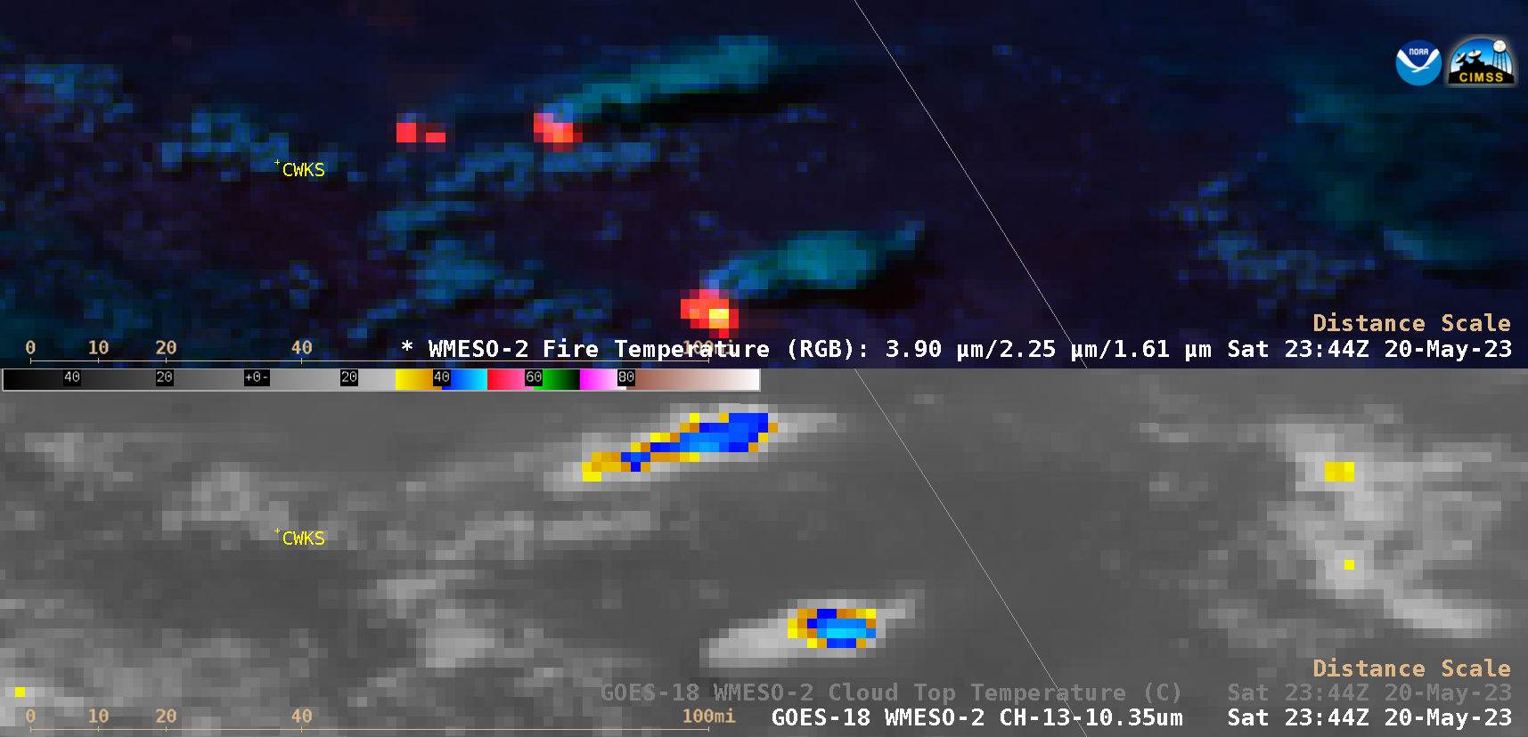
1-minute Mesoscale Domain Sector GOES-18 (GOES-West) Fire Temperature RGB and “Clean” Infrared Window (10.3 µm) images (above) showed the intensification of 3 wildfires in northeast British Columbia on 20 May 2023. Two of the fires produced pyrocumulonimbus (pyroCb) clouds, exhibiting cloud-top 10.3 µm infrared brightness temperatures of -50ºC or colder (shades of red) — which then eventually moved eastward... Read More

Tropical Storm Mawar in the West Pacific Ocean

As West Pacific Tropical Depression 02W — previously discussed in this blog post — intensified to become Tropical Storm Mawar at 1200 UTC on 20 May 2023, 2.5-minute rapid scan JMA Himawari-9 “Clean” Infrared Window (10.4 µm) images (above) showed pulses of cold overshooting tops that frequently exhibited infrared brightness temperatures in the -90... Read More