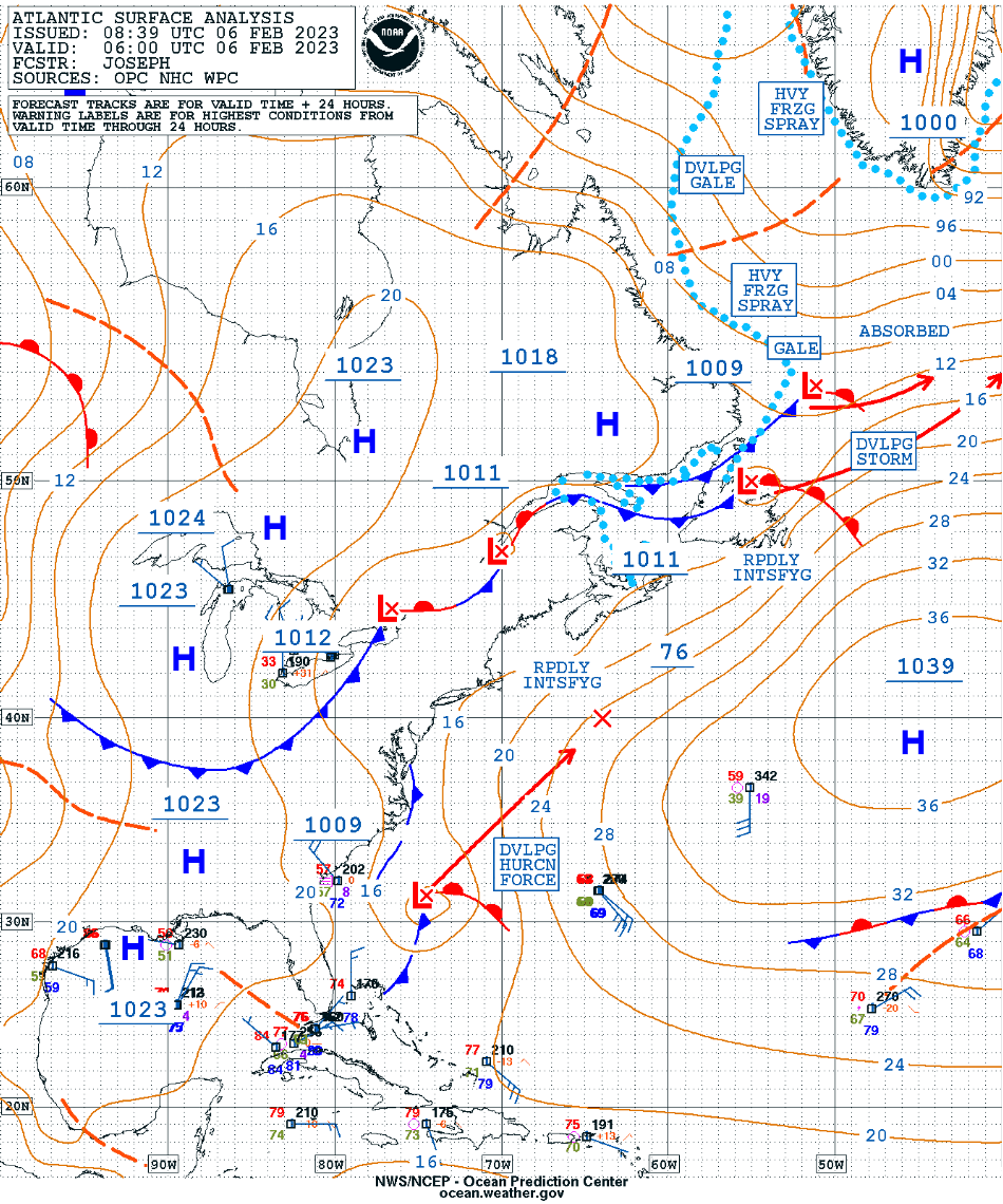
Rapidly intensifying midlatitude cyclone off the US East Coast
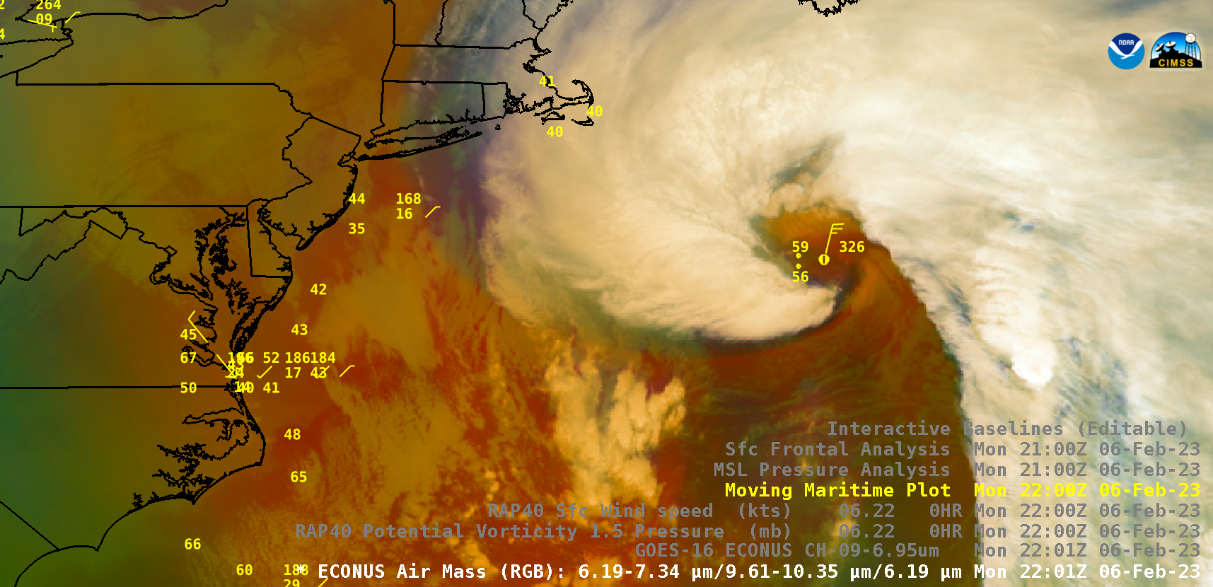
GOES-16 (GOES-East) Air Mass RGB images (above) included contours of RAP40 model PV 1.5 Pressure — and showed a Hurricane Force low pressure that had rapidly intensified as it moved northeastward off the US East Coast (surface analyses) on 06 February 2023. The PV 1.5 surface (which represents the dynamic tropopause) descended to the 500 hPa pressure level at... Read More
