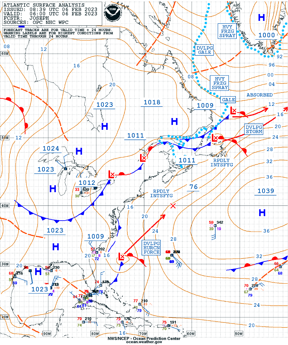
Rapidly intensifying midlatitude cyclone off the US East Coast

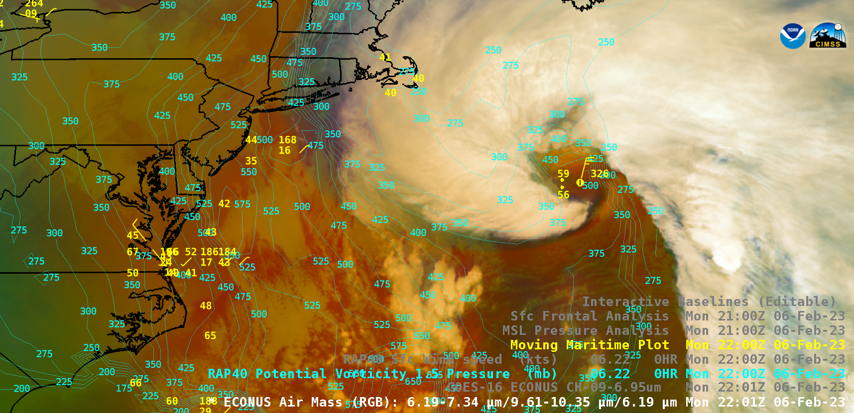
GOES-16 Air Mass RGB images, with and without contours of RAP40 model PV 1.5 Pressure [click to play animated GIF | MP4]
GOES-16 Mid-level Water Vapor (6.9 µm) images (below) included contours of RAP40 model surface wind speed. One prominent cloud feature was the development of what resembled a “scorpion tail” just south of the low pressure center — which is sometimes seen in storms that feature a sting jet.

GOES-16 Mid-level Water Vapor (6.9 µm) images, with and without contours of RAP40 model surface wind speed [click to play animated GIF | MP4]
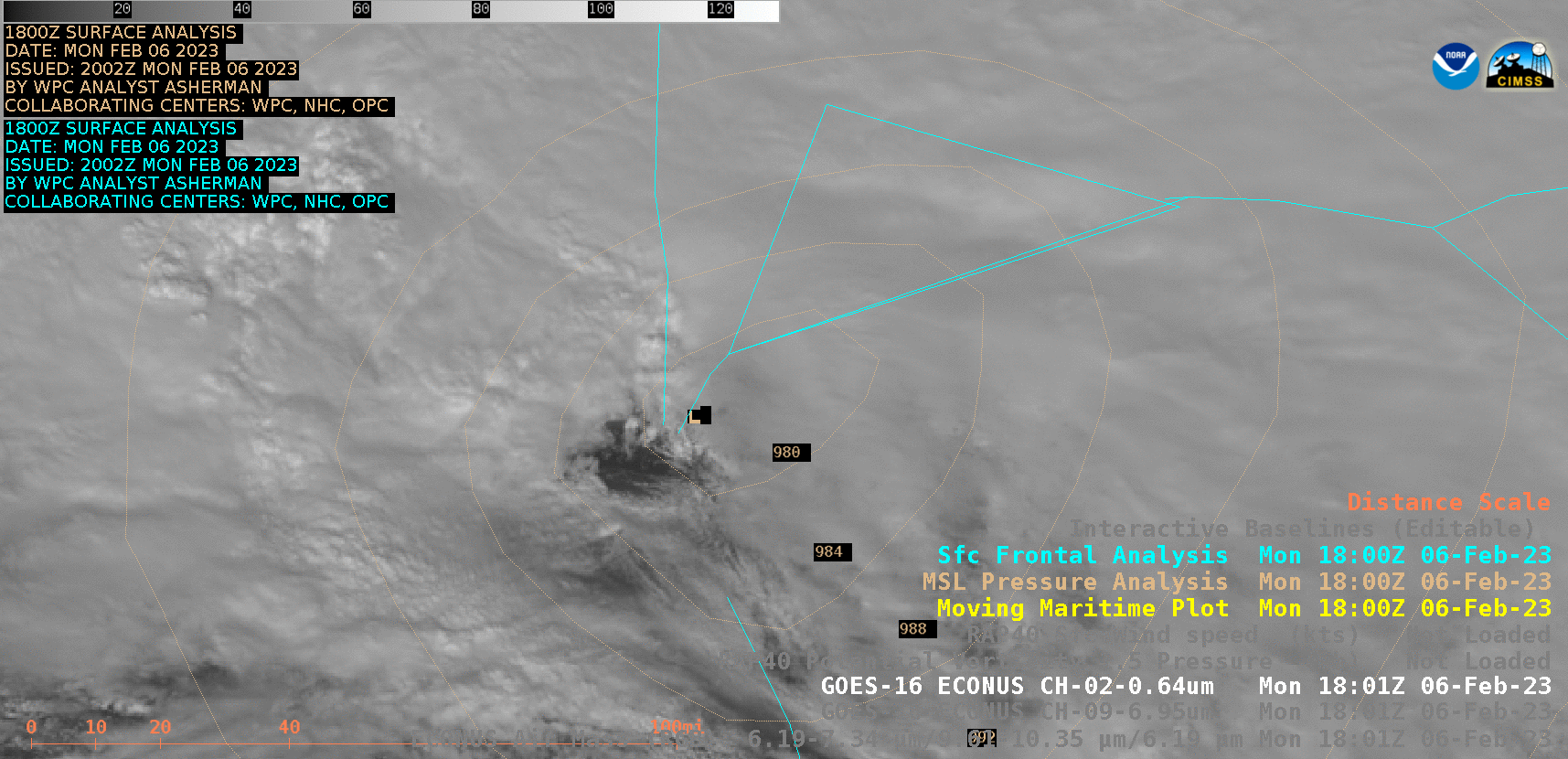
GOES-16 “Red” Visible (0.64 µm) images, with the 1800 UTC analysis of surface pressure and fronts [click to play animated GIF | MP4]
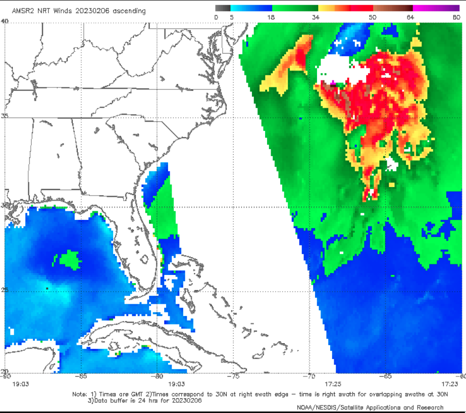
GCOM-W1 AMSR2 surface wind speed at 1725 UTC on 06 February