Disturbed weather in the tropics near American Samoa

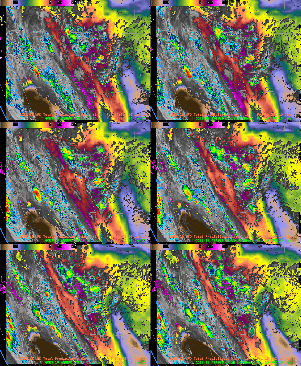
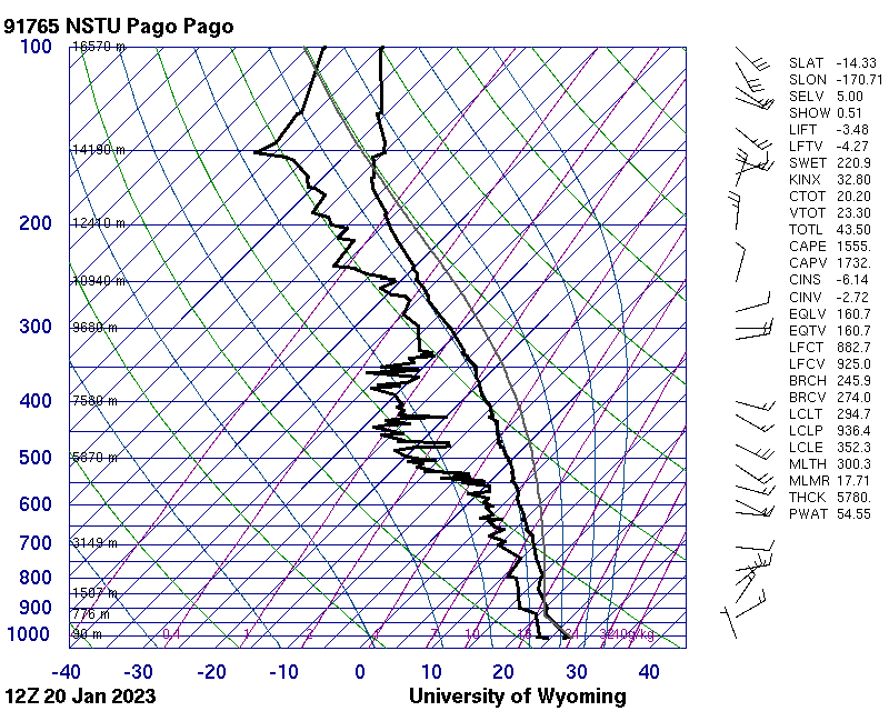
GOES-18 Clean window infrared imagery (10.3 µm, displayed at full resolution in a special sector over American Samoa, in the latest AWIPS build) shows an area of convection, within a region of abundant moisture (GOES-18 Total Precipitable water values are close to 2.5″), approaching the Samoan islands (that are located in the center of this domain). The Pago Pago sounding from 1200 UTC on 20 January is shown below, (from this site), and it also shows moisture (2.15″) over the island. Moisture behind the remains of tropical cyclone Irene are affecting Fiji in this image (Heavy Rains/flooding warnings are occurring), and at the far western edge of the domain, high clouds associated with Invest 92P are apparent.

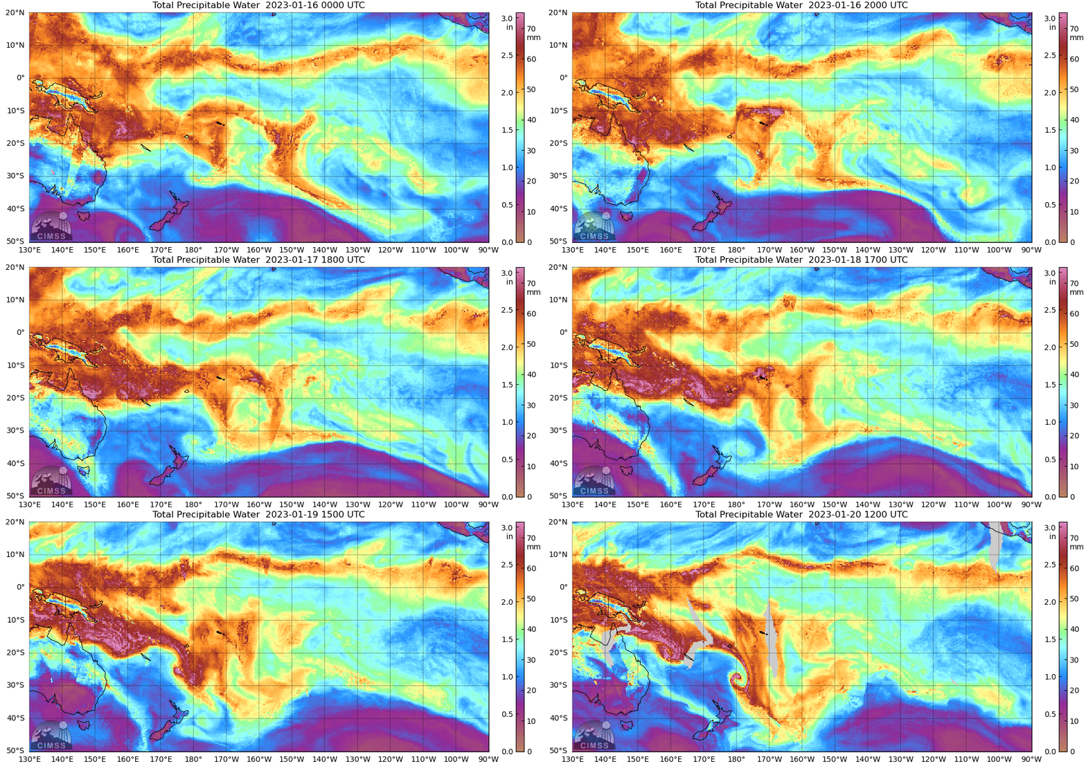
GOES-18 Level 2 Total Precipitable Water is computed only where clear skies are present. Total Precipitable Water can also be estimated using microwave data; microwave-derived MIMIC total precipitable water fields are shown below. The cyclonic circulations of Irene (passing between New Caledonia and Fiji on 18-19 January) and the developing 92P (near New Caledonia at the end of the animation) are apparent.

How likely is the tropical development of the disturbed weather over Samoa into a tropical cyclone? Wind shear values from the SSEC/CIMSS Tropical site, shown below, show a region of small shear over the Samoan islands, moving west with time. However, development is not anticipated; the chief threat for this region is likely persistent rains.

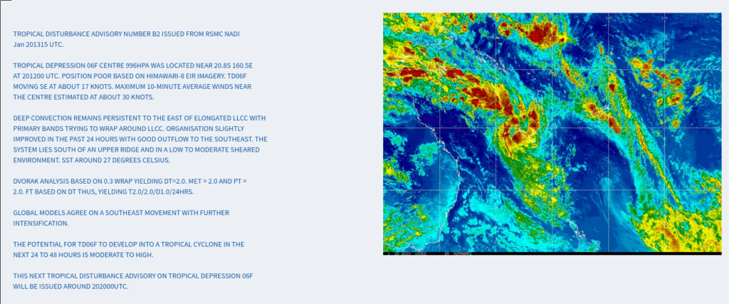
The area of disturbed weather (Invest 92P) between Australia and New Caledonia has a moderate to strong possibility of strengthening into a tropical storm, per the RSMC in Fiji, shown below (from this link).

GOES-18 imagery in this blog post was created using a cloud instance of AWIPS from TOWR-S. Thank you!

