Severe convective winds over Ohio
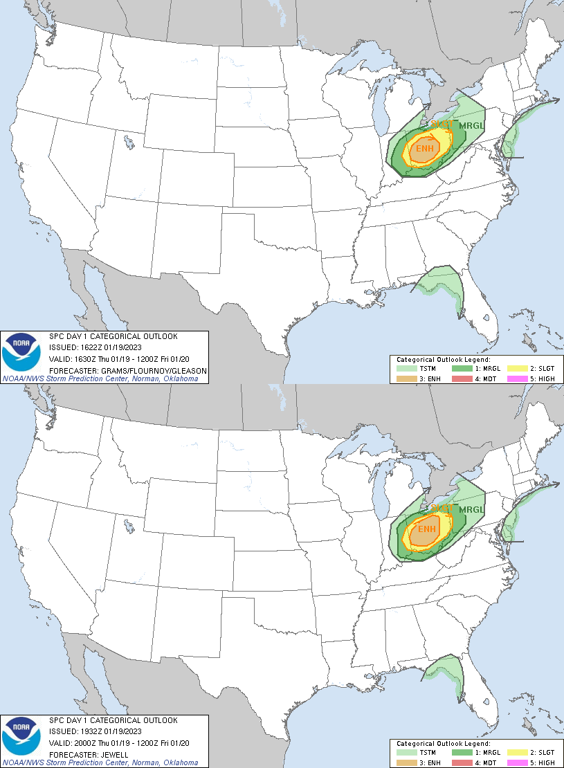
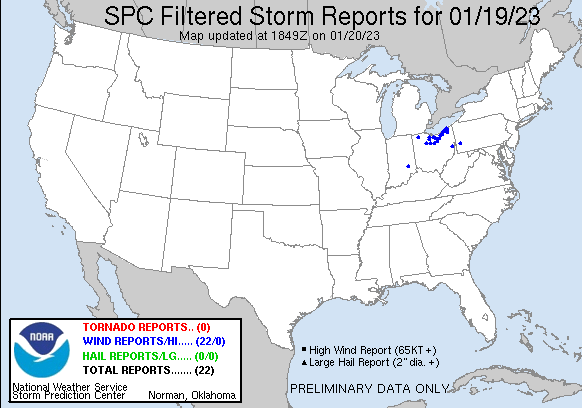
The Storm Prediction Center’s Convective Outlooks for late afternoon on 19 January 2023 contained a region of Enhanced Probabilities for Severe weather (primarily for wind) over portions of Ohio, as shown above. The chief difference between the 1630 and 2000 UTC outlooks was the extension of the Enhanced region to the north/northeast by a county or two at 2000 UTC. The unusually strong convection (for January!) that developed over Ohio on 19 January 2023 did cause a large swath of wind damage as shown by the SPC Storm reports below, mostly in the northern part of the Enhanced Risk. Most of the winds reports occurred between 2200 UTC on 19 January and 0100 UTC on 20 January, and most were within the Cleveland, OH, County Warning Area (CWA). What kind of satellite data could have been used on 19 January for situational awareness as the storms developed?
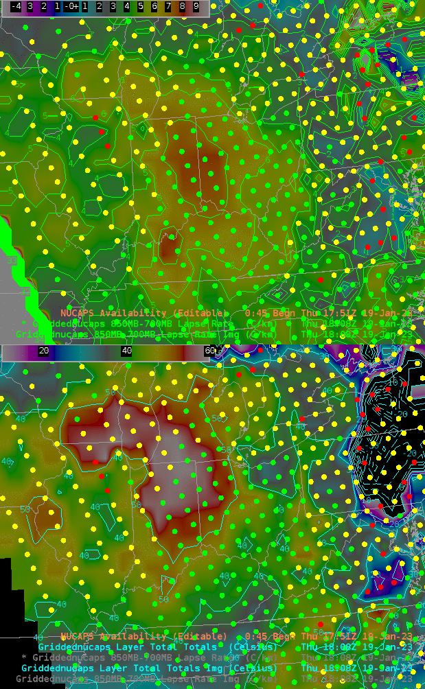
The toggle above shows thermodynamic fields from NUCAPS profiles from a NOAA-20 overpass just after 1800 UTC. Clear skies (as suggested by the green dots in the AWIPS display) prevailed over much of Indiana and Ohio at this time. The steepest low-level (that is, 850-700 mb) lapse rates were centered over the central Indiana/Ohio border; the largest Total Totals index values, however, were a bit farther north.
Because skies were clear, GOES-16 Derived Stability Indices gave information/could be used on this day. The animation below combines GOES-16 Band 13 imagery (for cloudy regions) and the derived Lifted Index in clear regions. For both of these fields, the default AWIPS enhancements were changed (because, in part, it’s January!) The coldest Band 13 brightness temperatures were -80oC (vs the default -109oC) and the Lifted Index is scaled from 0-12 (vs. the default of -10 to 20). It is revealing that the smallest Lifted Indices (around 1 or 2) occur in the northern half of the Enhanced Risk polygon as the convection moves into western/central Ohio. (Here is a still image from 1951 UTC, two hours before the onset of convective wind reports). Could the satellite-diagnosed lower stability in the northern part of the Enhanced Risk (relative to the southern part) help in situational awareness, especially when combined with the NUCAPS snapshot shown above?
Derived CAPE, shown below (and scaled to just 0-50) shows a small region of positive CAPE over north-central Ohio around 2100 UTC.
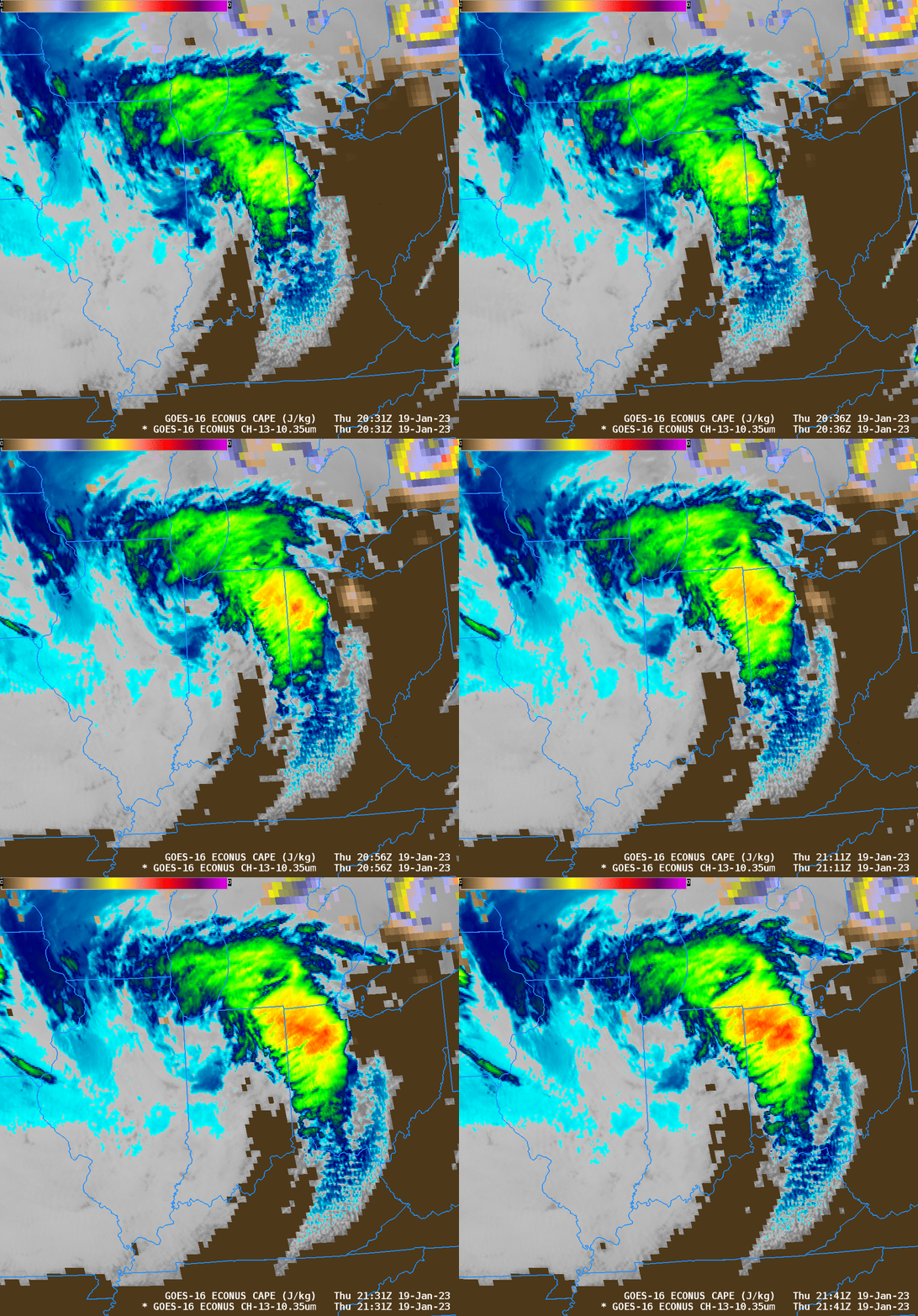
Note that the AWIPS default was changed in all the GOES-16 imagery/derived products shown above! Do not always rely on defaults. NUCAPS figures for this blog post were produced using the Product Browser on a TOWR-S Cloud Instance of AWIPS. Thanks!

