Hermits Peak / Calf Canyon Fire in New Mexico generates a pyrocumulonimbus cloud

GOES-16 “Red” Visible (0.64 µm, top left), Shortwave Infrared (3.9 µm, top right), Infrared Window (10.35 µm, bottom left) and Fire Temperature (bottom right) [click to play animated GIF | MP4]
However, in a comparison of 375-meter resolution NOAA-20 VIIRS True Color RGB, Shortwave Infrared (3.74 µm) and Infrared Window (11.45 µm) images valid at 2026 UTC — downloaded and processed using the SSEC/CIMSS Direct Broadcast ground station (below), a small cluster of cloud-top 11.45 µm brightness temperatures of -40 to -43.6ºC (red enhancement) indicated that this feature met the criteria for classification as a pyrocumulonimbus cloud.
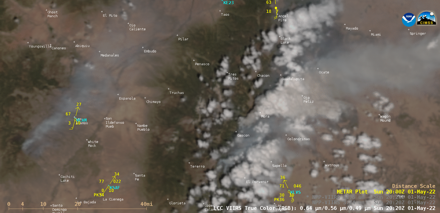
NOAA-20 VIIRS True Color RGB, Shortwave Infrared (3.74 µm) and Infrared Window (11.45 µm) images at 2026 UTC [click to enlarge]