Archive: Jun 2021
Severe thunderstorms across North Dakota, South Dakota and Montana
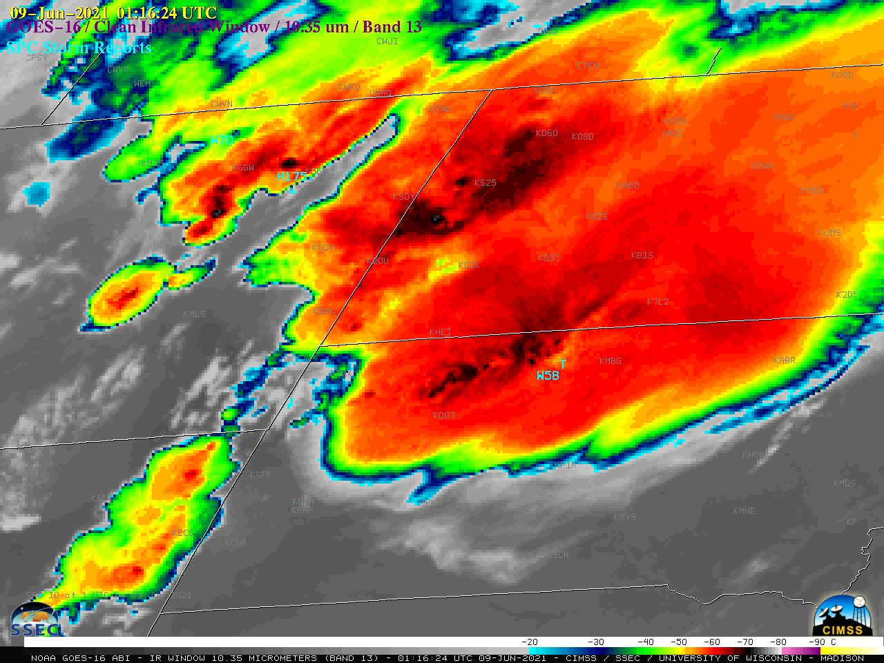
1-minute Mesoscale Domain Sector GOES-16 (GOES-East) “Red” Visible (0.64 µm) images (above) include time-matched plots of SPC Storm Reports — and showed a number of severe thunderstorms which produce a tornado and a wind gust to 94 mph in South Dakota and hail as large as 4.00 inches in diameter in Wyoming on 08 June 2021. Numerous pulsing overshooting tops were... Read More
Unstable Air Comes to Madison
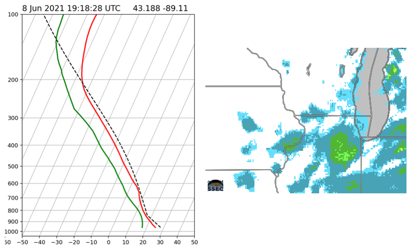
Most people in south-central Wisconsin have noticed how uncomfortable the weather has been over the past week. The unseasonably cool air from a week ago has been replaced with a hot, sticky airmass that feels more at home in late July than in early June. And while precipitation has been... Read More
Offshore islands as barriers to fog
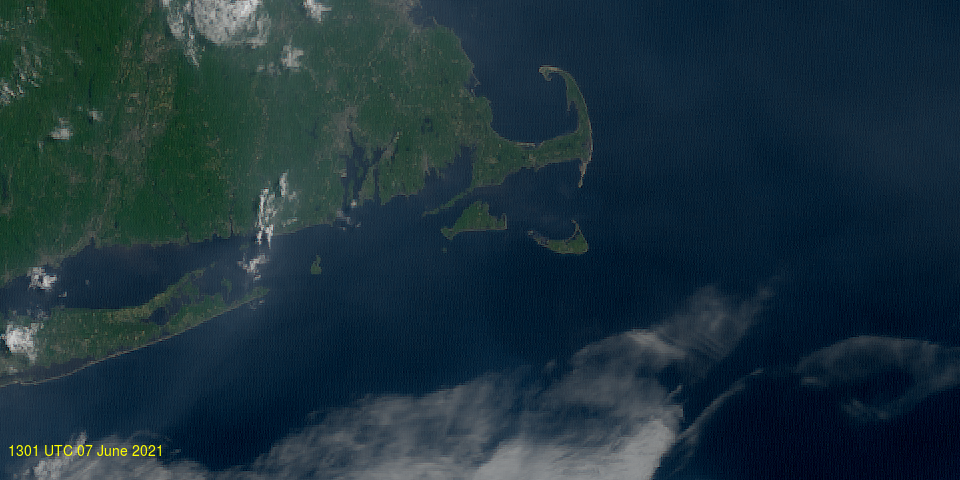
Moist air that moves from the mainland USA to over the north Atlantic will often induce fog formation over those cold shelf waters. This is a common occurrence (see this blog post, for a recent example) GOES-16 True-color imagery, above, from 1301-2101 UTC on 7 June 2021, shows the northeastward progress of... Read More
