This website works best with a newer web browser such as Chrome, Firefox, Safari or Microsoft Edge. Internet Explorer is not supported by this website.

Archive: Jun 2021

Strong winds from SAR over the South Pacific

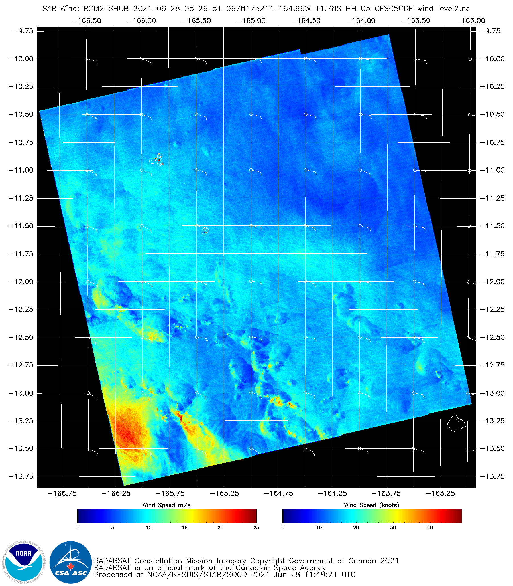
The animation above shows convection over the south Pacific to the east of American Samoa (note the Manu’a Islands just east of 170 W Longitude in the animation). Extensive cloud cover will limit the ability of the GOES-17 instrument to detect low-level cloud motions underneath the deep convection, which motions... Read More

Satellite signatures of solar farms across Minnesota

GOES-16 (GOES-East) “Red” Visible (0.64 µm), Near-Infrared “Snow/Ice” (1.61 µm), Near-Infrared “Cloud Particle Size” (2.24 µm), Shortwave Infrared (3.9 µm) and Fire Temperature RGB images along with Fire Temperature, Fire Power and Fire Area derived products (above) showed reflectance and thermal signatures of sunlight reflecting off large arrays of solar panels at solar farms across southern/central Minnesota... Read More

Severe weather in the central Plains

1-minute Mesoscale Domain Sector GOES-16 (GOES-East) “Red” Visible (0.64 µm) images (above) include time-matched plots of SPC Storm Reports — and showed severe thunderstorms across eastern Colorado, western Kansas and far southwestern Nebraska late in the day on 19 June 2021. Numerous pulsing overshooting tops were evident with many of these storms. Wind gusts to 88 mph were reported in KansasThe corresponding 1-minute GOES-16... Read More