Strong winds from SAR over the South Pacific
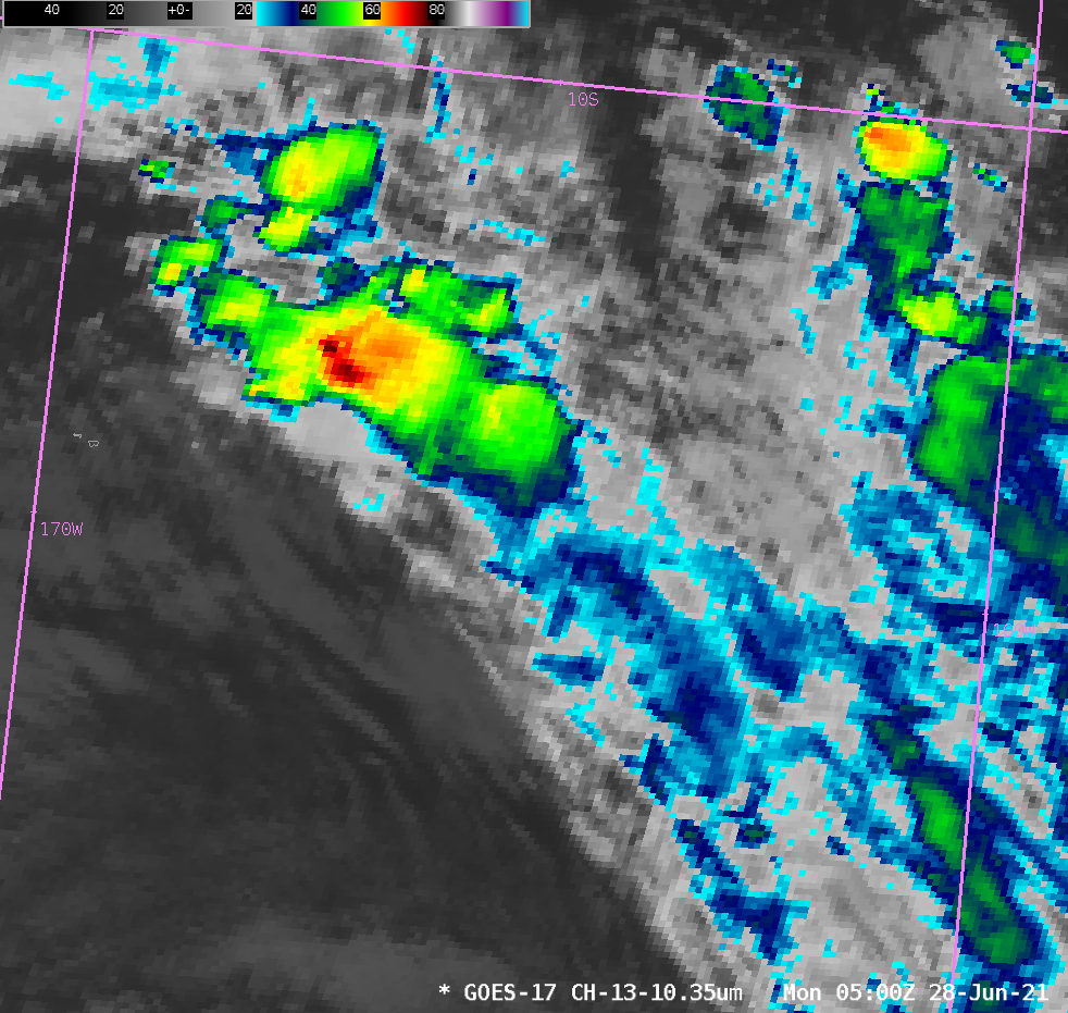
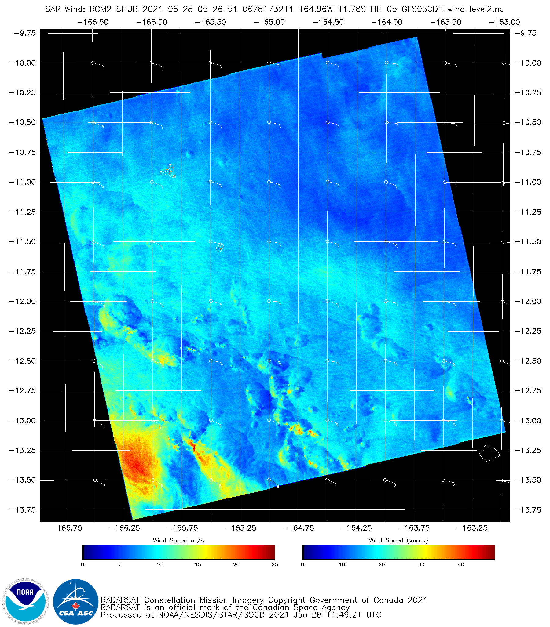
The animation above shows convection over the south Pacific to the east of American Samoa (note the Manu’a Islands just east of 170 W Longitude in the animation). Extensive cloud cover will limit the ability of the GOES-17 instrument to detect low-level cloud motions underneath the deep convection, which motions can be used to infer wind speeds. Other data sources are needed. In addition to scatterometry from the MetOp series of satellites, synthetic aperture radar (SAR) that flies on the RADARSAT Constellation Mission (RCM) satellites (and on Sentinel) (available at this website) can give high-quality estimates of wind speeds. Given the animation of full-disk imagery above (at ten-minute timesteps), taken from AWIPS and therefore sub-sampled down to 6-km horizontal resolution, how fast would you guess wind speeds might be near the surface under the convection. SAR data below shows winds near 25 m/s, i.e., storm-force winds, under the convection.
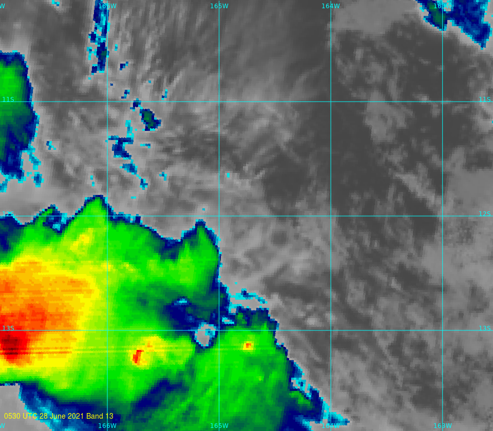
A full-resolution image of GOES-17 clean window infrared data (10.3 µm) (created using Geo2Grid) is shown below, at the closest time to the observed winds shown above. The deepest cloud tops are close to the strongest surface wind speeds.


