This website works best with a newer web browser such as Chrome, Firefox, Safari or Microsoft Edge. Internet Explorer is not supported by this website.

Archive: Sep 2020

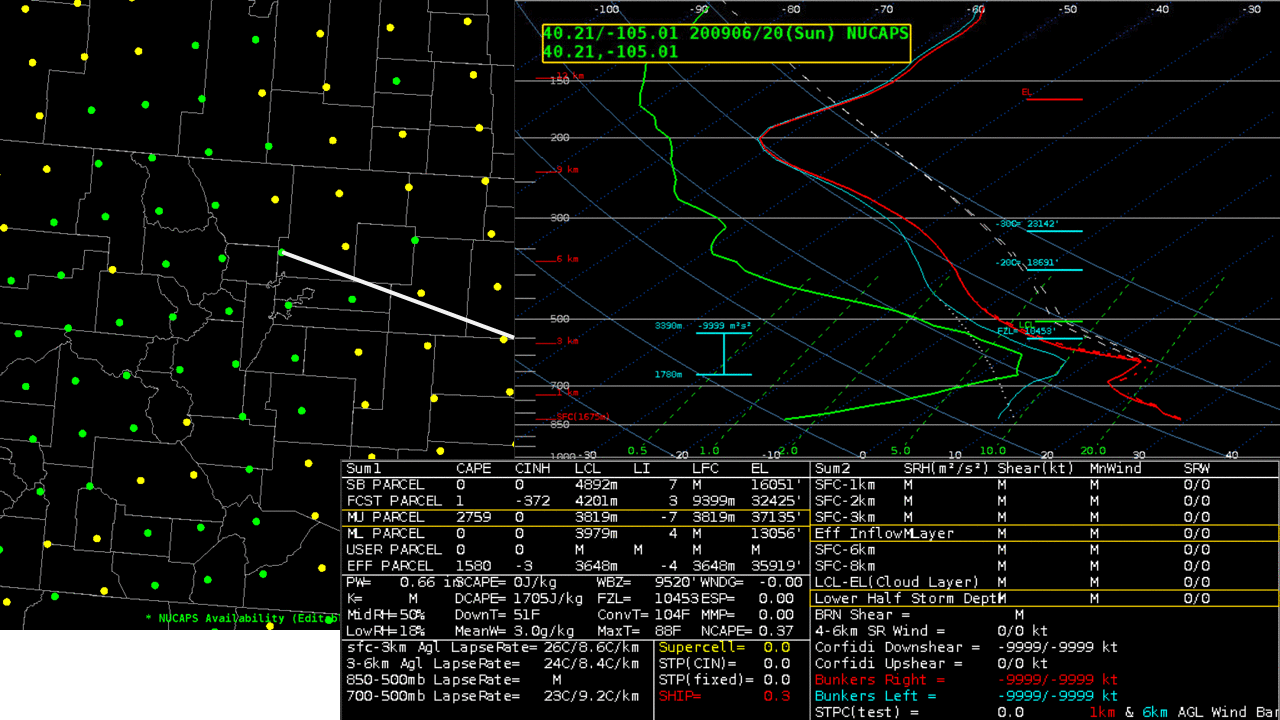
Fast-moving wildfires in Washington State

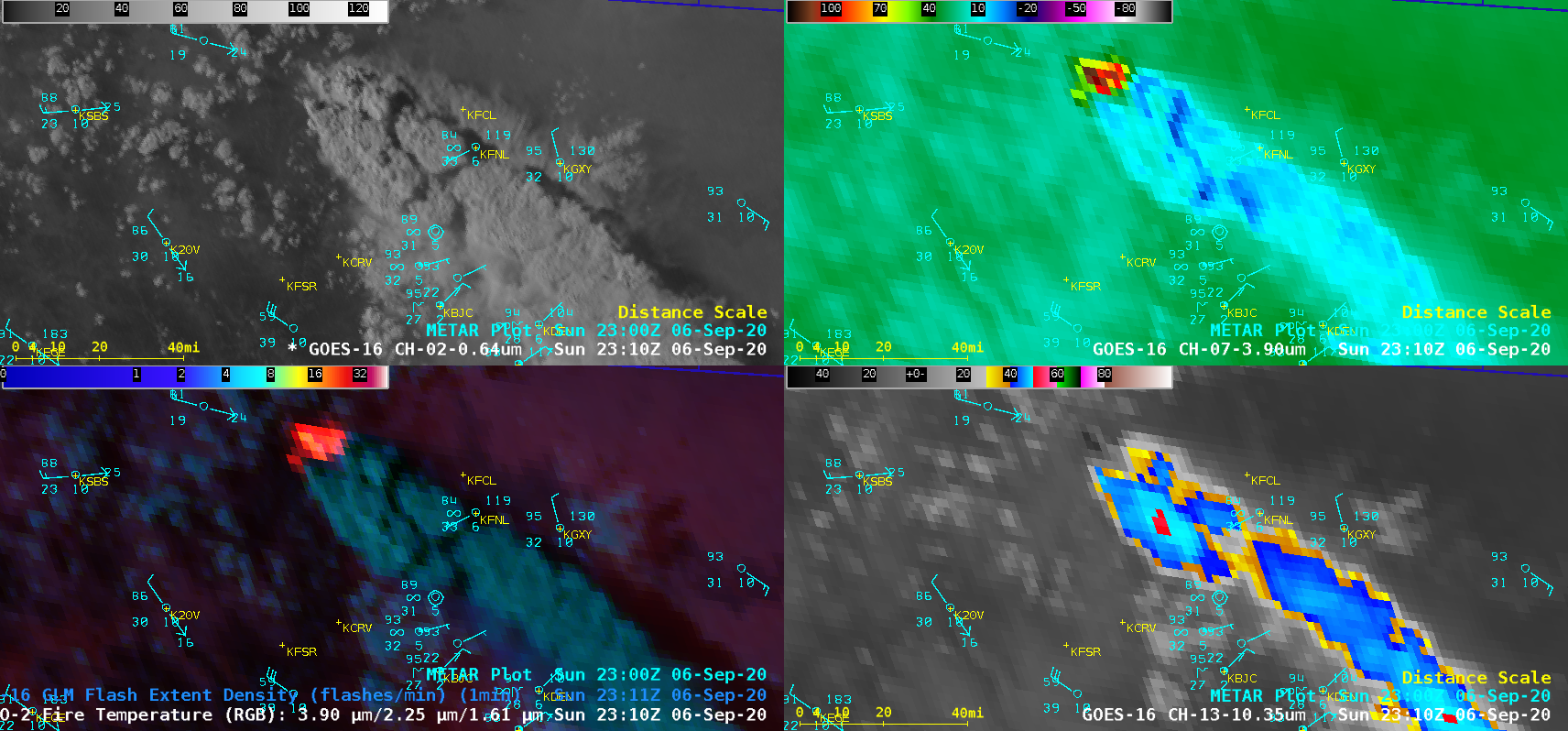
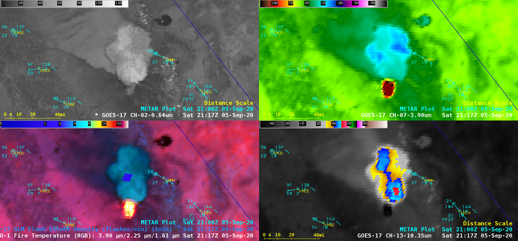
1-minute Mesoscale Domain Sector GOES-17 (GOES-West) “Red” Visible (0.64 µm), Shortwave Infrared (3.9 µm), Fire Temperature Red-Green-Blue (RGB) + GLM Flash Extent Density (FED) and “Clean” Infrared Window (10.35 µm) images (above) showed the smoke plume and thermal signature of the Pearl Hill Fire — which made a rapid ~50-mile run south-southwestward across northern Washington State on 07 September 2020. During this time, northwesterly winds gusted to 40 knots (46 mph) at Omak... Read More

Pyrocumulonimbus clouds produced by the Cameron Peak Fire in Colorado

1-minute Mesoscale Domain Sector GOES-16 (GOES-East) “Red” Visible (0.64 µm), GOES-17 Shortwave Infrared (3.9 µm), Fire Temperature Red-Green-Blue (RGB) + GLM Flash Extent Density (FED) and “Clean” Infrared Window (10.35 µm) images (above) showed 2 distinct pulses of pyrocumulonimbus (pyroCb) cloud emanating from the Cameron Peak Fire in north-central Colorado on 06 September 2020. The coldest cloud-top infrared brightness temperatures were -52.4ºC. Smoke was occasionally restricting the... Read More

Pyrocumulonimbus cloud spawned by the Creek Fire in California

1-minute Mesoscale Domain Sector GOES-17 (GOES-West) “Red” Visible (0.64 µm), GOES-17 Shortwave Infrared (3.9 µm), Fire Temperature Red-Green-Blue (RGB) + GLM Flash Extent Density (FED) and “Clean” Infrared Window (10.35 µm) images (above) showed the formation of a pyrocumulonimbus (pyroCb) cloud created by the Creek Fire in Central California on 05 September 2020. The appearance of a few brief GLM FED pixels (2026 UTC | 2117 UTC)... Read More