This website works best with a newer web browser such as Chrome, Firefox, Safari or Microsoft Edge. Internet Explorer is not supported by this website.

Archive: Tue Aug 2020

Laura becomes a hurricane in the Gulf of Mexico

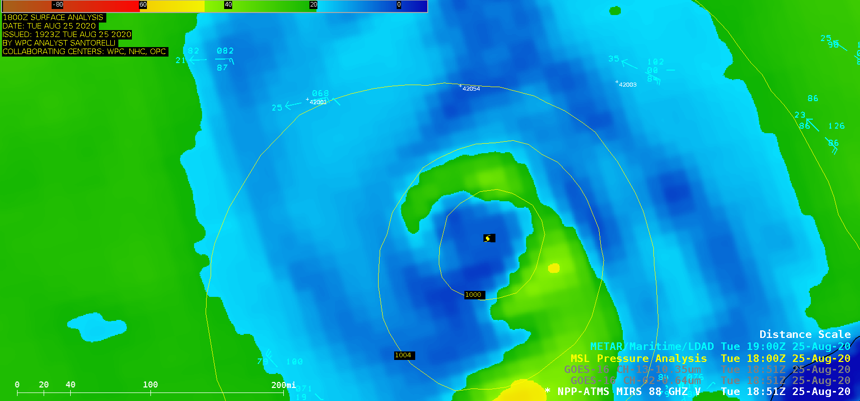
1-minute Mesoscale Domain Sector GOES-16 (GOES-East) “Red” Visible (0.64 µm) and “Clean” Infrared Window (10.35 µm) images (above) showed Laura during the the 12-hour period after it intensified from a Tropical Storm to a Hurricane in the southern Gulf of Mexico at 1215 UTC on 25 August 2020. Numerous convective overshooting tops were observed, some exhibiting cloud-top infrared brightness... Read More

True-color imagery from the CIMSS Direct Broadcast site

The Cooperative Institute for Meteorological Satellite Studies (CIMSS) acquires data directly from polar-orbiting satellites such as Suomi-NPP and NOAA-20 through Direct Broadcast antennae that are on the UW-Madison Campus. Community Satellite Processing Package (CSPP) software takes the Direct Broadcast signal and creates data files and, with Polar2Grid, imagery that are easily accessible at this ftp site where users can find directories for... Read More