Severe thunderstorms in South Dakota
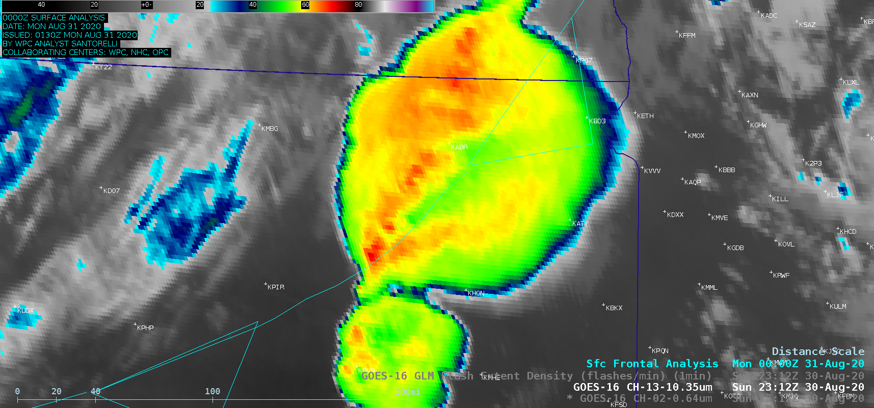
1-minute Mesoscale Domain Sector GOES-16 (GOES-East) “Red” Visible (0.64 µm) and “Clean” Infrared Window (10.35 µm) images — with and without an overlay of GLM Flash Extent Density (above) showed the rapid development of thunderstorms along a cold front across eastern South Dakota on 30 August 2020. One particularly well-defined and long-lived Enhanced-V signature with an Above-Anvil Cirrus Plume (reference | VISIT training) was seen in the Visible and... Read More
