Laura becomes a hurricane in the Gulf of Mexico
![GOES-16 “Red” Visible (0.64 µm) and “Clean” Infrared Window (10.35 µm) images [click to play animation | MP4]](https://cimss.ssec.wisc.edu/satellite-blog/images/2020/08/200825_goes16_visible_infrared_Hurricane_Laura_anim.gif)
GOES-16 “Red” Visible (0.64 µm) and “Clean” Infrared Window (10.35 µm) images [click to play animation | MP4]
A comparison of NOAA-20 MiRS Microwave (88 GHz), GOES-16 “Red” Visible (0.64 µm) and GOES-16 “Clean” Infrared Window (10.35 µm) images at 1851 UTC (below) revealed a curved convective band wrapping around the eye of Laura.
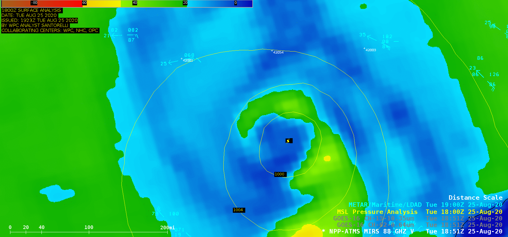
NOAA-20 MiRS Microwave (88 GHz), GOES-16 “Red” Visible (0.64 µm) and GOES-16 “Clean” Infrared Window (10.35 µm) images at 1851 UTC [click to enlarge]
![Infrared Window images from Suomi NPP (11.45 µm) and GOES-16 (10.35 µm) images at 1943 UTC [click to enlarge]](https://cimss.ssec.wisc.edu/satellite-blog/images/2020/08/200825_1943utc_suomiNPP_goes16_infrared_Hurricane_Laura_anim.gif)
Infrared Window images from Suomi NPP (11.45 µm) and GOES-16 (10.35 µm) at 1943 UTC [click to enlarge]