Severe thunderstorms in Wyoming, Nebraska and South Dakota
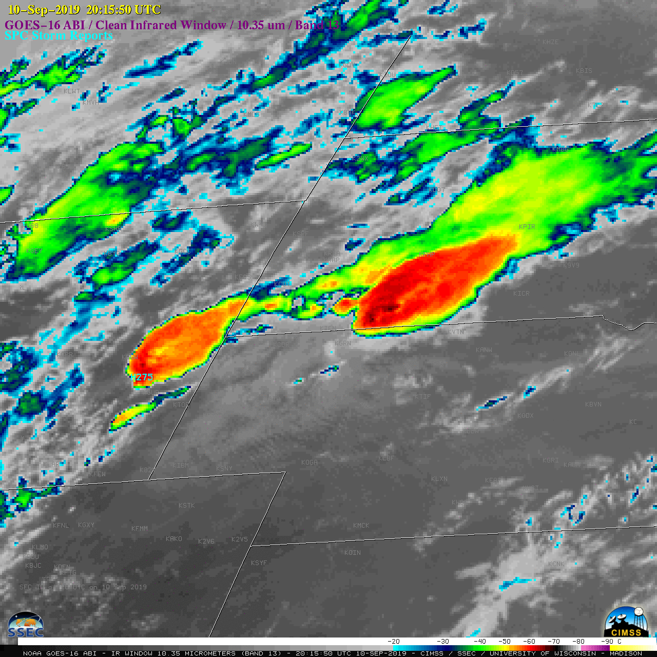
1-minute Mesoscale Domain Sector GOES-16 “Red” Visible (0.64 µm) images (above) showed the development of thunderstorms that produced large hail, tornadoes and damaging winds (SPC Storm Reports) across eastern Wyoming, northern Nebraska and southern South Dakota on 10 September 2019. Note that many of the storms exhibited Above-Anvil Cirrus Plumes. Pulsing overshooting tops reached -80ºC and colder (violet pixels)... Read More
