Severe thunderstorms in Wyoming, Nebraska and South Dakota

GOES-16 “Red” Visible (0.64 µm) images, with SPC Storm Reports plotted in red [click to play animation | MP4]
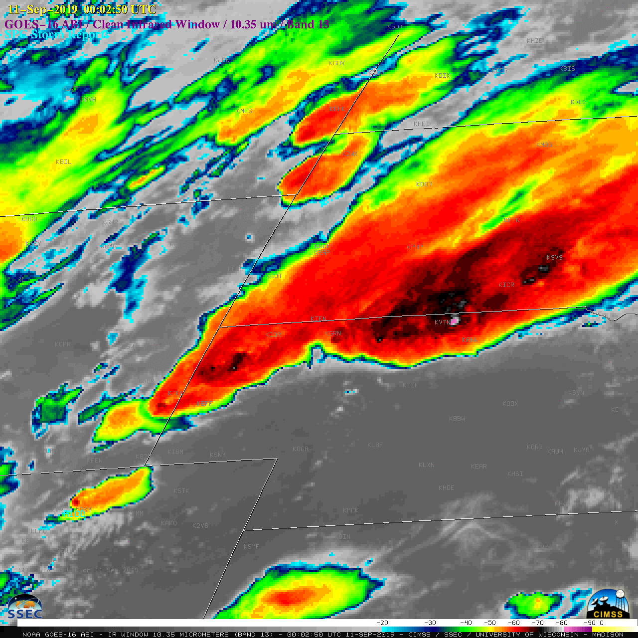
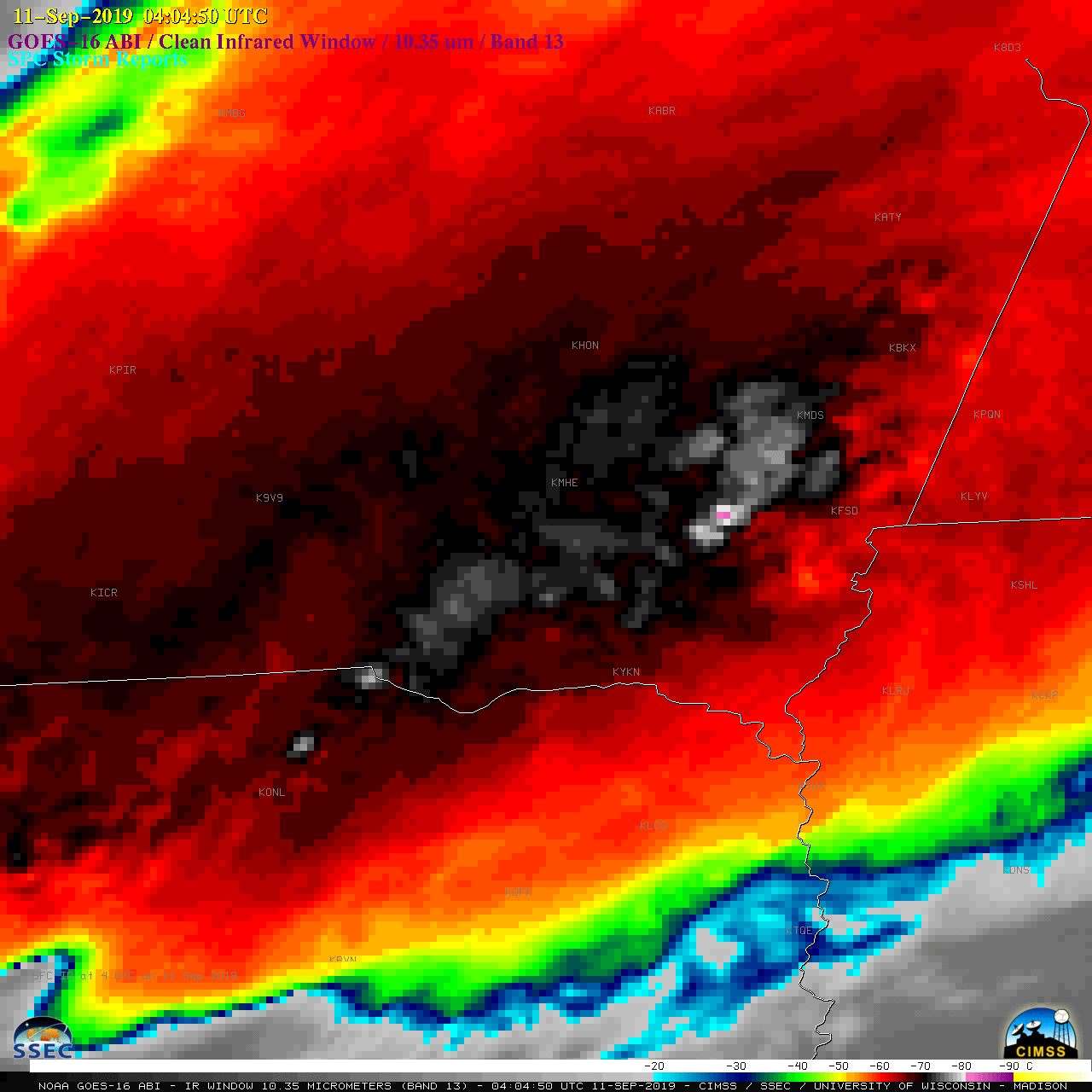
The corresponding GOES-16 “Clean” Infrared Window (10.35 µm) images are shown below.
![GOES-16 "Clean" Infrared Window (10.35 µm) images, with SPC Storm Reports plotted in cyan [click to play animation | MP4]](https://cimss.ssec.wisc.edu/satellite-blog/wp-content/uploads/sites/5/2019/09/190910_goes16_infrared_WY_NE_SD_anim.gif)
GOES-16 “Clean” Infrared Window (10.35 µm) images, with SPC Storm Reports plotted in cyan [click to play animation | MP4]
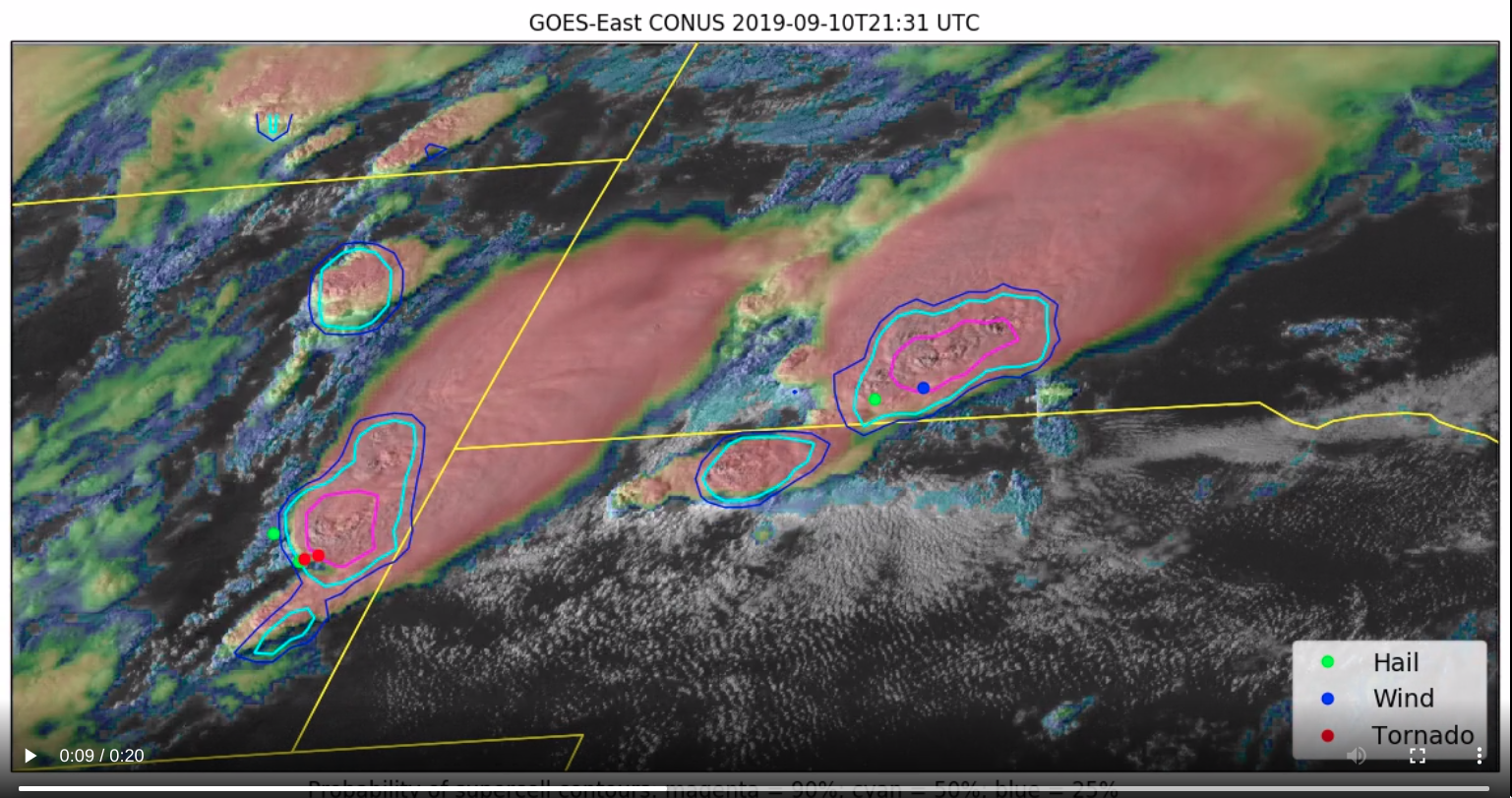
GOES-16 Visible/Infrared Sandwich RGB and “Clean” Infrared Window (10.35 µm) images, with “probability of supercell” contours and SPC Storm Reports (courtesy of John Cintineo, CIMSS) [click to play MP4 animation]
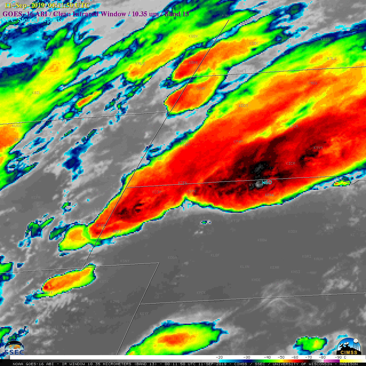
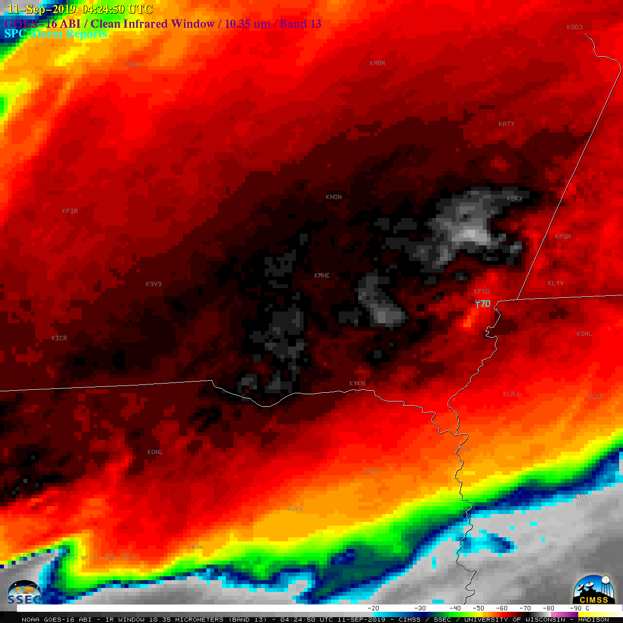
![GOES-16 "Clean" Infrared Window (10.35 µm) images, with SPC Storm Reports plotted in cyan [click to play animation | MP4]](https://cimss.ssec.wisc.edu/satellite-blog/wp-content/uploads/sites/5/2019/09/190910_goes16_infrared_spcStormReports_SD_NE_anim.gif)
GOES-16 “Clean” Infrared Window (10.35 µm) images, with SPC Storm Reports plotted in cyan [click to play animation | MP4]
Here is a look at all three tornado tracks across Sioux Falls from Tuesday night.
Additional surveys are expected to continue into Thursday. pic.twitter.com/vW5qAnrglG
— NWS Sioux Falls (@NWSSiouxFalls) September 11, 2019