GOES-17 Loop Heat Pipe data outages reach seasonal peak
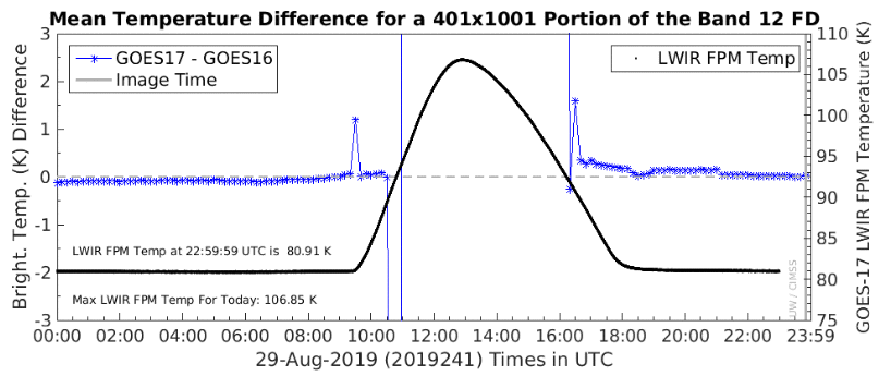
The periodic deleterious heating of the GOES-17 Advanced Baseline Imager (ABI) will reach a peak on 30 or 31 August 2019. The effects (in ABI bands 8-16) of the heating are manifest because the Loop Heat Pipe on the GOES-17 satellite does not operate at peak efficiency and cannot dissipate... Read More
