Category: Tropical cyclones
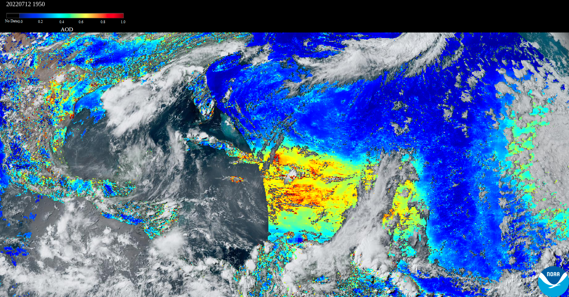
Hurricane Darby in the East Pacific Ocean
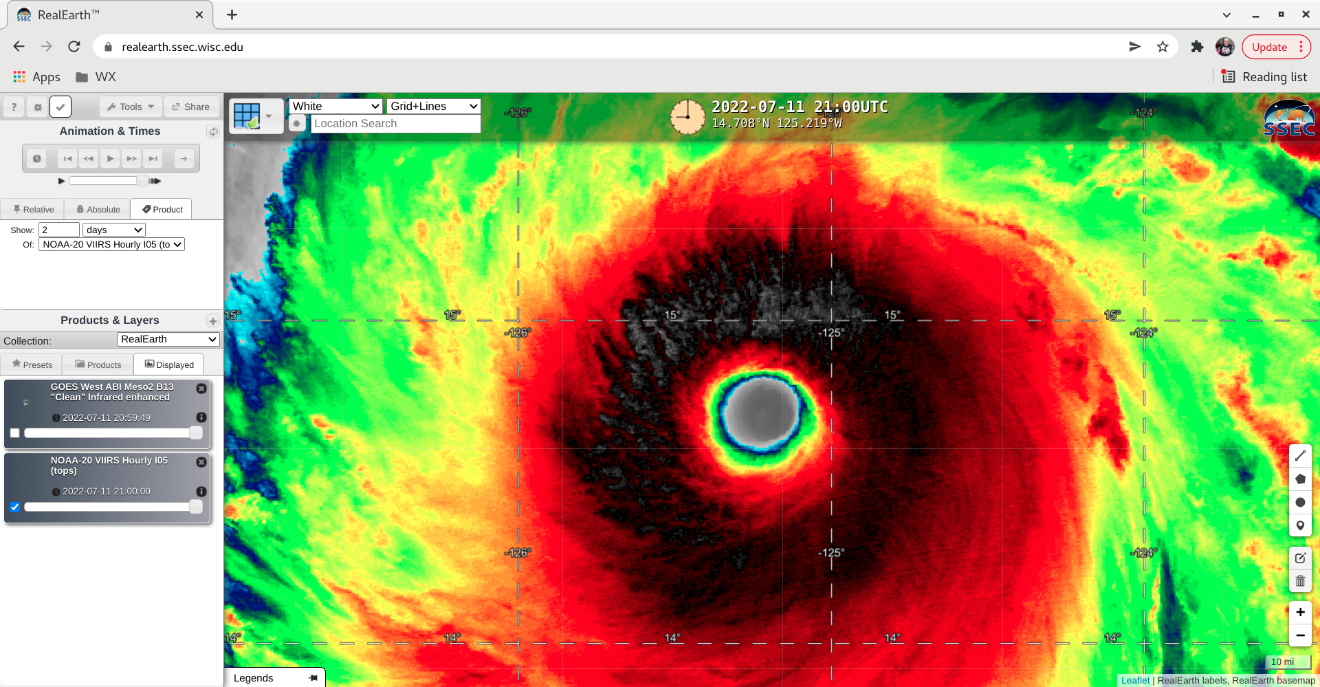
1-minute Mesoscale Domain Sector GOES-17 (GOES-West) “Red” Visible (0.64 µm) and “Clean” Infrared Window (10.35 µm) images (above) showed the evolution of the eye of Hurricane Darby as it moved westward across the East Pacific Ocean on 11 July 2022. Mesovortices were evident within the eye, along with a stadium effect eye structure —... Read More
Tropical Storm Alex
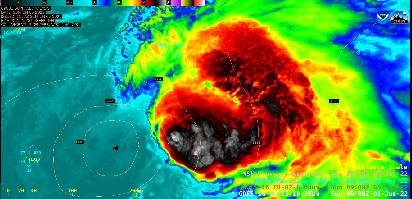
1-minute Mesoscale Domain Sector GOES-16 (GOES-East) “Clean” Infrared Window (10.35 µm) and “Red” Visible (0.64 µm) images (above) showed Tropical Storm Alex after it reached tropical storm intensity at 0900 UTC on 05 June 2022. Overshooting tops within the deep convection exhibited infrared brightness temperatures of -80ºC or colder (shades of violet).GOES-16 Infrared Window (11.2 µm) images... Read More
Hurricane Agatha in the East Pacific
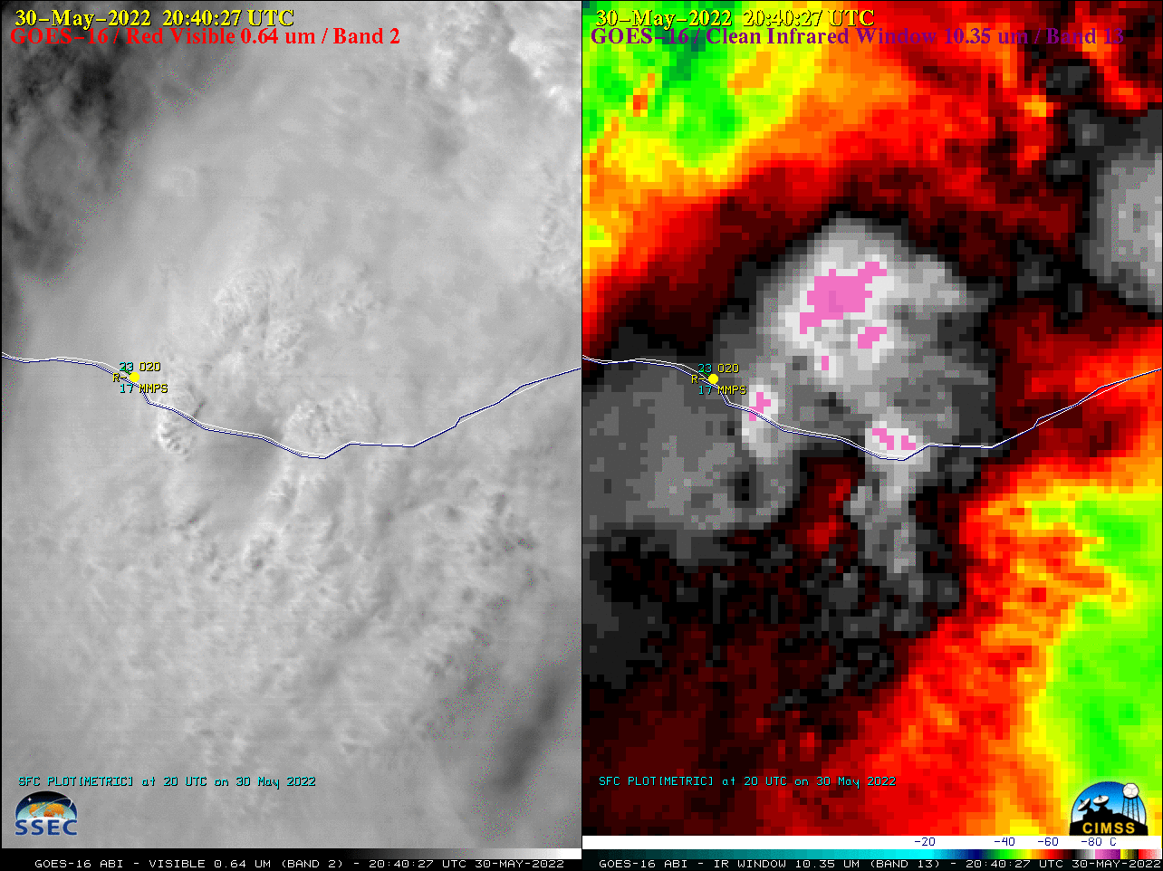
1-minute Mesoscale Domain Sector GOES-17 (GOES-West) — and GOES-16 (GOES-East) after 1621 UTC — “Clean” Infrared Window (10.35 µm) and “Red” Visible (0.64 µm) images (above) showed Hurricane Agatha after the tropical storm reached hurricane intensity at 1200 UTC on 29 May 2022. Overshooting tops near the storm center exhibited infrared brightness temperatures... Read More
