Hurricane Agatha in the East Pacific

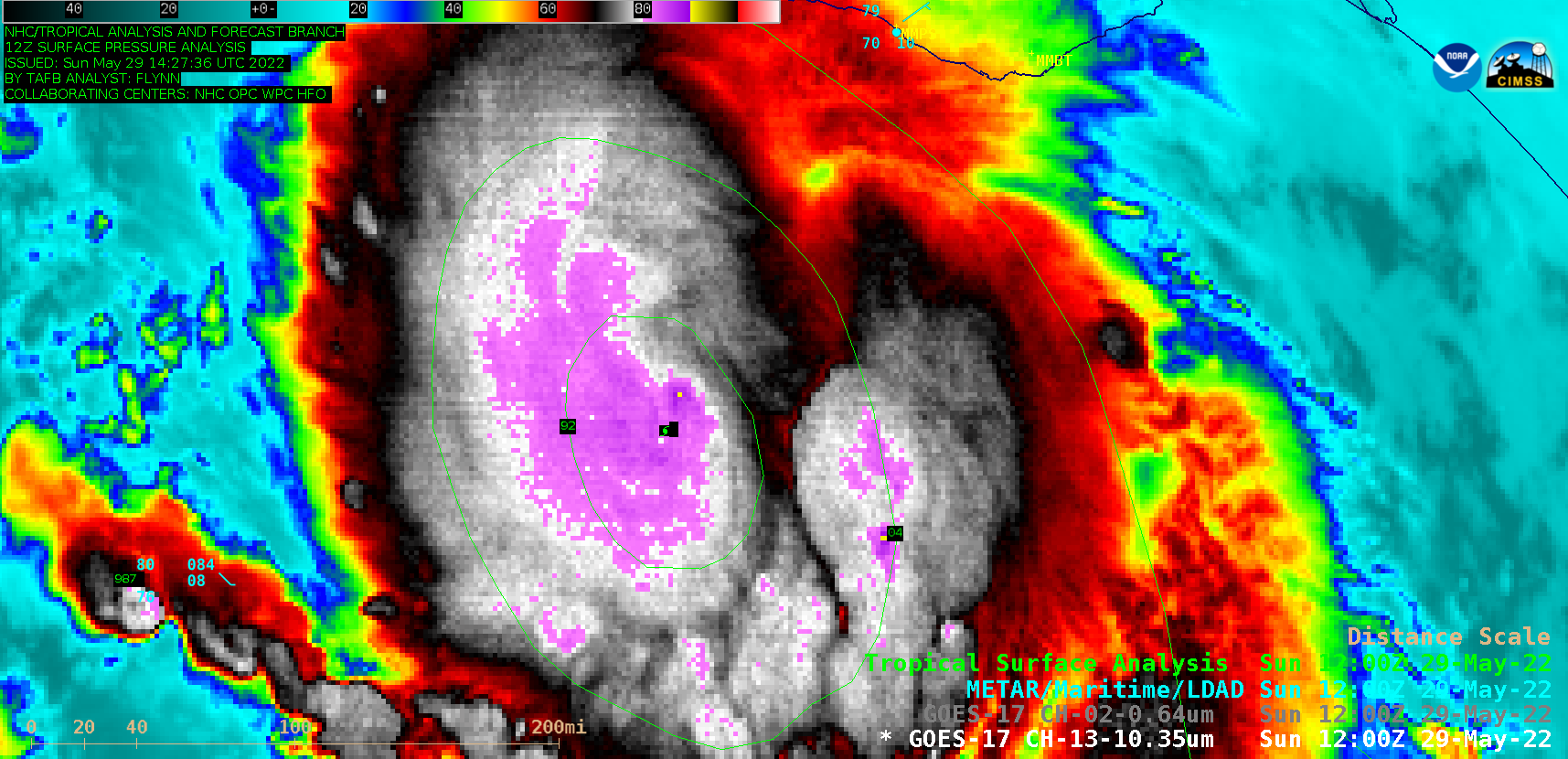
GOES-17 and GOES-16 “Clean” Infrared Window (10.35 µm) and “Red” Visible (0.64 µm) images [click to play animated GIF | MP4]
1-minute Mesoscale Domain Sector GOES-17 (GOES-West) — and GOES-16 (GOES-East) after 1621 UTC — “Clean” Infrared Window (10.35 µm) and “Red” Visible (0.64 µm) images (above) showed Hurricane Agatha after the tropical storm reached hurricane intensity at 1200 UTC on 29 May 2022. Overshooting tops near the storm center exhibited infrared brightness temperatures as cold as -90 to -95ºC at times.
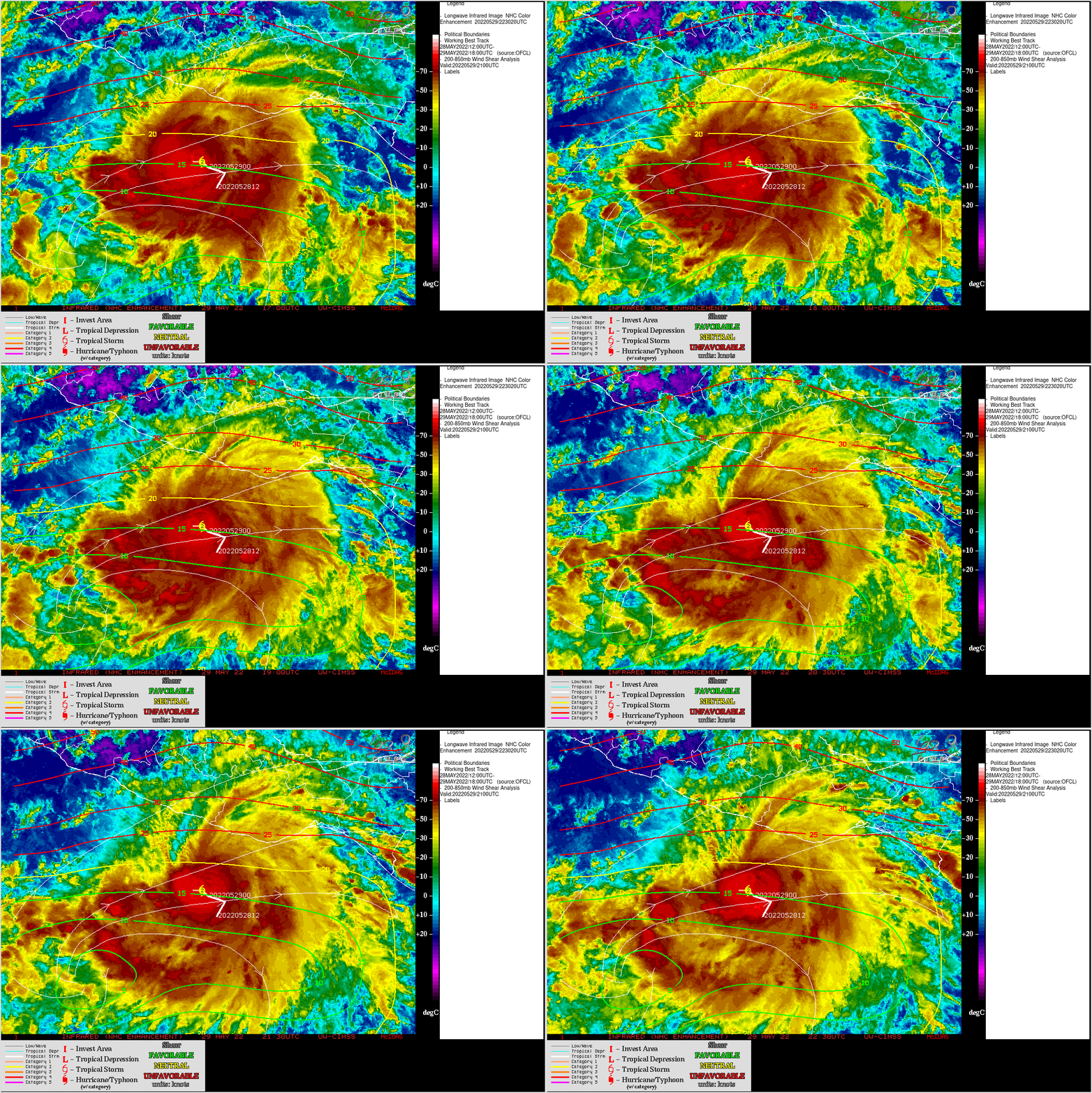
GOES-16 Infrared Window (11.2 µm) images from the CIMSS Tropical Cyclones site (below) include contours of deep-layer wind shear at 12 UTC and 21 UTC — which indicated that Agatha was moving through an environment of relatively low shear, one factor that favored its phase of rapid intensification (ADT | SATCON).

GOES-16 Infrared Window (11.2 µm) images, with contours of deep-layer wind shear at 12 UTC [click to enlarge]

GOES-16 Infrared Window (11.2 µm) images, with contours of deep-layer wind shear at 21 UTC [click to enlarge]
Agatha was also moving across warm water, with high Sea Surface Temperature and modest Ocean Heat Content values.
===== 30 May Update =====

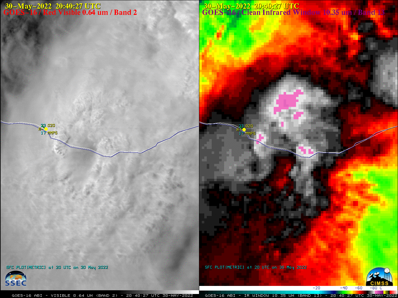
GOES-16 “Red” Visible (0.64 µm, left) and “Clean” Infrared Window (10.35 µm, right) images [click to play animated GIF | MP4]
Hurricane Agatha made landfall along the southern coast of Mexico — between Puerto Escondido MMPS and Bohias De Huatulco MMBT — around 2040 UTC on 30 May, as seen in 1-minute GOES-16 Visible and Infrared images (above).

