Super Typhoon Hinnamnor in the West Pacific
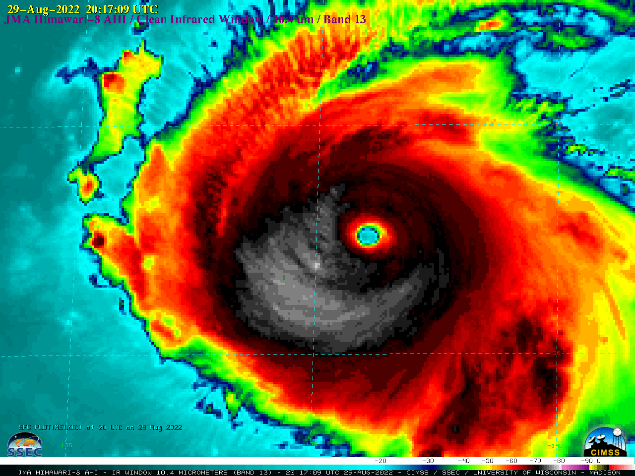
2.5-minute rapid scan JMA Himawari-8 Visible (0.64 µm) images (above) showed rapidly-intensifying Category 4 Typhoon Hinnamnor as it moved across the West Pacific Ocean (southeast of Japan) on 29 August 2022. Mesovortices within the eye were faintly evident though breaks in patchy high clouds overhead.2.5-minute Himawari-8 Infrared (10.4 µm) images (below) revealed... Read More

