Fiona becomes a Hurricane near Puerto Rico
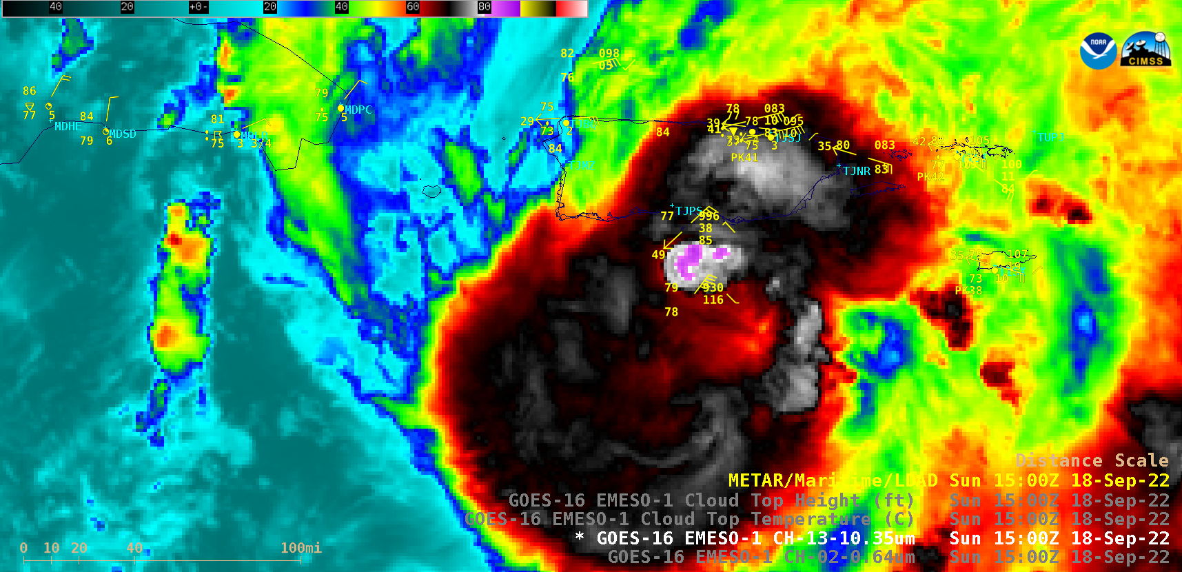
1-minute Mesoscale Domain Sector GOES-16 (GOES-East) “Red” Visible (0.64 µm) and “Clean” Infrared Window (10.35 µm) images (above) showed Fiona as it intensified to a Category 1 Hurricane just south of Puerto Rico during the morning hours on 18 September 2022. The coldest cloud-top 10.35 µm infrared brightness temperatures were around -88ºC.The... Read More
